Harts River

Last updated
Harts River
Hartsrivier
10 of 'History of the Boers in South Africa ... with three maps' (11189449154), crop.jpg
Harts River on a map of 1887
South Africa relief location map.svg
Red pog.svg
Location of the Harts River mouth
EtymologyTranslated into Afrikaans from its Khoekhoe name ǂGaoblgarib, meaning 'heart river'; possibly named after a chief or a tribal group [1]
Native nameǂGaoblgarib  (Khoekhoe)
Location
Country South Africa
Region North West Province, Northern Cape
Physical characteristics
Source Witwatersrand
  locationNear Lichtenburg
  elevation1,520 m (4,990 ft)
Mouth Vaal River
  location
Delportshoop
  coordinates
28°24′4″S24°16′38″E / 28.40111°S 24.27722°E / -28.40111; 24.27722 Coordinates: 28°24′4″S24°16′38″E / 28.40111°S 24.27722°E / -28.40111; 24.27722
  elevation
1,017 m (3,337 ft)
Length320 km (200 mi)

The Harts River (Afrikaans : Hartsrivier) is a northern tributary of the Vaal River, which in turn is the largest tributary of the Orange River (also known as the Gariep River, the largest river in South Africa). Its source is in the North West Province, but the greater part of its basin is located in the Northern Cape Province, which it enters a few kilometers downstream from the Taung Dam. [2]

Contents

The Harts forms a natural boundary for the Ghaap Plateau, located between the Harts River and the Kuruman Hills.

Course

It rises near Lichtenburg on the far southwestern slopes of the Witwatersrand and flows for 320 km (about 200 miles) in a southwesterly direction, mostly through very flat areas of the North West and Northern Cape Provinces before flowing into the Vaal River about 100 km above the confluence of that river with the Orange River. [3]

The Little Harts River which rises near Coligny joins the Great Harts River, which rises near Lichtenburg, to form the main river. Near Taung, the Dry Harts River, a seasonal river with its headwaters in the Vryburg area, also joins it. The river is characterised by highly intermittent runoff, but is regulated to optimise water usage. At Taung the Tswana referred to the Harts River as the Noka (meaning River) Kolong. [4]

Further downstream, the town of Schweizer-Reneke (founded in October 1888) lies on the banks of the river. Wenzel Dam, just north of the town on the river, has been developed into a holiday resort.

Around 1850, a dam was built in the river next to Dikgatlong, but it was washed away during a flood in 1856.

Near the confluence of the Harts and Vaal Rivers at Delportshoop a major irrigation system, the Vaal-Harts Scheme was set up in 1933 as part of the national reconstruction effort after the Depression. Here water drawn from both the Vaal and the Harts rivers provide water to intensively irrigate numerous smallholdings through a system of canals in an otherwise dry area of the country, supporting towns such as Jan Kempdorp and Hartswater. [5]

Around the northern part of the Scheme lie the settlements of Pampierstad, Motsweding, Mokgareng, Manthestad and Taung, all with mostly Tswana speaking residents. Taung became famous after the discovery of the skull of the so-called Taung Child in a lime quarry 14 km west of the town. The quarry is not in use anymore and is now the Taung Heritage Site and open to the public. To the west of the town, the Taung Dam was built in the Harts River. Upstream of the dam some rock engravings can be seen. [6]

History

On 31 March 1902, during the final months of the Second Boer War, the Battle of Harts River, also known as "Battle of Boschbult", was fought between the Boers and the British forces near the confluence of the Harts River and the Brak Spruit, one of its dry tributaries. The battle was a British defeat and was also the second bloodiest day of that war for the Canadian forces, who fought on the British side. [7]

Mining

Alluvial diamond mining still occurs in ancient river beds within the Harts River catchment area. The Newlands Mine is located some 60 km northwest of Kimberley on the river. It is currently being mined at a rate of 3000 tonnes per month by the company Dwyka Diamonds Limited. Noble Minerals, in cooperation with the local Ba-Ga-Maidi tribe has set up an operation to exploit the alluvial diamonds within 20 square kilometres of diamantiferous gravels of the river system, near Taung. [8]

Protected areas

Most of the fish found in the Harts River are introduced species, except in the area of Barberspan, where indigenous species can be found. [9] It was declared a nature reserve in 1949.

Near the towns of Sannieshof and Delareyville, the river is connected to Barberspan (26°35' S 25°35' E) 26°35′S25°35′E / 26.583°S 25.583°E / -26.583; 25.583 , which lies partially inside the Barberspan Nature Reserve and is a Ramsar wetland site. The pan is 11 km long and 3.5 km wide, and it is named either after Frederick Hugh Barber FRGS, who hunted along the Harts River in 1875, or after the barbel (baber in the Afrikaans language), a species of catfish found in South African rivers. [10]

In 1913, Jan Christiaan Smuts, who owned a farm near the southern end of the pan, provided the labour and his foreman, Mr M. S. Basson, supervised the digging of a channel which diverted water from the Harts River into the pan, which lies about 9 m lower than the river. The area is so flat that the Harts River now pushes enough water into Barberspan during the rainy season to last through the dry winter months, where previously the pan used to dry up during the dry season. This was ecologically important, since the pan now became a large perennial water body in an area of otherwise seasonal pans and vleis. It became an oasis for birds (especially water fowl) which use it for feeding, drinking, roosting, moulting and breeding. Up to 20,000 birds of more than 320 species can be seen at the Barberspan Bird Sanctuary, making it a popular birding spot, probably the finest in South Africa. Seven endangered bird species and two endangered mammal species occur here. Barberspan also supports a rich plankton community. (Ramsar, 1994).

Barberspan is also the venue for off-road vehicle rallies, like the Barberspan 500. There is a hotel, self-catering accommodation and camping facilities on the site.

See also

Related Research Articles

Orange River Major river in southern Africa

The Orange River is a river in Southern Africa. It is the longest river in South Africa. With a total length of 2,432 km (1,511 mi), the Orange River Basin extends from Lesotho into South Africa and Namibia to the north. It rises in the Drakensberg mountains in Lesotho, flowing westwards through South Africa to the Atlantic Ocean. The river forms part of the international borders between South Africa and Lesotho and between South Africa and Namibia, as well as several provincial borders within South Africa. Except for Upington, it does not pass through any major cities. The Orange River plays an important role in the South African economy by providing water for irrigation and hydroelectric power. The river was named the Orange River in honour of the Dutch ruling family, the House of Orange, by the Dutch explorer Robert Jacob Gordon. Other names include simply the word for river, in Khoekhoegowab orthography written as !Garib, which is rendered in Afrikaans as Gariep River with the intrusion of a velar fricative in place of the alveolar click, Groote River or Senqu River, derived from ǂNū "Black". It is known in isiZulu as isAngqu

Vaal River Tributary of the Orange River, South Africa

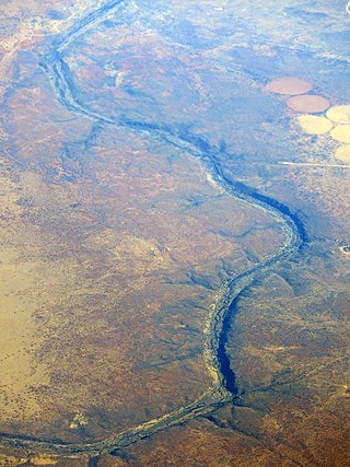
The Vaal River is the largest tributary of the Orange River in South Africa. The river has its source near Breyten in Mpumalanga province, east of Johannesburg and about 30 kilometres (19 mi) north of Ermelo and only about 240 kilometres (150 mi) from the Indian Ocean. It then flows westwards to its conjunction with the Orange River southwest of Kimberley in the Northern Cape. It is 1,458 kilometres (906 mi) long, and forms the border between Mpumalanga, Gauteng and North West Province on its north bank, and the Free State on its south.

<span class="mw-page-title-main">Northern Cape</span> Province of South Africa

The Northern Cape is the largest and most sparsely populated province of South Africa. It was created in 1994 when the Cape Province was split up. Its capital is Kimberley. It includes the Kalahari Gemsbok National Park, part of the Kgalagadi Transfrontier Park and an international park shared with Botswana. It also includes the Augrabies Falls and the diamond mining regions in Kimberley and Alexander Bay.

<span class="mw-page-title-main">North West (South African province)</span> Province in South Africa

North West is a province of South Africa. Its capital is Mahikeng. The province is located to the west of the major population centre of Gauteng and south of Botswana.

Boise River River in Idaho, United States

The Boise River is a 102-mile-long (164 km) tributary of the Snake River in the Northwestern United States. It drains a rugged portion of the Sawtooth Range in southwestern Idaho northeast of Boise, as well as part of the western Snake River Plain. The watershed encompasses approximately 4,100 square miles (11,000 km2) of highly diverse habitats, including alpine canyons, forest, rangeland, agricultural lands, and urban areas.

Vaal Dam Dam in Border Gauteng and Free State

The Vaal Dam in South Africa was constructed in 1938 and lies 77 km south of OR Tambo International Airport. The lake behind the dam wall has a surface area of about 320 square kilometres (120 sq mi) and is 47 meters deep. The Vaal Dam lies on the Vaal River, which is one of South Africa's strongest-flowing rivers. Other rivers flowing into the dam are the Wilge River, Klip River, Molspruit and Grootspruit. It has over 800 kilometres (500 mi) of shoreline and is South Africa's second biggest dam by area and the fourth largest by volume.

Lichtenburg, North West Town in North West Province, South Africa

Lichtenburg is a town situated in North West Province of South Africa. It is the administrative centre of Ditsobotla Local Municipality.

Highveld Geographic region of the South African inland plateau

The Highveld is the portion of the South African inland plateau which has an altitude above roughly 1500 m, but below 2100 m, thus excluding the Lesotho mountain regions to the south-east of the Highveld. It is home to some of the country's most important commercial farming areas, as well as its largest concentration of metropolitan centres, especially the Gauteng conurbation, which accommodates one-third of South Africa's population.

Warrenton, Northern Cape Place in Northern Cape, South Africa

Warrenton is an agricultural town of approximately 22,588 people in the Northern Cape province of South Africa, situated 70 kilometres (40 mi) north of Kimberley on the Vaal River.

Riet River River in South Africa

The Riet River is a westward-flowing tributary of the Vaal River in central South Africa. In precolonial times the Riet was known as the Gama-!ab, a !Kora name meaning 'muddy'. Its main tributary is the Modder River and after the confluence the Riet River flows westwards to meet the Vaal.

Lower Vaal WMA, or Lower Vaal Water Management Area , includes the following major rivers: the Harts River, Molopo River and Vaal River, and covers the following Dams:

Crocodile River (Limpopo) River in South Africa

The Crocodile River is a river in South Africa. At its confluence with the Marico River, the Limpopo River is formed.

Taung Dam is a gravity type dam located on the Harts River near Taung, North West, South Africa. It was established in 1993 and serves mainly for irrigation purposes. Its hazard potential has been ranked high (3).

Delportshoop is a town in Frances Baard District Municipality in the Northern Cape Province of South Africa. It lies next to the Vaal River. The Harts River runs by closely.

Notwane River River in Botswana

The Notwane River is a river in southeastern Botswana. Certain sections of its course form the international boundary with South Africa. Its mouth is at the head of the Limpopo River. It has a catchment area of 18,053 square kilometers.

The Mooi River is a river in North West Province, South Africa. It is a tributary of the Vaal River and belongs to the Upper Vaal Water Management Area.

The Motloutse River is a river in Botswana, a tributary of the Limpopo River. The catchment area is 19,053 square kilometres (7,356 sq mi). The Letsibogo Dam on the Motloutse has been built to serve the industrial town of Selebi-Phikwe and surrounding local areas, with potential for use in irrigation.

Kadva river is a minor but important tributary of Godavari in Nashik district, Maharashtra. It originates and flows through the Dindori Taluka of Nashik District.

Batlhaping tribe

Batlhaping is one of the Tswana tribes which resides mostly in the Northern Cape and North West of South Africa. The name of the Batlhaping loosely translates to; " those with an affinity for fish". After Barolong settled on the banks of the Vaal River known as Kolong, fish became a staple of their diet. During their migration, the Batlhaping encounted the Korana, a nomadic Khoisan tribe in 1750. The two tribes settled together.There were several harassing raids by the Ndebele which led to most Barolong to move Northwards to modern day Ganyesa. Those who were left behind stayed and fought back against the raids of the Ndebele and they were referred to from that point as "those who remained behind to eat fish", thus this became their name. This however did not mean that they were independent from Barolong. "Tlhapi" means "Fish", and this is not the tribe's totem. The tribe does have the symbol of the fish in usage under some circumstances to differentiate themselves from other Barolong, however since they are Barolong their totem or equivalent is a Kudu, which in Setswana is called Tholo. This is why Barolong affectionately refer to each other as "Tholo".

The Vaalharts Valley is located in the north-east corner of the Northern Cape province of South Africa, bordering the North West province. It gets its name because it is located between two rivers, the Vaal and the Harts. Because of its advantageous position between the two rivers, an irrigation scheme was built in the Vaalharts Valley in the 1930s.

References

  1. Dictionary of Southern African Place Names
  2. Lower Vaal WMA 10
  3. Harts River - Overview
  4. Van Vreeden, B.F. 1961. Noordkaapland plekname. PhD thesis, University of the Witwatersrand
  5. "Vaalharts Irrigation Scheme, South Africa". Archived from the original on 2012-07-20. Retrieved 2012-04-08.
  6. "Finger paintings in the Harts River Valley, Northern Cape Province, South Africa". Archived from the original on 2011-08-12. Retrieved 2012-04-08.
  7. Canadian War Museum - Battle of Harts River
  8. "Dwyka Diamonds - Newlands Kimberlite Mine". Archived from the original on 2007-04-06. Retrieved 2007-04-11.
  9. "North West Province Tourism - Barbers Pan Bird Sanctuary". Archived from the original on 2005-11-11. Retrieved 2005-09-12.
  10. Dictionary of Southern African Place Names