


Hasserode has been a quarter in the town of Wernigerode in the German state of Saxony-Anhalt since 1907.


Hasserode has been a quarter in the town of Wernigerode in the German state of Saxony-Anhalt since 1907.
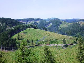
Hasserode lies at the foot of the Harz Mountains in the valley of the River Holtemme, whose upper reaches include the water cascade of the Steinerne Renne. A state road ( Landstraße ) runs through the quarter to Drei Annen Hohne and Schierke in the direction of the Harz's highest mountain, the Brocken. The Harz Railway and Brocken Railway, part of the Harz Narrow Gauge Railways also run through the district which has three stations: Hochschule Harz (formerly Kirchstraße), Wernigerode-Hasserode and Steinerne Renne.
The village grew up around Hasserode Castle in the 12th century, but was abandoned by the 16th century and was only reoccupied again in 1768 by order of King Frederick II of Prussia, hence the name Friedrichsthal for the lower part of the parish and the village name of Hasserode-Friedrichsthal which has been used from time to time.
The Hasserode Holiday (Hasseröder Ferienpark) was established at the start of the 21st century on Langen Stieg and in the Nessel valley, on the terrain of the old open-air swimming pool. It is a holiday camp with an indoor pool.
Amongst the walking destinations in the area is the Elversstein.

Wernigerode is a town in the district of Harz, Saxony-Anhalt, Germany. Until 2007, it was the capital of the district of Wernigerode. Its population was 32,181 in 2020.

The Harz, also called the Harz Mountains, is a highland area in northern Germany. It has the highest elevations for that region, and its rugged terrain extends across parts of Lower Saxony, Saxony-Anhalt, and Thuringia. The name Harz derives from the Middle High German word Hardt or Hart. The name Hercynia derives from a Celtic name and could refer to other mountain forests, but has also been applied to the geology of the Harz. The Brocken is the highest summit in the Harz with an elevation of 1,141.1 metres (3,744 ft) above sea level. The Wurmberg is the highest peak located entirely within the state of Lower Saxony.
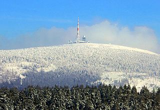
The Brocken, also sometimes referred to as the Blocksberg, is the highest peak in the Harz mountain range and also the highest peak in Northern Germany; it is near Schierke in the German state of Saxony-Anhalt between the rivers Weser and Elbe. Although its elevation of 1,141 metres (3,743 ft) is below alpine dimensions, its microclimate resembles that of mountains of about 2,000 m (6,600 ft). The peak above the tree line tends to have a snow cover from September to May, and mists and fogs shroud it up to 300 days of the year. The mean annual temperature is only 2.9 °C (37.2 °F). It is the easternmost mountain in northern Germany; travelling east in a straight line, the next prominent elevation would be in the Ural Mountains in Russia.

The Selke Valley Railway (Selketalbahn), Gernrode-Harzgerode Railway and the Anhalt Harz Railway were different names for the metre gauge railway in the Lower Harz, Germany, originally owned by the Gernrode-Harzgerode Railway Company.

Schierke is a village and a former municipality in the Harz district, in the German state of Saxony-Anhalt. Since 1 July 2009, it is part of the town Wernigerode. Situated within the Harz mountain range in the valley of the river Bode, at the rim of the Harz National Park, it is mainly a tourist resort, especially for hiking and all kinds of winter sports.
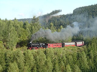
The Harz Railway or Trans-Harz Railway was formerly the main line of the Harz Narrow Gauge Railways and runs north to south right across the Harz Mountains from Wernigerode to Nordhausen. However, the tourist attraction of the Brocken, the highest mountain in the Harz, is so great that the Brocken Railway is effectively the main line today. The Trans-Harz Railway joins up with the Selke Valley Railway to Quedlinburg at Eisfelder Talmühle where all trains are organised to make good connections.
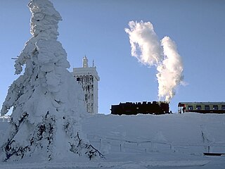
The Brocken Railway is one of three tourist metre gauge railways which together with the Harz Railway and Selke Valley Railway form the Harz Narrow Gauge Railways railway network in the Harz mountain range of Germany.

The Zeterklippen are a striking rock formation or tor on the 930-metre-high Renneckenberg mountain, overlooking the Ilse valley in the Harz mountains in Germany. The Renneckenberg is an eastern sub-peak of the Brocken. The rocks themselves lie at a height of about 830 metres (2,720 ft) above sea level. They can be reached from the Molkenhausstern after about 2.5 km. The track initially runs uphill through dense spruce forest until the view opens out towards the Hohnekamm and down to Wernigerode. Then the route branches off to the right onto a steep, 0.5 km, path and, after about 200 m, a gentler 0.4 km path leads to the Große Zeterklippe. Immediately below this highest of the rocks is a mountain hut that dates to the time when a botanical garden had been laid out here as a replacement for the inaccessible Brockengarten.
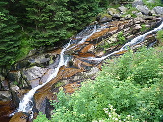
The Holtemme is a 47-kilometre (29 mi) long tributary of the river Bode in Saxony-Anhalt, Germany.
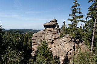
The Ottofels, named after Prince Otto of Stolberg-Wernigerode, is a tor and natural monument near Wernigerode in the Harz mountains of central Germany.

Drei Annen Hohne is the name of a small settlement within the municipal area of Wernigerode in Saxony-Anhalt, Germany.

The Steinerne Renne is a waterfall and natural monument near the town of Wernigerode in the Harz mountains of central Germany.

Hasserode Castle in the quarter of the same name in the town of Wernigerode am Harz was a medieval fortification whose site is near Hasserode station on the Harz Narrow Gauge Railways. Today there are no visible traces left of the castle.

The Trudenstein is a rock formation and popular hiker's destination in the Harz Mountains of central Germany. It is located in the federal state of Saxony-Anhalt.
The Molkenhaus is a historic house near Wernigerode, Harz, Germany, located on the Jägerkopf hill above the Steinerne Renne waterfall and the source region of the Holtemme river. The timber-framed building, which was built by order of the Senior Master Hunter (Oberjägermeister) of the counts of Stolberg, von Meseberg, at the beginning of the 18th century, belonged to the Ilsenburger Marienhof and was used for hunting purposes and the production of butter. Nowadays it is used by the Harz National Park.
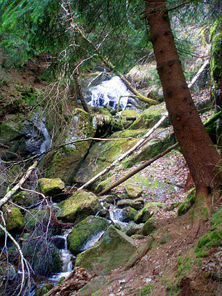
The Kleine Renne is a cascading mountain stream and officially designated natural monument near the town of Wernigerode in the Harz Mountains of Germany.
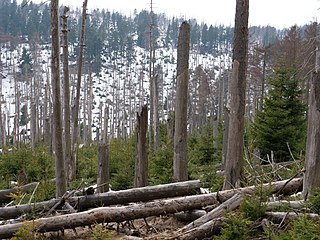
The Eckerloch is a forested mountain valley, 845 metres above sea level near the village of Schierke in the Harz Mountains of central Germany.
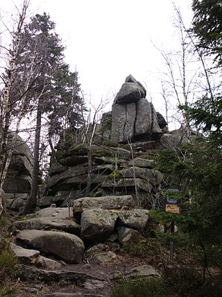
The Ahrensklint or Ahrentsklint in the Harz Mountains is a granite rock formation, 822.4 m above sea level (NN), on the Erdbeerkopf in Harz district in the German state of Saxony-Anhalt.
The Elversstein in the Harz Mountains of Germany is a granite rock formation with a maximum elevation of 499 m above sea level (NN) on the Steinberg near Hasserode in the county of Harz in Saxony-Anhalt.

The Aufgeklärtes Glück Mine is an old mine, now closed, in the valley of Thumkuhlental in the Harz Mountains of Germany. It lies southwest of Hasserode, a village on the edge of the town of Wernigerode in the state of Saxony-Anhalt. Nowadays, its exterior facilities form part of a nature and geological educational path that, thanks to the reconstruction of an old mine water management system (Wasserkunst), make a very graphic witness of the former mining activity at the foot of the Harz' highest mountain, the Brocken.