Hassi R'Mel District

Last updated
Hassi R'Mel District
دائرة حاسي الرمل
DZ-03 (2019).svg
Map of Algeria highlighting Laghouat Province
Dz - 03 - Daira de Hassi R'Mel.svg
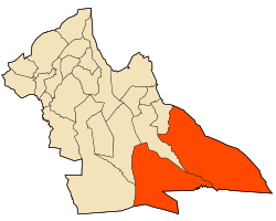
Map of Laghouat Province highlighting Hassi R'Mel District
Country Flag of Algeria.svg Algeria
Province Laghouat
District seat Hassi R'Mel
Area
  Total
5,912 km2 (2,283 sq mi)
Population
 (2008 [1] )
  Total
33,337
  Density5.6/km2 (15/sq mi)
Time zone UTC+01 (CET)
Municipalities 2

Hassi R'Mel is a district in Laghouat Province, Algeria. It was named after its capital, the natural gas extraction town of Hassi R'Mel.

Municipalities

The district is further divided into 2 municipalities [2]

32°55′41″N3°16′16″E / 32.928°N 3.271°E / 32.928; 3.271

References

  1. "Wilaya de Laghouat: répartition de la population résidente des ménages ordinaires et collectifs, selon la commune de résidence et la dispersion" (PDF) (in French). Retrieved 2019-11-03.. Data from the 2008 General Population and Housing Census on the site of the NOS Algeria.
  2. "Décret executif n° 91-306 du 24 août 1991 fixant la liste des communes animées par chaque chef de daïra. 03 - Wilaya de Laghouat" [List of municipalities animated by each District chief: 03 - Laghouat Province](PDF) (in French). Journal officiel de la République Algérienne. 4 September 1991. p. 1294. Retrieved 2019-11-03.