Nuñoa District is one of nine districts of the Melgar Province in Peru.
Challwamayu is a river in Peru located in the Huancavelica Region, Huaytará Province, Pilpichaca District. It is an affluent of the Pampas River, the one which flows along the border of the Ayacucho and Huancavelica Regions. The confluence of the rivers is on the border of these regions, near Pukarumi (Pucarume). Challwamayu originates near the mountain Artisayuq (Artisayoc).

Kunka is a mountain in the La Raya mountain range in the Andes of Peru. It is situated at the La Raya Pass and the road and rail which connect Cusco with Lake Titicaca. It is located in the Cusco Region, Canas Province, Layo District, and in the Puno Region, Melgar Province, Santa Rosa District, and about 5,200 metres (17,060 ft) high. Kunka lies southwest of the mountains Yana Khuchilla and Chimpulla. Other neighboring mountains are Huch'uy K'uchu north of it and Hatun Ichhuna Kunka in the south. Between the road and the mountain there is a little lake named Q'umirqucha.

Hatun Pastu is a mountain in the Andes of Peru, about 5,170 metres (16,962 ft) high. It is located in the Puno Region, Lampa Province, on the border of the districts Palca and Paratía, southeast of the mountain Qillqa and north of Waykira.
Chillcamayu which upstream is called Jampamayo and downstream Pitumarca is a river in Peru located in the Cusco Region, Canchis Province, in the districts Checacupe and Pitumarca. Its waters flow to the Vilcanota River.
Jatuncucho is a mountain in the Vilcanota mountain range in the Andes of Peru, about 5,400 metres (17,717 ft) high. It is situated in the Cusco Region, Canchis Province, San Pablo District, in the Puno Region, Carabaya Province, Corani District, and in the Melgar Province, Nuñoa District. Jatuncucho lies between Pomanota in the north-west and Jonorana in the east and north-east of the mountain Cochacucho.
Cochacucho is a mountain in the Vilcanota mountain range in the Andes of Peru. The mountain is about 5,300 metres (17,388 ft) high. It is located in the Cusco Region, Canchis Province, San Pablo District, and in the Puno Region, Melgar Province, Nuñoa District. It is situated southwest of the mountains Pomanota and Jatuncucho, and north of the mountain Jatun Sallica.
Jatun Sallica is a mountain in the Vilcanota mountain range Andes of Peru, about 5,200 metres (17,060 ft) high. It is located in the Cusco Region, Canchis Province, San Pablo District, and in the Puno Region, Melgar Province, Nuñoa District. Jatun Sallica is situated south-west of the mountains Pomanota and Jatuncucho, south of the mountain Cochacucho and north-east of the mountain Hueco.
Hatun Ch'aqu is a mountain in the Andes of Peru, about 5,000 metres (16,404 ft) high. It is located in the Cusco Region, Canchis Province, Pitumarca District, and in the Quispicanchi Province, Cusipata District. It lies south-west of the mountain Ch'aqu, west of the mountain Yanaqaqa, north-west of the mountain Tiklla Q'asa and north of the mountain Tuqtu. Its ridge stretches to the north-west.
Jatunyurac Caca is a mountain in the southern extensions of the Vilcanota mountain range in the Andes of Peru, about 5,000 metres (16,404 ft) high. It is situated in the Puno Region, Melgar Province, Nuñoa District. Jatunyurac Caca lies southwest of the mountain Collpacaja, east of Yaretani and north of a lower mountain named Yuracgaga.
Hatun Qurini is a mountain in the Peruvian Andes, about 5,000 metres (16,404 ft) high. It is situated in the Puno Region, Azángaro Province, San José District. Hatun Qurini lies northwest of the mountain Surupana.

Jatun Quenamari is a mountain in the Vilcanota mountain range in the Andes of Peru, about 5,400 metres (17,717 ft) high. It is situated in the Puno Region, Carabaya Province, Corani District. Jatun Quenamari lies east of the large glaciated area of Quelccaya, southwest of Cuncunani.
Huch'uy K'uchu is a 5,339-metre-high (17,516 ft) mountain in the La Raya mountain range in the Andes of Peru. It is located in the Cusco Region, Canas Province, Layo District, and in the Canchis Province, Marangani District. Huch'uy K'uchu lies near the La Raya pass northwest of Chimpulla and north of Kunka. It stretches along the Hatun K'uchu valley from west to east whose stream flows to the Willkanuta River.
Hatun Ichhuna Kunka is a mountain in the La Raya mountain range in the Andes of Peru, about 5,000 metres (16,404 ft) high. It is located in the Cusco Region, Canas Province, Layo District, and in the Puno Region, Melgar Province, Santa Rosa District. Hatun Ichhuna Kunka lies near the La Raya pass southwest of Kunka. Huch'uy Ichhuna Kunka and Pichaqani are the lower elevations of the ridge to the northwest.
Piyacuyani is a mountain in the Vilcanota mountain range in the Andes of Peru, about 5,100 metres (16,732 ft) high. The mountain is located in the Puno Region, Melgar Province, Nuñoa District. Piyacuyani lies southwest of Jonorana, west of Jarupata, north of Huisahuisa, northeast of Jatun Sallica and Jochajucho, and southeast of Jampatune, Pomanota and Jatuncucho. It is situated west of Llankamayu, a right tributary of Hatun Mayu.
Huisahuisa is a mountain in the Vilcanota mountain range in the Andes of Peru, about 5,300 metres (17,388 ft) high. It is located in the Puno Region, Melgar Province, Nuñoa District. Huisahuisa lies south of Pomanota, Jatuncucho and Piyacuyani, northwest of Conatira, northeast of Hueco and Jatun Sallica and east of Cochacucho. Llancamayo, a right tributary of Jatun Mayo, flows along its eastern slope.
Yana Ranra is a mountain in the La Raya mountain range in the Andes of Peru, about 5,000 metres (16,404 ft) high. It is located in the Cusco Region, Canas Province, Layo District, and in the Canchis Province, Marangani District. Yana Ranra lies near the La Raya pass northwest of Chimpulla and Kunka and southwest of Huch'uy K'uchu. It is situated at the Hatun K'uchu valley whose stream flows to the Willkanuta River.
Hatun Pata is a 5,182-metre (17,001 ft) mountain in the Chunta mountain range in the Andes of Peru. It is located in the Huancavelica Region, Huancavelica Province, Ascensión District. Hatun Pata lies northwest of Pinqullu and northeast of Pata Pata. The river Kachimayu originates south of the mountain. It flows to the northeast as a tributary of Ichhu River.
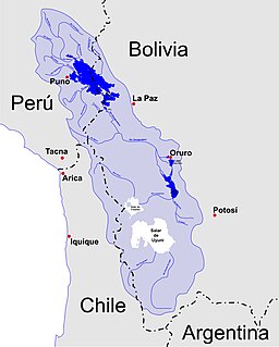
Kuntur Pata is a 5,107-metre-high (16,755 ft) mountain in the Andes of Peru. It is located in the Puno Region, Melgar Province, on the border of the districts of Antauta and Nuñoa. Kuntur Pata lies north of Pirwani. The Pirwani River originates near the mountain. It is a right tributary of the Crucero River whose waters flow to Lake Titicaca.
Hatun Wayq'u which downstream successively is named T'uruyunka(Toroyunca) and Chuqisayra(Choquesayra) is a river in Peru. It is located in the Cusco Region, La Convención Province, Vilcabamba District. It belongs to the watershed of the Apurímac River, the source of the Amazon River.