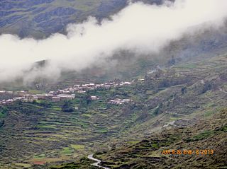
Sandia Province is a province of the Puno Region in Peru. The capital of the province is the city of Sandia.
Coasa District is one of ten districts of the Carabaya Province in Peru.
Crucero District is one of ten districts of the province Carabaya in Peru.

Patambuco District is one of ten districts of the Sandia Province in Peru.

Ritipata is a 5,350-metre-high (17,552 ft) mountain in the Apolobamba mountain range in the Andes of Peru. It is located in the Puno Region, Putina Province, Ananea District, as well as in the Sandia Province, Quiaca District. Ritipata is situated south-east of the mountain Vilacota, east of the mountain Ananea and north-west of the mountain Chapi, next to it.

Kunka is a mountain in the La Raya mountain range in the Andes of Peru. It is situated at the La Raya Pass and the road and rail which connect Cusco with Lake Titicaca. It is located in the Cusco Region, Canas Province, Layo District, and in the Puno Region, Melgar Province, Santa Rosa District, and about 5,200 metres (17,060 ft) high. Kunka lies southwest of the mountains Yana Khuchilla and Chimpulla. Other neighboring mountains are Huch'uy K'uchu north of it and Hatun Ichhuna Kunka in the south. Between the road and the mountain there is a little lake named Q'umirqucha.

Jatun Pinguilluni is a mountain in the Carabaya mountain range in the Andes of Peru, about 5,100 metres (16,732 ft) high. It is located in the Puno Region, Carabaya Province, on the border of the districts Ajoyani and Coasa. Jatun Pinguilluni lies southeast of a lake named Pampacocha.

Hatun Pastu is a mountain in the Andes of Peru, about 5,170 metres (16,962 ft) high. It is located in the Puno Region, Lampa Province, on the border of the districts Palca and Paratía, southeast of the mountain Qillqa and north of Waykira.

Jatuncucho is a mountain in the Vilcanota mountain range in the Andes of Peru, about 5,400 metres (17,717 ft) high. It is situated in the Cusco Region, Canchis Province, San Pablo District, in the Puno Region, Carabaya Province, Corani District, and in the Melgar Province, Nuñoa District. Jatuncucho lies between Pomanota in the north-west and Jonorana in the east and north-east of the mountain Cochacucho.

Utkhuqaqa or Utkhu Qaqa is a 5,049-metre-high (16,565 ft) mountain in the Apolobamba mountain range in the Andes of Peru. It is located in the Puno Region, Sandia Province, Cuyocuyo District. It lies northwest of the mountain Wilaquta and northeast of Qurwari and Janq'u Uma. Little streams named Qullqipirwa (Jolljepirhua), Janq'u Uma (Janjouma) and Utkhuqaqa (Utjujaja) flow along its slopes. They are the origin of the river Lawa Lawani which runs to the north. It belongs to the watershed of the Inambari River.

Jatunyurac Caca is a mountain in the southern extensions of the Vilcanota mountain range in the Andes of Peru, about 5,000 metres (16,404 ft) high. It is situated in the Puno Region, Melgar Province, Nuñoa District. Jatunyurac Caca lies southwest of the mountain Collpacaja, east of Yaretani and north of a lower mountain named Yuracgaga.

Pinkilluni is a mountain in the Peruvian Andes, about 5,000 metres (16,404 ft) high. It is located in the Moquegua Region, Mariscal Nieto Province, Carumas District, and in the Puno Region, Puno Province, Pichacani District. Pinkilluni lies northwest of the mountain Q'iwiri.

Puka Pukayuq is a mountain in the Andes of Peru, about 4,800 metres (15,748 ft) high. It is located in the Puno Region, Sandia Province, Limbani District It lies northeast of the peaks of Ariquma, Ankayuq K'uchu and Wirta Pata, and north of a lake named Ch'uxñaquta.

Pinkilluni is a mountain in the Andes of Peru, about 4,800 metres (15,748 ft) high. It is located in the Puno Region, Sandia Province, Patambuco District. It lies north of the mountain Huch'uy Pinkilluni and northeast of Hatun Pinkilluni.

Hatun Qurini is a mountain in the Peruvian Andes, about 5,000 metres (16,404 ft) high. It is situated in the Puno Region, Azángaro Province, San José District. Hatun Qurini lies northwest of the mountain Surupana.

Jatun Quenamari is a mountain in the Vilcanota mountain range in the Andes of Peru, about 5,400 metres (17,717 ft) high. It is situated in the Puno Region, Carabaya Province, Corani District. Jatun Quenamari lies east of the large glaciated area of Quelccaya, southwest of Cuncunani.

Hatun Ichhuna Kunka is a mountain in the La Raya mountain range in the Andes of Peru, about 5,000 metres (16,404 ft) high. It is located in the Cusco Region, Canas Province, Layo District, and in the Puno Region, Melgar Province, Santa Rosa District. Hatun Ichhuna Kunka lies near the La Raya pass southwest of Kunka. Huch'uy Ichhuna Kunka and Pichaqani are the lower elevations of the ridge to the northwest.

Hatun Mayu which upstream is called Qinamari(Quenamari) and downstream successively is named Nuñoa and Río Grande is a river in Peru. It is a right tributary of the Crucero River whose waters flow to Lake Titicaca. It is located in the Puno Region, Azángaro Province, Asillo District, and in the Melgar Province, in the districts Nuñoa and Orurillo.

Pukara is a mountain in the Andes of Peru, about 4,200-metre (13,800 ft) high, with an archaeological site on top. It is located in the Puno Region, Sandia Province, Patambuco District, southwest of Patambuco. The pre-Inca funerary site is also known as Trinchera. The place was declared a National Cultural Heritage by Resolución Directoral Nacional No. 296/INC-2003 by the National Institute of Culture. It consists of tombs, walls, houses, squares and tunnels.


