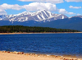
Mount Elbert is the highest summit of the Rocky Mountains of North America. With an elevation of 14,438 feet (4400.58 m), it is also the highest point in the U.S. state of Colorado and the second-highest summit in the contiguous United States after Mount Whitney, which is slightly taller. The ultra-prominent fourteener is the highest peak in the Sawatch Range, as well as the highest point in the entire Mississippi River drainage basin. Mount Elbert is located in San Isabel National Forest, 12.1 miles (19.4 km) southwest of the city of Leadville in Lake County, Colorado.

Mount Massive is the second-highest summit of the Rocky Mountains of North America and the U.S. state of Colorado. It is located in the Mount Massive Wilderness of San Isabel National Forest, 10.6 miles (17.1 km) west-southwest of the City of Leadville in Lake County, Colorado, United States. Mount Massive edges out the third-highest summit of the Rockies, Mount Harvard, by 2 feet (0.61 m), but falls short of Mount Elbert by 14 feet (4.3 m). It ranks as the third-highest peak in the contiguous United States after Mount Whitney and Mount Elbert.

Mount of the Holy Cross is a high and prominent mountain summit in the northern Sawatch Range of the Rocky Mountains of North America. The 14,011-foot (4270.5 m) fourteener is located in the Holy Cross Wilderness of White River National Forest, 6.6 miles (10.7 km) west-southwest of the Town of Red Cliff in Eagle County, Colorado, United States. The summit of Mount of the Holy Cross is the highest point in Eagle County and the northern Sawatch Range.

Grand Teton is the highest mountain of the Teton Range in Grand Teton National Park at 13,775 feet (4,199 m) in Northwest Wyoming. Below its north face is Teton Glacier. The mountain is a classic destination in American mountaineering via the Owen-Spalding route, the North Ridge and North Face.

Mount Moran is a mountain in Grand Teton National Park of western Wyoming, USA. The mountain is named for Thomas Moran, an American western frontier landscape artist. Mount Moran dominates the northern section of the Teton Range rising 6,000 feet (1,800 m) above Jackson Lake. Several active glaciers exist on the mountain with Skillet Glacier plainly visible on the monolithic east face. Like the Middle Teton in the same range, Mount Moran's face is marked by a distinctive basalt intrusion known as the Black Dike.

Ferdinand Vandeveer Hayden was an American geologist noted for his pioneering surveying expeditions of the Rocky Mountains in the late 19th century. He was also a physician who served with the Union Army during the Civil War.

La Plata Peak is the fifth-highest summit of the Rocky Mountains of North America and the U.S. state of Colorado. The prominent 14,343-foot (4,372 m) fourteener is located in the Collegiate Peaks Wilderness of San Isabel National Forest, 22.7 miles (36.5 km) northwest by west of the Town of Buena Vista in Chaffee County, Colorado, United States.

Tempe Butte is the official name of an andesite butte of volcanic origin, located partially on Arizona State University's Tempe campus in Tempe, Arizona. It is often referred to by locals as A Mountain, after the 60-foot-tall (18 m) gold-painted letter 'A' near the top. Another name for the area, used by the City of Tempe, is Hayden Butte.

Mount Wilson is the highest summit of the San Miguel Mountains range of the Rocky Mountains of North America. The prominent 14,254.1-foot (4,345 m) fourteener is located in the Lizard Head Wilderness of San Juan National Forest, 10.6 miles (17.1 km) north by east of the Town of Rico in Dolores County, Colorado, United States. Mount Wilson should not be confused with the lower Wilson Peak nearby.

Mount Eolus is a high mountain summit of the Needle Mountains range of the Rocky Mountains of North America. The 14,085-foot (4,293 m) fourteener is located in the Weminuche Wilderness of San Juan National Forest, 27.4 miles (44.1 km) northeast by north of the City of Durango in La Plata County, Colorado, United States.

The Oregon State Senate is the upper house of the statewide legislature for the US state of Oregon. Along with the lower chamber Oregon House of Representatives it makes up the Oregon Legislative Assembly. There are 30 members of the state Senate, representing 30 districts across the state, each with a population of 141,242. The state Senate meets in the east wing of the Oregon State Capitol in Salem.

Electric Peak is the tallest mountain in the Gallatin Range of southern Montana, close to the Wyoming border and rising to an altitude of 10,969 feet (3,343 m). The peak has some of the greatest physical relief in Yellowstone National Park, rising 3,389 ft (1,033 m) above its base.

Alsea is an unincorporated community in Benton County, in the U.S. state of Oregon. It is on Oregon Route 34 and the Alsea River. For statistical purposes, the United States Census Bureau has defined Alsea as a census-designated place (CDP). The census definition of the area may not precisely correspond to the local understanding of the area with the same name. As of the 2023 Census population estimates, the population was 220.

Mount Peale is the highest point in the La Sal Mountains of San Juan County, in the southeastern part of Utah, United States. It is also the highest point in Utah outside the Uinta Mountains. It is located about 20 mi (32 km) southeast of Moab. The summit is the highest point in the Manti-La Sal National Forest and the Mount Peale Research Natural Area. Mount Peale was named for Albert Peale, a mineralogist on the Hayden Survey of 1875.

The Hayden Homes Amphitheater is an outdoor amphitheater built in the historic Old Mill District in Bend, Oregon. The amphitheater's name-in-title sponsor is Hayden Homes, a Central Oregon home builder. The venue was formerly named the Les Schwab Amphitheater, after a Central Oregon businessman.
Mount Stevenson el. 10,230 feet (3,120 m) is a mountain peak in the Absaroka Range of Yellowstone National Park. Mount Stevenson was named in 1871 by geologist Ferdinand Hayden during the Hayden Geological Survey of 1871 for his friend and chief assistant, James Stevenson (1840–1888). Stevenson, who had run away from home as a young boy, first met Hayden in 1853 during an exploration of the Dakota Badlands. In 1866, Stevenson began working for Hayden and did so until 1879. Hayden specifically cited Stevenson's loyalty to him in his 1872 report on the 1871 survey of the park. Stevenson Island on Yellowstone Lake is also named for James Stevenson.
My principal assistant, Mr. James Stevenson, labored with his usual efficiency and fidelity throughout the entire trip. In honor of his great services not only during the past season, but for over twelve years of unremitting toil as my assistant, oftentimes without pecuniary reward, and with little of the scientific recognition that uaually comes to the original explorer, I have desired that one of the principal islands of the lake and one of the noble peaks reflected in its clear waters should bear his name forever.
Grass Mountain is a 3,607-foot (1,099 m) tall mountain in the Central Oregon Coast Range in the U.S. state of Oregon. Located in Benton County, it is the second highest peak in the Central Coast Range.

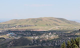
Green Mountain is a mesa on the eastern flank of the Front Range of the Rocky Mountains of North America. The 6,854-foot (2,089 m) mesa summit is located in William Frederick Hayden Park in the City of Lakewood, Colorado, United States, 4.0 miles (6.5 km) west of the municipal center of Lakewood in Jefferson County.

The North Portland Harbor is an Oregon waterway or channel in Multnomah County, specifically in Portland. An anabranch, about 5 miles (8 km) long, of the Columbia River, it separates Hayden and Tomahawk islands from the mainland. Flowing generally northwest, the channel rejoins the main stem slightly upstream of Kelley Point Park and the mouth of the Willamette River.


