Dathina, the Dathina Sheikhdom, or sometimes the Dathina Confederation, was a state in the British Aden Protectorate, the Federation of Arab Emirates of the South, and its successor, the Federation of South Arabia. Its capital was Mudiyah.
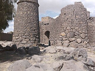
Jabal Baʽdan, also known as Mount Baʽdan or Baʽadan, is a mountain in western central Yemen with an altitude over 2.8 km, it is one of the highest mountains in Yemen. It is located in the Ba'adan District, Ibb Governorate and borders Ibb city from the East. Ba'adan is famous with its green sceneries, and contains several cultural and tourist locations such as The Castle of Hab.
Bogojevići is a village in the municipality of Arilje, Serbia. According to the 2011 census, the village has a population of 634 people.
Grdovići is a village in the municipality of Arilje, Serbia. According to the 2011 census, the village has a population of 519 people.
Dražinovići is a village in the municipality of Požega, western Serbia. According to the 2022 census, the village has a population of 225 people.
Hagedal is a village in Belgaum district in the southern state of Karnataka, India.
Brniševo is a village in the municipality of Tutin, Serbia. According to the 2002 census, the village has a population of 88 people.
Potreb is a village in the municipality of Tutin, Serbia. According to the 2002 census, the village has a population of 267 people.
Ramoševo is a village in the municipality of Tutin, Serbia. According to the 2002 census, the village has a population of 238 people.
Iyal Surayh District is a district of the 'Amran Governorate, Yemen. As of 2003, the district had a population of 54,015 inhabitants.
Ad Dahi District is a district of the Al Hudaydah Governorate, Yemen. In 2003, the district had a population of 54,503.
Bayt al-Faqih District is a district of the Al Hudaydah Governorate, Yemen. As of 2003, the district had a population of 241,300 inhabitants.
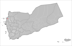
Harad District is a district of the Hajjah Governorate, Yemen. As of 2003, the district had a population of 93,523 inhabitants.

Maqbanah District is a district of the Taiz Governorate, Yemen. As of 2003, the district has a population of 62,471 inhabitants. The district is divided into three Makhalief: Mikhlaf Shamir, Mikhlaf Mirab and Mikhlaf al-Tharibat.
Radfan District is a district of the Lahij Governorate, Yemen. As of 2003, the district had a population of 45,570 people.
Majz District is a district of the Sa'dah Governorate, Yemen. As of 2003, the district had a population of 68,598 inhabitants.
Monabbih District is a district of the Sa'dah Governorate, Yemen. As of 2003, the district had a population of 51,823 inhabitants.
Hamdan District is a district of the Sana'a Governorate, Yemen. As of 2003, the district had a population of 85,370 inhabitants. It is named after the ancient Yemeni tribe of Hamdan.
Sa'fan District is a district of the Sana'a Governorate, Yemen. As of 2003, the district had a population of 33,722 inhabitants.
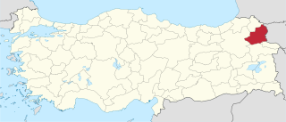
Kars is an electoral district of the Grand National Assembly of Turkey. It elects three members of parliament (deputies) to represent the province of the same name for a four-year term by the D'Hondt method, a party-list proportional representation system.