
Al Mahwit is one of the governorates of Yemen.

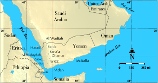
Al Hudaydah is a governorate of Yemen. Its capital is Al Hudaydah. The governorate is also sometimes referred to as the Western Coast. With an estimated population of nearly 4 million, it is the third-most populous governorate in Yemen, behind Ibb and Taiz.
Al Qaflah District is a district of the 'Amran Governorate, Yemen. As of 2003, the district had a population of 36,722 inhabitants.
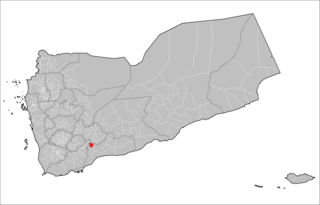
Sibah District is a district of the Abyan Governorate, Yemen. As of 2003, the district had a population of 15,996 inhabitants.
Al Mansuriyah District is a district of the Al Hudaydah Governorate, Yemen. As of 2003, the district had a population of 44,744 inhabitants.
As Sukhnah District is a district of the Al Hudaydah Governorate, Yemen. As of 2003, the district had a population of 59,652 inhabitants.
Az Zuhrah District is a district of the Al Hudaydah Governorate, Yemen. As of 2003, the district had a population of 138,045 inhabitants.
Bayt al-Faqih District is a district of the Al Hudaydah Governorate, Yemen. As of 2003, the district had a population of 241,300 inhabitants.
Bura District is a district of the Al Hudaydah Governorate, Yemen. As of 2003, the district had a population of 45,116 inhabitants.
Zabid District is a district of the Al Hudaydah Governorate in western Yemen.
Man'ar District is a district of the Al Mahrah Governorate, Yemen. As of 2003, the district had a population of 5,388 inhabitants.
Harad District is a district of the Hajjah Governorate, Yemen. As of 2003, the district had a population of 93,523 inhabitants.
Midi District is a district of the Hajjah Governorate, Yemen. As of 2003, the district had a population of 16,604 inhabitants.
Mustaba District is a district of the Hajjah Governorate, Yemen. As of 2003, the district had a population of 42,531 inhabitants.
Qarah District is a district of the Hajjah Governorate, Yemen. As of 2003, the district had a population of 30,641 inhabitants.

Rumah District is a district of the Hadhramaut Governorate, Yemen. As of 2021, the district had a population of 10,080 inhabitants.
Baqim District is a district of the Sa'dah Governorate, Yemen. As of 2003, the district had a population of 22,965 people.
Qatabir District is a district of the Sa'dah Governorate, Yemen. As of 2003, the district had a population of 22,658 inhabitants.
Shada'a District is a district of the Sa'dah Governorate, Yemen. As of 2003, the district had a population of 11,202 inhabitants.

Arhab District is a district of the Sana'a Governorate, Yemen. As of 2003, the district had a population of 90,038 inhabitants.
