French Somaliland was a French colony in the Horn of Africa. It existed between 1884 and 1967, at which became the French Territory of the Afars and the Issas. The Republic of Djibouti is its legal successor state.

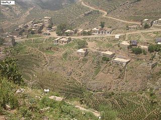
Village Alotna / Attna is a village in Yemen.
Al Qaflah District is a district of the 'Amran Governorate, Yemen. As of 2003, the district had a population of 36,722 inhabitants.
Dhi Bin District (Arabic: مديرية ذيبين) is a district of the 'Amran Governorate, Yemen. As of 2003, the district had a population of 30,799 inhabitants.

Huth District is a district of the 'Amran Governorate, Yemen. As of 2003, the district had a population of 22,267 inhabitants.
Kharif District is a district of the 'Amran Governorate, Yemen. As of 2003, the district had a population of 45,977 inhabitants. On July 13, 2020, it is reported that the Houthi militia captured the last Jews of Yemen in the Kharif District.

Shaharah District is a district of the 'Amran Governorate, Yemen. As of 2003, the district had a population of 43,738 inhabitants. Its capital lies at Shaharah.
Suwayr District is a district of the 'Amran Governorate, Yemen. As of 2003, the district had a population of 20,854 inhabitants.

Mudiyah District is a district of the Abyan Governorate, Yemen. As of 2003, the district had a population of 34,879 inhabitants.
Ad Dahi District is a district of the Al Hudaydah Governorate, Yemen. In 2003, the district had a population of 54,503.
Ad Durayhimi District is a district of the Al Hudaydah Governorate, Yemen. As of 2003, the district had a population of 55,013 inhabitants.
At Tuhayta District is a district of the Al Hudaydah Governorate, Yemen. As of 2003, the district had a population of 67,660 people.
Zabid District is a district of the Al Hudaydah Governorate in western Yemen.
Hufash District is a district of the Al Mahwit Governorate, Yemen. As of 2003, the district had a population of 37,884 inhabitants.
Mustaba District is a district of the Hajjah Governorate, Yemen. As of 2003, the district had a population of 42,531 inhabitants.
Qarah District is a district of the Hajjah Governorate, Yemen. As of 2003, the district had a population of 30,641 inhabitants.
Hidaybu District is one of two districts of the Socotra Governorate, Yemen. It occupies the eastern part of the main island of Socotra archipelago. It is named after its capital and the principal town of the archipelago, the town of Hidaybu (Hadibu). As of 2003, the district had a population of 34,011 people.
Huraidhah District is a district of the Hadhramaut Governorate, Yemen. As of 2021, the district had a population of 26,340 inhabitants.
Attyal District is a district of the Sana'a Governorate, Yemen. As of 2003, the district had a population of 36,253 inhabitants. Hajrat Shawkan village is in this district.
Sanhan and Bani Bahlul District is a district of the Sana'a Governorate, Yemen. Its seat is Sanhan. As of 2003, the district had a population of 400,399 inhabitants. The former President of Yemen Ali Abdullah Saleh comes from Beit al-Ahmar, which lies in Sanhan District.


