The National Register of Historic Places (NRHP) is the United States federal government's official list of districts, sites, buildings, structures, and objects deemed worthy of preservation for their historical significance or "great artistic value". A property listed in the National Register, or located within a National Register Historic District, may qualify for tax incentives derived from the total value of expenses incurred in preserving the property.
Monocacy National Battlefield is a unit of the National Park Service, the site of the Battle of Monocacy in the American Civil War fought on July 9, 1864. The battlefield straddles the Monocacy River southeast of the city of Frederick, Maryland. The battle, labeled "The Battle That Saved Washington," was one of the last the Confederates would carry out in Union territory. The two opposing leaders were General Jubal Early, fighting for the South, and General Lew Wallace, fighting for the North.

West Hartford is an unincorporated community village in the town of Hartford, Windsor County, Vermont. It is the most rural of Hartford's five villages, situated on the White River and crossed by the Appalachian Trail.

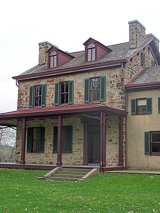
Friendship Hill was the home of early American politician and statesman Albert Gallatin (1761–1849). Gallatin was a U.S. Congressman, the longest-serving Secretary of the Treasury under two presidents, and ambassador to France and Great Britain. The house overlooks the Monongahela River near Point Marion, Pennsylvania, about 50 miles (80 km) south of Pittsburgh.

The Grand Circus Park Historic District contains the 5-acre (2.0 ha) Grand Circus Park in Downtown Detroit, Michigan that connects the theatre district with its financial district. It is bisected by Woodward Avenue, four blocks north of Campus Martius Park, and is roughly bounded by Clifford, John R. and Adams Streets. The district was listed on the National Register of Historic Places in 1983. The building at 25 West Elizabeth Street was added to the district in 2000, and additional structures located within the district, but built between 1932 and 1960, were approved for inclusion in 2012.

Ohio Drive is a street in Southwest Washington, D.C., located in East and West Potomac Parks and bordering the Tidal Basin, Washington Channel, and the Potomac River. It is a central organizing feature of East Potomac Park, providing the only major vehicular route to and through the area. Unlike most roadways named after states in the District of Columbia, Ohio Drive is not an avenue, nor it is heavily used like Wisconsin or Rhode Island Avenues. However, the segment from Independence Avenue to the Rock Creek and Potomac Parkway is an important commuter route.

Ambler's Texaco Gas Station, also known as Becker's Marathon Gas Station, is a historic filling station located at the intersection of Old U.S. Route 66 and Illinois Route 17 in the village of Dwight, Illinois, United States. The station has been identified as the longest operating gas station along Route 66; it dispensed fuel for 66 continuous years until 1999. The station is a good example of a domestic style gas station and derives its most common names from ownership stints by two different men. North of the station is an extant outbuilding that once operated as a commercial icehouse. Ambler's was the subject of major restoration work from 2005–2007, and reopened as a Route 66 visitor's center in May 2007. It was added to the U.S. National Register of Historic Places in 2001.

U.S. Highway 63 is a north-south U.S. highway that begins in Ruston, LA. In the US state of Arkansas the highway enters the state from Louisiana concurrent with US 167 in Junction City. The highway runs north through the eastern part of the state, serving rural areas of South Arkansas and the Arkansas Delta, as well as Pine Bluff and Jonesboro. The highway exits the state at Mammoth Spring traveling into Missouri.
This is a list of the National Register of Historic Places listings in Zion National Park.
Hazen is an unincorporated community in Churchill County, Nevada, United States. The community is approximately 12 miles (19 km) southeast of Fernley and 16 miles (26 km) northwest of Fallon, on U.S. Route 50 Alternate.

The Daniels Farm House represents one of the last vestiges of West Texas pioneer farming in Big Bend National Park, Texas. Most of the small-scale farms in the Big Bend area quickly fell into ruin after the park was established in 1944. Larger-scale ranch structures survived in greater numbers, but the small-scale irrigated bottomland farms have not. The farm is located next to the Rio Grande.

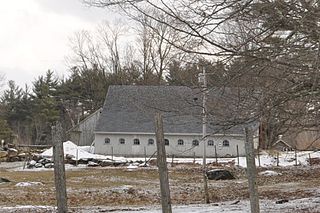
The Frost Farm is a historic farmstead on Korpi Road in Dublin, New Hampshire. It includes a farmhouse built in 1806 and subsequently enlarged, and a renovated 19th-century barn. The property is significant for its architecture, and for its ownership by both early settlers and later Finnish immigrants. A portion of the property was listed on the National Register of Historic Places in 1983.

The Furnace Grove Historic District encompasses the remains of a historic 19th-century iron processing facility near Bennington, Vermont. Located on the north side of Vermont Route 9 east of the town center, its production peaked in the 1830s, and was afterward converted into a gentleman's farm. Surviving elements of its past include the remains of iron smelting furnaces, housing, and agricultural outbuildings. The district was listed on the National Register of Historic Places in 1997.

The Broad Run–Little Georgetown Rural Historic District encompasses a large rural landscape in northeastern Fauquier County, Virginia, and a small portion of neighboring Prince William County, Virginia. The district covers about 9,500 acres (3,800 ha) of rolling hills, that has an agricultural history dating to the 18th century. It is roughly divided by the John Marshall Highway, and is bounded on the west by The Plains, the east by the Bull Run Mountains, and the south by Pignut Mountain.

The Bayley Historic District encompasses a small cluster of buildings in Newbury, Vermont, a number of which are associated with the historically prominent Bayley family. It includes some of the town's oldest buildings, and is where the founder of the town, Jacob Bayley, first settled and later died. The district is oriented along Oxbow Road west of United States Route 5 and north of the town's main village. It was listed on the National Register of Historic Places in 1983.

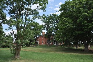
The Colonel Ephraim and Sarah Doolittle Farm is a historic farm property on Doolittle Road in Shoreham, Vermont. It is one of the oldest colonial farm properties in western Vermont, established in 1766 by Colonel Ephraim Doolittle, a veteran of the French and Indian War and the American Revolutionary War. It was listed on the National Register of Historic Places in 1995.

The Cornwall General Store, also known as the LaValley General Store, was a historic commercial building at 2635 Vermont Route 30 in the center of Cornwall, Vermont. Built in 1880 and in retail use for more than half a century, it was a well-preserved example of a dwindling business type, the rural general store with attached residence, listed on the National Register of Historic Places in 2005. Sold to the town for preservation in 2000, it was demolished about 2013.

The Montgomery House is a historic travel accommodation on Vermont Route 118 in the center of Montgomery, Vermont. Built in 1803, it is one of the town's oldest buildings, and it served for many years as a social and civic center in the small community. It was listed on the National Register of Historic Places in 1992.

The J.R. Darling Store is a historic commercial building at 1334 Scott Highway in Groton, Vermont. It was built about 1895 on a site that has long housed commercial activity, and was the town's last general store. It was listed on the National Register of Historic Places in 2004.

The Hardwick Street Historic District encompasses the earliest settlement area of Hardwick, Vermont. Extending along Hardwick Street and Bayley-Hazen Road in a rural area of eastern Hardwick, it includes eight farm properties dating to the early 19th century. It was listed on the National Register of Historic Places in 1979.


