| Marker # | Year installed | Title | Address | Picture |
|---|
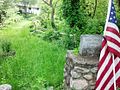
| NY-0 | | Crown Point | 21 Grandview Dr, Crown Point, NY 12928 |  |
| NY-1 | | Fort Ticonderoga (located inside the Fort) | 102 Fort Ti Rd, Ticonderoga, NY 12883 |  |
| NY-2 | | Fort Ticonderoga Marker #2 | 102 Fort Ti Rd (Sandy Redoubt South Entrance to Park), Ticonderoga, NY 12883 |  |
| NY-3 | | Ticonderoga | 137 Montcalm St, Ticonderoga, NY 12883 |  |
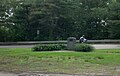
| NY-4 | | Lake George | 651 Black Point Rd, Ticonderoga, NY 12883 |  |
| NY-5 | | Sabbath Day Point | 44 Sabbath Day Point Rd, Silver Bay, NY 12874 | |
| NY-6 | | Bolton Landing | 19 Rogers Memorial Park Rd, Bolton Landing, NY 12814 |  |
| NY-7 | | Lake George Battlefield | 75 Fort George Rd, Lake George, NY 12845 (43°25'04.4"N, 73°42'25.9"W) |  |
| NY-8 | | Bloody Brook | 1716 State Route 9, Lake George, NY 12845 |  |
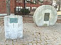
| NY-9 | | Glens Falls | 626 Glen St, Queensbury, NY 12804 |  |
| NY-10 | | Hudson Falls | 220 Main St, Hudson Falls, NY 12839 |  |
| NY-11 | | Fort Edward | 219 Broadway, Fort Edward, NY 12828 |  |
| NY-12 | | Fort Miller | 1061 State Route 4, Greenwich, NY 12834 |  |
| NY-13 | | Northumberland | 107 Starks Knob Rd, Schuylerville, NY 12871 |  |
| NY-14 | | Schuylerville | 2 Broad St, Schuylerville, NY 12871 |  |
| | Ensign House | 513 Saratoga County Veterans Memorial Highway, Stillwater, NY 12170 | |
| NY-15 | | Bemis Heights | 1173 Old Route 32, Stillwater, NY 12170 |  |
| NY-16 | | Stillwater | 75 Hudson Ave, Stillwater, NY 12170 |  |
| NY-17 | | Mechanicville | 6 S Main St, Mechanicville, NY 12118 |  |
| NY-18 | | Waterford | 55 1st St, Waterford, NY 12188 |  |
| NY-19 | | Klaus' Ferry | 1258 New Loudon Rd, Cohoes, NY 12047 |  |
| NY-20 | | Latham | 206 Old Loudon Rd, Latham, NY 12110 |  |
| NY-21 | | Albany | 350 Northern Blvd, Albany, NY 12204 |  |
| NY-22 | | Albany Riverside Park | 191 Broadway, Albany, NY 12202 |  |
| NY-23 | | Rensselaer | 30 Aiken Ave, Rensselaer, NY 12144 |  |
| NY-24 | | East Greenbush | 688 Columbia Tpke, East Greenbush, NY 12061 |  |
| NY-25 | | Schodack | 1972 Route 9, Castleton on Hudson, NY 12033 |  |
| NY-26 | | Kinderhook | 1 Hudson St, Kinderhook, NY 12106 |  |
| NY-27 | | West Ghent | 6 Snyder Rd, Ghent, NY 12075 |  |
| NY-28 | | Claverack | 1202 Harlemville Rd, Ghent, NY 12075 |  |
| NY-29 | | Old Nobletown | 40 Nobletown Rd, Hillsdale, NY 12529 |  |
| NY-30 / MA-1 | | Alford, MA | MA-71 179 Green River Valley Rd. [6] |  |
| MA-2 | | North Egremont, MA | 223 Egremont Plain Rd. |  |
| MA-3 | | Great Barrington, MA | Intersection of Route 23 and Route 7 |  |
| MA-4 | | Monterey, MA | Route 23 |  |
| | Otis, MA | Route 23 |  |
| MA-5 | | Blandford, MA | Route 23 & North Blandford Rd., Blandford, MA 01008 |  |
| MA-6 | | Russell, MA | Intersection of General Knox Road and South Quarter Road |  |
| MA-7 | | Westfield, MA | Main Street at N 42° 07.252; W 072° 44.892 |  |
| MA-8 | | West Springfield, MA | Route 20 [7] |  |
| MA-9 | | Springfield, MA | Boston Post Rd. (State Street) |  |
| MA-10 | | Wilbraham, MA | Route 20 & Main Street |  |
| MA-11 | | Palmer, MA | 1 Wilbraham Street |  |
| MA-12 | | Warren, MA | Route 67 (Main St.) at the intersection with Washington St. |  |
| MA-13 | | Brookfield, MA | State Route 9 at the intersection with State Route 148 |  |
| MA-14 | | Spencer, MA | next to 117 Main St. [8] |  |
| MA-15 | | Leicester, MA | 1136 Main St., in front of the Leicester Public Library and Museum |  |
| MA-16 | | Worcester, MA | Main Street at Lincoln Square |  |
| MA-17 | | Shrewsbury, MA | Main St. at Shrewsbury Common | |
| MA-18 | | Northborough, MA | 63 Main Street (in front of Town Hall) |  |
| MA-19 | | Marlborough, MA | |  |
| MA-20 | | Southborough, MA | 28 Main Street, Southborough, MA |  |
| MA-21 | | Framingham, MA | |  |
| MA-23 | | Wayland, MA | Old Connecticut Path and Cochituate Rd. |  |
| MA-24 | | Weston, MA | Boston Post Rd. and Town House Rd. |  |
| MA-25 | | Waltham, MA | Route 20 (Weston St.) & Main Street |  |
| MA-26 | | Watertown | 481 Mt Auburn St, Watertown, MA 02472 |  |
| MA-27 | | Cambridge | 42° 22.593′ N, 71° 7.313′ W, Corner of Garden St and Mason St on the Cambridge Common, Cambridge, MA [9] |  |
| MA-27.5 | | Roxbury, MA | Malcolm X Blvd & Roxbury Street |  |
| MA-28 | | South Boston | Thomas Park, Dorchester Heights |  |


