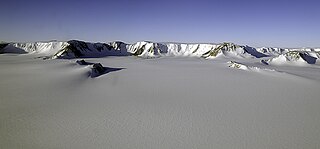
The Nimrod Glacier is a major glacier about 135 km (85 mi) long, flowing from the polar plateau in a northerly direction through the Transantarctic Mountains into the Ross Ice Shelf, Antarctica.
The Geologists Range is a mountain range about 55 km (34 mi) long, standing between the heads of Lucy and Nimrod Glaciers in Antarctica. Seen by the northern party of the New Zealand Geological Survey Antarctic Expedition (NZGSAE) (1961–62) and named to commemorate the work of geologists in Antarctic exploration.

The Shackleton Range is a mountain range in Antarctica that rises to 1,875 metres (6,152 ft) and extends in an east–west direction for about 100 miles (160 km) between the Slessor and Recovery Glaciers.
Skelton Glacier is a large glacier flowing from the polar plateau into the Ross Ice Shelf at Skelton Inlet on the Hillary Coast, south of Victoria Land, Antarctica.

The Bay of Whales was a natural ice harbour, or iceport, indenting the front of the Ross Ice Shelf just north of Roosevelt Island, Antarctica. It holds the distinction of being the southernmost point of open ocean, not only within the Ross Sea but worldwide. While the Ross Sea stretches considerably further south – encompassing the Gould Coast, located around 320 kilometres from the South Pole – the majority of this expanse is covered by the Ross Ice Shelf, rather than open sea.

Leverett Glacier in Antarctica is about 50 nautical miles (90 km) long and 3 to 4 nautical miles wide, flowing from the Antarctic Plateau to the south end of the Ross Ice Shelf. It is an important part of the South Pole Traverse from McMurdo Station to the Admundson–Scott South Pole Station, providing a route for tractors to climb from the ice shelf through the Transantarctic Mountains to the polar plateau.

The Byrd Glacier is a major glacier in Antarctica, about 136 km (85 mi) long and 24 km (15 mi) wide. It drains an extensive area of the Antarctic plateau, and flows eastward to discharge into the Ross Ice Shelf.

The Darwin Glacier is a large glacier in Antarctica. It flows from the polar plateau eastward between the Darwin Mountains and the Cook Mountains to the Ross Ice Shelf. The Darwin and its major tributary the Hatherton are often treated as one system, the Darwin–Hatherton.

Patriot Hills Base Camp was a private seasonally occupied camp in Antarctica. It was located in the Heritage Range of the Ellsworth Mountains, next to the Patriot Hills that gave it its name.

The South Pole, also known as the Geographic South Pole, Terrestrial South Pole or 90th Parallel South, is the southernmost point on Earth and lies antipodally on the opposite side of Earth from the North Pole, at a distance of 12,430 miles in all directions. It is one of the two points where Earth's axis of rotation intersects its surface.
Wilson Nunataks is an irregular string of nunataks about 8 nautical miles (15 km) long, lying between the Douglas Peaks and the head of Hercules Inlet in the Heritage Range, Ellsworth Mountains. Named by the University of Minnesota Geological Party to these mountains, 1963–64, for Chief Warrant Officer Kenneth Wilson, pilot with the 62nd Transportation Detachment which assisted the party.
The Carlstrom Foothills are a group of peaks and ridges in the Churchill Mountains, Antarctica.
Constellation Inlet is an ice-filled inlet, 30 nautical miles (60 km) long and 10 nautical miles (20 km) wide, between the Dott Ice Rise and the Skytrain Ice Rise at the southwest margin of the Ronne Ice Shelf. It was mapped by the United States Geological Survey from surveys and from U.S. Navy air photos, 1961–66, and named by the Advisory Committee on Antarctic Names for the Lockheed Super Constellation aircraft, C-121J. Equipped only with wheeled tricycle landing gear, it was for many years the principal carrier of personnel from the U.S. to New Zealand and thence to the ice runway near McMurdo Station. In addition to its role of hauling men and supplies, the "Connie" flew many hours of aerial photography over Antarctica.

Nicholson Peninsula is a broad ice-covered peninsula about 15 nautical miles (28 km) long, between Couzens Bay and Matterson Inlet on the Shackleton Coast on the west side of the Ross Ice Shelf, Antarctica.
Cape Lyttelton is a cape forming the southern entrance point of Shackleton Inlet, along the western edge of the Ross Ice Shelf, Antarctica.

Air Development Squadron Six was a United States Navy Air Development Squadron based at McMurdo Station, Antarctica. Established at Naval Air Station Patuxent River, Maryland on 17 January 1955, the squadron's mission was to conduct operations in support of Operation Deep Freeze, the operational component of the United States Antarctic Program.
Ryan Waters is an American mountaineer, mountaineering guide, and polar skiing guide.

This is a Timeline ofwomen in Antarctica. This article describes many of the firsts and accomplishments that women from various countries have accomplished in different fields of endeavor on the continent of Antarctica.

Harpreet Kaur "Preet" Chandi is a British physiotherapist and British Army medical officer who completed a solo expedition across Antarctica to the South Pole, finishing on 3 January 2022. In January 2023, she recorded the longest ever solo and unsupported polar expedition.


