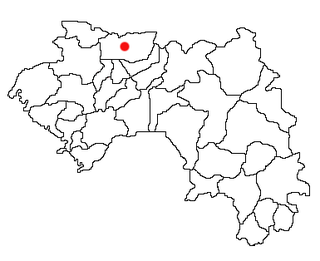
Télimélé is a town in the Fouta Djallon highlands of Guinea. Its population was estimated at 15,973 in 2008. It is the capital of Télimélé Prefecture.
Faranah is a town and sub-prefecture in central Guinea, lying by the River Niger. As of 2014 it had a population of 78,108 people. The town is mainly inhabited by the Malinke people.

Yomou is a prefecture located in the Nzérékoré Region of Guinea. The capital and principal town of the prefecture is Yomou. The prefecture covers an area of 3,920 km.² and has an estimated population of 114,371.

Lélouma is a prefecture located in the Labé Region of Guinea. The capital is Lélouma. The prefecture covers an area of 2,140 km.² In census of 2014, it had population of 163,000.

Koundara is a prefecture located in the Boké Region of Guinea. The capital is Koundara. The prefecture covers an area of 5,238 km.² and has a population of 130,205.

The Mamou Region is located in central Guinea. It is bordered by the country of Sierra Leone and the Guinean regions of Faranah, Labé, and Kindia.

The Labé Region is located in north-central Guinea. It is bordered by the countries of Senegal and Mali and the Guinean regions of Faranah, Kindia, Mamou, and Boké.
Boffa is a town and sub-prefecture located on Guinea's coast. It is the capital of Boffa Prefecture. Boffa is the nearest town to the mouth of the River Pongo. As of 2014 it had a population of 27,047 people.
Piedrabuena is a municipality in Ciudad Real, Castile-La Mancha, Spain. It has a population of 4,759.
Almoharín is a municipality located in the province of Cáceres, Extremadura, Spain. According to the 2005 census (INE), the municipality has a population of 2050 inhabitants. The village is primarily concerned with agriculture with many inhabitants having fincas of olives and figs. Almoharin is known as the 'Fig Capital of the World' on account of these figs; black and smooth-textured. Both dried figs and chocolate figs are exported worldwide. The village also boasts a cheese-making workshop where you can make your own cheese - after milking the sheep. There is an accompanying exhibition of the history of sheep and cheese-making in the area.
Kaala is a town and sub-prefecture in the Dalaba Prefecture in the Mamou Region of western Guinea.
Foulamory is a town and sub-prefecture in Gaoual Prefecture, in the Boké Region of northwestern Guinea. As of 2014 it had a population of 10,207 people.
Bardou is a town and sub-prefecture in the Kissidougou Prefecture in the Faranah Region of Guinea. As of 2014 it had a population of 9,767 people.
Kondiadou or Koundiatou is a town and sub-prefecture in the Kissidougou Prefecture in the Faranah Region of Guinea. As of 2014 it had a population of 14,897 people.
Yendé-Millimou is a sub-prefecture in the Kissidougou Prefecture in the Faranah Region of Guinea. It includes the settlements of Yendé and Millimou. As of 2014 it had a population of 20,372 people.
Kounsankoro is a town and sub-prefecture in the Kérouané Prefecture in the Kankan Region of south-eastern Guinea. As of 2014, it had a population of 7,053 people.
Sibiribaro is a town and sub-prefecture in the Kérouané Prefecture in the Kankan Region of south-eastern Guinea. As of 2014 it had a population of 16,485 people.
Fassankoni is a town and sub-prefecture in the Macenta Prefecture in the Nzérékoré Region of south-eastern Guinea.
Madina-Wora is a town and sub-prefecture in the Mali Prefecture in the Labé Region of northern Guinea.
Soyah is a town and sub-prefecture in the Mamou Prefecture in the Mamou Region of Guinea.