Highburton

Last updated

Highburton
Cycle shop, North Road, Highburton, Kirkburton township - geograph.org.uk - 393945.jpg
North Road, Highburton
West Yorkshire UK location map.svg
Red pog.svg
Highburton
Location within West Yorkshire
Civil parish
Metropolitan borough
Metropolitan county
Region
Country England
Sovereign state United Kingdom
Post town Huddersfield
Postcode district HD8
UK Parliament
List of places
UK
England
Yorkshire
53°37′05″N1°42′47″W / 53.618060°N 1.713038°W / 53.618060; -1.713038

Highburton is part of the township of Kirkburton, a village in the county of West Yorkshire, England. It is five miles southeast of Huddersfield. It occupies much of the high ground that can be found at the top of the steep inclines of Far Dene and Slant Gate and is a mixture of densely congregated housing estates and open pastoral farmland.

Contents

According to the 2001 census Highburton had a population of 3,288. [1]

History

Highburton was listed as "Bertone" in the Domesday Book . [2] It has been suggested[ by whom? ] that Highburton was the location of the original settlement that now makes up Kirkburton, given its strategic high ground. Historians[ which? ] consider that the original church or religious temple was located in this part of the village before it was relocated to its present position. It is more likely, given the possible existence of an Iron Age settlement in Kirkburton that both villages commenced life at similar stages.[ according to whom? ] It was a hamlet until the middle of the 20th century, when housing developments increased the size of the village substantially. The historic old part of the village is around the Cross on Slant Gate, Far Dene and Towngate. Houses towards the eastern part of the village, on the streets that border Moor Lane and Burton Acres Lane, were built much later on what were fields and allotments. Today Highburton is the largest residential area within the township, whilst Kirkburton remains, as it was traditionally, the commercial part.[ citation needed ]

Other information

Highburton is home to Highburton First School, the school contains six years including a reception year. [3]

Highburton's local magazine is The Burton Bulletin. [4] It contains news and pictures from Kirkburton, Highburton, Storthes Hall and the surrounding areas and is published every quarter. In A5 format, about 40% of the content is in full colour and usually has a total of approx 200 pages. The editorial office is now in Skelmanthorpe and is printed in Peterborough. It is a free publication, delivered by volunteers to 2100 homes every quarter and additional copies are sent on subscription to various parts of the UK, Canada, USA, Ireland and France.[ citation needed ]

A Royal Navy minesweeper HMS Highburton (M1130) served from 2 June 1954 until she was scrapped in 1978. [5]

Landmarks

Highburton Cross with the rear of The Smiths Arms in the background Highburton Cross.jpg
Highburton Cross with the rear of The Smiths Arms in the background

Highburton Cross marks the site of the medieval market, the steps at the base probably date from the 14th century, the shaft and ball from the 18th or 19th. The cross stands at the top of Far Dene at its junction with Town Gate and Hall Lane. [6] Morehouse states that this ancient cross denoted the place of a market, however "whether originated by charter, or by prescription, is unknown". Highburton (Burton) was a market town in the 12th century, and Court Rolls for the Manor of Wakefield for 1352 indicate the rights to impose tolls on Burton market were being let. [7]

Burton Village Hall, formerly Highburton School, was extensively renovated in 1999 with funds raised by the local community and a grant from the National Lottery Fund. It is home to Kirkburton Parish Council and a number of groups. [6]

Highburton Co-op was located on Towngate in the village centre. It laid claim to being the world's oldest operating independent single retail cooperative outlet until its closure in February 2009. The building was purchased from the church in 1856 and began trading in the same year. The co-operative society was wound up in March 2010 and its assets, including the building, were disposed of. After being closed for 22 months, the building re-opened in December 2010 as a village shop with private offices on the first floor. [6]

The Smiths Arms at the summit of Far Dene is Grade II listed [8] and is the only public house in the village and occupies one of its oldest buildings. Built in 1669 in a Tudor/Jacobean style, it began trading as a public house in 1830. Whilst it is the oldest building in the township it is not the oldest public house. That honour goes to the George Inn in Kirkburton, which dates to the 18th century. [6]

The Primitive Methodists built a chapel at a cost of £100 for 100 people in 1832. [7] It is at the top of Slant Gate. A school, now demolished, was built in 1899 and the chapel was enlarged in 1926. Like the Methodist chapel in Kirkburton it closed in 1973, and is a private house. [6]

See also

Related Research Articles

<span class="mw-page-title-main">Dewsbury</span> Market town in West Yorkshire, England

Dewsbury is a market town in the Metropolitan Borough of Kirklees in West Yorkshire, England. It lies on the River Calder and on an arm of the Calder and Hebble Navigation waterway. It is to the west of Wakefield, east of Huddersfield and south of Leeds. Historically a part of the West Riding of Yorkshire, after undergoing a period of major growth in the 19th century as a mill town, Dewsbury went through a period of decline. Dewsbury forms part of the Heavy Woollen District of which it is the largest town. The population of the built-up area was 63,722 at the 2021 Census.

<span class="mw-page-title-main">Kirkburton</span> Village and civil parish in West Yorkshire, England

Kirkburton is a village, civil parish and ward in Kirklees in West Yorkshire, England. It is 5 miles (8 km) south-east of Huddersfield. Historically part of the West Riding of Yorkshire, the township comprised the villages of Kirkburton and Highburton and several hamlets, including Thunder Bridge, Thorncliffe, Storthes Hall and Linfit. According to the 2011 census the civil parish had a population of 26,439, while the village had a population of 4,299.

<span class="mw-page-title-main">Meltham</span> Town and civil parish in West Yorkshire, England

Meltham is a town and civil parish within the Metropolitan Borough of Kirklees, in West Yorkshire, England. It lies in the Holme Valley, below Wessenden Moor, 5 miles south-west of Huddersfield on the edge of the Peak District National Park. It had a population of 8,089 at the 2001 census, which was estimated to have increased to 8,600 by 2005. The population assessed at the 2011 Census was 8,534. It has 12 elected council members who meet up around every 6 weeks.

<span class="mw-page-title-main">Shelley, West Yorkshire</span> Village in West Yorkshire, England

Shelley is a village in the civil parish of Kirkburton, in the Kirklees district, in the county of West Yorkshire, England. The village is 3 miles (5 km) north of Holmfirth and 6 miles (10 km) south-east of Huddersfield.

<span class="mw-page-title-main">Littleover</span> Human settlement in England

Littleover is a village and suburb in the city of Derby, in Derbyshire, England, between Rose Hill, Normanton, Sunny Hill and Mickleover, about 3 miles (4.8 km) southwest of Derby city centre.

<span class="mw-page-title-main">Worrall</span> Village in South Yorkshire, England

Worrall is a small rural village in the civil parish of Bradfield, South Yorkshire, England, 4 miles (6.5 km) north west of Sheffield city centre. It has an area of 233 hectares, and population of 1,306 as of 2006, and borders the Sheffield suburbs of Wadsley, Middlewood and Loxley to the south and east and the adjoining village of Oughtibridge to the north; to the west is a rural area extending towards the village of High Bradfield.

<span class="mw-page-title-main">Tottington, Greater Manchester</span> Town in Greater Manchester, England

Tottington is a town in the Metropolitan Borough of Bury in Greater Manchester, England, on the edge of the West Pennine Moors. In 2011 it had a population of 9783.

<span class="mw-page-title-main">Birstall, West Yorkshire</span> Market Town in West Yorkshire, England

Birstall is a market and mill town in the metropolitan borough of Kirklees, West Yorkshire, England. It is part of the Birstall and Birkenshaw ward, which had a population of 16,298 at the 2011 census. Historically in the West Riding of Yorkshire, and part of the Heavy Woollen District, Birstall is approximately 6 miles (10 km) south-west of Leeds and situated close to the M62 motorway. The town is situated between Leeds, Bradford, Huddersfield and Wakefield.

<span class="mw-page-title-main">Appleby Magna</span> Village in Leicestershire, England

Appleby Magna is a village and civil parish in the North West Leicestershire district, in the county of Leicestershire, England. It includes the small hamlets of Appleby Parva and Little Wigston.

<span class="mw-page-title-main">Clayton West</span> Village in West Yorkshire, England

Clayton West is a village in the parish of Denby Dale, in Kirklees, West Yorkshire, England. It had a population of 2,704 in 2008. It is 11 miles (18 km) south-east of Huddersfield and 7 miles (11 km) north-west of Barnsley.

<span class="mw-page-title-main">Lepton, West Yorkshire</span> Suburb of Huddersfield, West Yorkshire, England

Lepton is a village near Huddersfield, in the civil parish of Kirkburton, in the Kirklees district of West Yorkshire, England. It is 4.25 miles (7 km) to the east of Huddersfield on the A642 road, 120 metres (390 ft) above the town centre directly north of Lepton Great Wood.

<span class="mw-page-title-main">Shepley</span> Village in West Yorkshire, England

Shepley is a village in the civil parish of Kirkburton, in Kirklees, West Yorkshire, England. It lies 8 miles (13 km) south south east of Huddersfield and 6 miles (9.7 km) north west of Penistone.

<span class="mw-page-title-main">Flockton</span> Village in West Yorkshire, England

Flockton is a village in the civil parish of Kirkburton, in Kirklees, West Yorkshire, England. It is halfway between Huddersfield and Wakefield. In 2020, the population of Flockton and Flockton Green was estimated to be 2,107.

<span class="mw-page-title-main">Emley</span> Village in West Yorkshire, England

Emley is a village in the parish of Denby Dale, in the Kirklees district of West Yorkshire, England between Huddersfield and Wakefield. In the 2021 census it has a population of 1,434. It is 6.4 miles (10 km) east of Huddersfield and 7.1 miles (11 km) west of Wakefield. The village dates from Anglo-Saxon times and is on high ground, close to the Emley Moor transmitting station.

<span class="mw-page-title-main">Almondbury</span> Village in West Yorkshire, England

Almondbury is a village 2 miles (3.2 km) south-east of Huddersfield town centre in the Kirklees district, of West Yorkshire, England. The population of Almondbury in 2001 was 7,368 increasing to 18,346 at the 2011 census.

<span class="mw-page-title-main">Southowram</span> Village in West Yorkshire, England

Southowram is a village and former civil parish in Calderdale, West Yorkshire, England. It stands on hill top between Halifax and Brighouse, on the south side of the Shibden Valley. Northowram is on the northern side of the valley. Southowram falls within the Town ward of Calderdale Council. The village is included within the Halifax built-up area as defined by the Office for National Statistics.

<span class="mw-page-title-main">Thurstonland</span> Village in West Yorkshire, England

Thurstonland is a village in the civil parish of Kirkburton, in Kirklees, West Yorkshire, England. It has a population of almost 400.

<span class="mw-page-title-main">Farnley Tyas</span> Village in West Yorkshire, England

Farnley Tyas is a village in the parish of Kirkburton, in the Kirklees district, in the county of West Yorkshire, England 3 miles (4.8 km) south east of Huddersfield. It is located on a hilltop between Almondbury, Castle Hill, Thurstonland and Honley. It is mostly rural and farmland with private housing and some local authority social housing. In 1921 the parish had a population of 486.

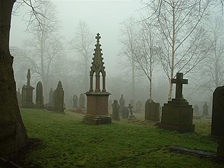
Kirkburton is a civil parish in the metropolitan borough of Kirklees, West Yorkshire, England. It contains 165 listed buildings that are recorded in the National Heritage List for England. Of these, two are listed at Grade I, the highest of the three grades, three are at Grade II*, the middle grade, and the others are at Grade II, the lowest grade. The list also includes two listed buildings outside the parish but in Kirkburton ward; both of these are at Grade II. There are no major towns in the parish, but it contains villages and smaller settlements including Farnley Tyas, Flockton, Flockton Green, Grange Moor, Highburton, Kirkheaton, Lepton, Shelley, Shepley, Stocksmoor, Thunder Bridge, and Thurstonland. The parish is otherwise rural.

References

  1. Kirklees census data by settlement - Highburton (xls format) Archived 5 February 2012 at the Wayback Machine
  2. The Great Domesday Book, Folio 299v
  3. Highburton C.E. First School homepage
  4. Burton Bulletin, Community Directory, Kirklees Council. Retrieved 2 December 2018
  5. Napier Power Heritage Trust: Napier Powered, NPI Media Group, 1997
  6. 1 2 3 4 5 Eddy, Richard; Carter, Robert; Kirkburton Township Guide and Trail (2006), Kirkburton and District Civic Society
  7. 1 2 Morehouse, Henry James (1861) The History and Topography of the Parish of Kirkburton and the Graveship of Holme, H Roebuck, King Street, Huddersfield. pp. 79, 82
  8. Historic England. "Smiths Arms Public House (Grade II) (1313296)". National Heritage List for England . Retrieved 22 July 2022.


Commons-logo.svg Media related to Highburton at Wikimedia Commons