
The Funeral Mountains is a short, arid mountain range in the United States along the California-Nevada border approximately 100 mi (160 km) west of Las Vegas. The mountains are considered a subrange of the Amargosa Range that form the eastern wall of Death Valley.

The Pah Rah Range is a mountain range located in western Nevada in Washoe County just to the northeast of Reno. It is a hook shaped range with the main eastern portion oriented northwest–southeast, approximately 20 miles (32 km) long. The northwest flowing Cottonwood Creek in Warm Springs Valley is bounded on three sides by the range. To the south and east the Truckee River forms the boundary and Pyramid Lake is at the northeast. Spanish Springs Valley north of Reno forms the southwest margin. To the north, the narrow Mullen Pass separates the Pah Rah Range from the Virginia Mountains.
The Shoshone Mountains, in west central Nevada, make up one of the longest mountain ranges in the state. The range runs in a general north-south direction in Nye and Lander counties. The range has a length of about 66 miles (106 km) and a width of about 6 mi (9.7 km) with an area of approximately 400 sq mi (1,000 km2).

The New York Mountains are a small mountain range found in northeastern San Bernardino County in California, USA. The range's northeastern area lies in southeastern Nevada. The range lies just south of the small community of Ivanpah, and north of the Lanfair Valley. The mountains are part of the mountain ranges, cones, mountains, and landforms in the Mojave National Preserve. The mountains reach an elevation of 7,533 feet (2,296 m), and run in a mostly southwest-northeasterly direction between the Providence Mountains and the McCullough Range approximately five miles into Nevada and border the northwest corner of the Piute Valley of Nevada-California.

The Ivanpah Mountains are located in the southeastern Mojave Desert of California in the United States. The range lies to the south and east of the Mescal Range and Clark Mountain Range. Piute Valley lies between the Ivanpahs and the Mescal Range and Wheaton Wash lies between the Ivanpahs and the Clark Mountains to the north. Interstate 15 traverses the Wheaton Wash to the north of the Ivanpahs.
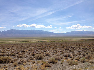
The Tule Desert is located in southeastern Nevada in Lincoln County, near the Utah state line. The desert lies northeast of the Mormon Mountains, south of the Clover Mountains and west of the Tule Springs Hills.

The Piute Range is located in the Mojave Desert, primarily in northeast San Bernardino County, California, United States, with a north portion in Nevada. Most of the range is the eastern border of the Mojave National Preserve, a National Park Service natural area and park.

The Eldorado Mountains, also called the El Dorado Mountains, are a north-south trending mountain range in southeast Nevada bordering west of the south-flowing Colorado River; the endorheic Eldorado Valley borders the range to the west, and the range is also on the western border of the Colorado River's Black Canyon of the Colorado, and El Dorado Canyon on the river. The range is 50 miles (80 km) southeast of Las Vegas, Nevada; and the Eldorado Mountains connect with the Highland and Newberry mountains.
The Delamar Mountains are a mountain range in Lincoln County, Nevada, named after Captain Joseph Raphael De Lamar. The range extends for approximately 50 miles (80 km) in a NNE–SSW orientation with a width of about 11 miles (18 km). Surrounding ranges include the Burnt Springs Range and the Chief Range to the north, the Clover Mountains and Meadow Valley Mountains to the east and the Sheep Range and South Pahroc Range on the west. The Delamar Valley lies to the west, the Kane Springs Valley to the east and the Coyote Springs Valley lies to the south of the range.

The Meadow Valley Mountains is a mountain range in Lincoln and Clark counties in southern Nevada. The range is a narrow north to northeast trending ridgeline with a length of about 40 miles (64 km). The Clover Mountains lie to the north, Meadow Valley Wash and the Mormon Mountains to the east, the Moapa Valley to the southeast, Arrow Canyon Range to the south, Coyote Springs Valley to the southwest and the Kane Springs Valley and Delamar Mountains to the west and northwest.

The Little Ajo Mountains is a mountain range in southern Arizona, in extreme western Pima County, Arizona. The city of Ajo sits on the northeast of this small mountain range. Both the mountain range and city take their name from the Spanish word for garlic.
The Seven Troughs Range is a mountain range in western Pershing County, Nevada.

The Bullfrog Hills are a small mountain range of the Mojave Desert in southern Nye County, southwestern Nevada. Bullfrog Hills was so named from a fancied resemblance of its ore to the color of a bullfrog.
The Tule Springs Hills are a mountain range in eastern Lincoln County, Nevada. The Tule Desert lies to the west. The Mormon Mountains and East Mormon Mountains are to the southwest, the Clover Mountains to the north and the Beaver Dam Mountains of Utah are to the east.
The San Luis Mountains are a small, lower elevation mountain range of central-southern Pima County Arizona adjacent to the U.S.-Mexico border, northeast of Sasabe, Arizona–Sasabe, Sonora.

The Piute Wash of extreme southeastern Nevada and northeast San Bernardino County California is the south-flowing drainage of the Piute Valley. The wash and valley are located northwest of Needles, California.
The Piute Valley is a 45-mile-long (72 km) north–south valley southeast of Las Vegas, Nevada, and northwest of Needles. The north of the valley is at Searchlight, with some of the valley extending northwest from Searchlight. At the center-north lies Cal-Nev-Ari, Nevada.
The Antelope Valley of southern Eureka County is a small 35 mi long valley, surrounded by four mountain ranges. Antelope Wash flows north, to endorheic flatlands at the valley's north end. Eureka, Nevada lies 20 mi east nestled among mountain ranges. From Eureka U.S. Route 50 travels west through the north end of the valley on a route to Austin.

Sarcobatus Flat is a closed valley in western Nye County, Nevada between Goldfield and Beatty. The Bullfrog Hills form the southern boundary and the Grapevine Mountains along with Bonnie Claire Flat form the western boundary. Pahute Mesa bounds the area to the east and north. To the north the flat is contiguous with Lida Valley and Stonewall Flat.
The Battle Mountains or Battle Mountain Range is a mountain range in western Lander and southeastern Humboldt counties of Nevada. The communities of Battle Mountain and Valmy lie just to the east and north respectively along Interstate 80 in the Humboldt River valley. Nevada State Route 305 runs along the southeast side of the range from Battle Mountain toward Austin to the south.

