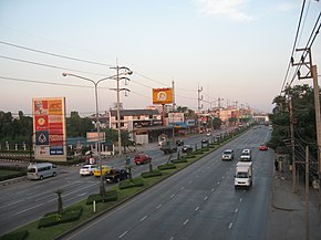
Nakhon Ratchasima is one of Thailand's seventy-six provinces (changwat) lies in lower northeastern Thailand also called Isan. It is the country's largest province by area, has a population of approximately 2.7 million, and generates about 250 billion baht in GDP, the highest in Isan. Neighbouring provinces are Chaiyaphum, Khon Kaen, Buriram, Sa Kaeo, Prachinburi, Nakhon Nayok, Saraburi, and Lopburi.

Prachinburi province is one of Thailand's seventy-seven provinces (changwat), it lies in eastern Thailand. Neighboring provinces are Nakhon Ratchasima, Sa Kaeo, Chachoengsao, and Nakhon Nayok.

Saraburi is one of the central provinces (changwat) of Thailand. Neighboring provinces are Lopburi, Nakhon Ratchasima, Nakhon Nayok, Pathum Thani, and Ayutthaya. It is believed to have been constructed in the year 1548 during the reign of King Maha Chakkraphat of Ayutthaya as a centre for recruiting troops.

Sukhumvit Road, or Highway 3, is a major road in Thailand, and a major surface road of Bangkok and other cities. It follows a coastal route from Bangkok to Khlong Yai District, Trat border to Koh Kong, Cambodia.

Mittraphap Road or Highway 2 is one of the four primary highways in Thailand, along with Phahonyothin Road, Sukhumvit Road, and Phetkasem Road. It runs from Saraburi to Nong Khai.
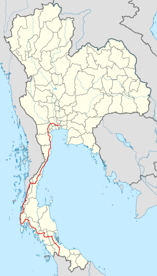
Phet Kasem Road or Highway 4 is one of the four primary highways in Thailand, along with Phahonyothin Road, Mittraphap Road, and Sukhumvit Road. At 1,310.554 km, route 4 is the longest highway in Thailand.

Pak Chong is the westernmost district (amphoe) of Nakhon Ratchasima province, northeastern Thailand, and the main point of entry into Isan as the main road and rail lines cross the Dong Phaya Yen Mountains into the region. It is a popular tourist destination, especially among weekenders from Bangkok, and is home to many resorts and touristy attractions, in addition to the main entrance into Khao Yai National Park.
Khao Yai, meaning 'large mountain' in Thai, usually refers to an area in the Sankamphaeng mountain range of Thailand which is now Khao Yai National Park.
Sungai Padi Road or Khao Kong - Su-ngai Kolok Or Narathiwat - Su-ngai Kolok. Highway 4056 is a major highway in Narathiwat Province of Thailand.

The Sankamphaeng Range, also Sankambeng Range or Sungumpang Range is one of the mountain ranges separating eastern Thailand from the northeast or Isan. It is in Nakhon Nayok, Prachinburi, Sa Kaeo, Saraburi, and Nakhon Ratchasima Provinces, Thailand.

Thap Lan National Park is in the Sankamphaeng Range in Prachinburi, Nakhon Ratchasima Provinces, Thailand. Established as a national park on 23 December 1981, it was the country's 40th national park. Its attractions include Lan Forest and Recreational Garden (ป่าลานและสวนพักผ่อนหย่อนใจ); Namtok Thap Lan (น้ำตกทับลานหรือน้ำตกเหวนกกก); Thap Lan Reservoir (อ่างเก็บน้ำทับลาน); Namtok Huai Yai (น้ำตกห้วยใหญ่); Lam Mun Bon Dam (เขื่อนลำมูลบน); Hat Chom Tawan (หาดชมตะวัน).
Highway 11 is a national highway in Thailand.

Kanchanaphisek Road, also known as the Bangkok Outer Ring Road is a highway in Thailand, connecting Bangkok, Samut Prakan province, Nonthaburi province, Pathum Thani province and Phra Nakhon Si Ayutthaya province. It consists of multiple sections, including a controlled-access toll road, and almost forms a complete loop around the Bangkok Metropolitan Area.
Pak Kret is a city in Nonthaburi province, Thailand. It lies in the Central Thai plains on the east bank of the lower Chao Phraya River, bordering Bangkok to the east, Mueang Nonthaburi district of Nonthaburi province to the south, and Pathum Thani province to the north. It is part of the Bangkok Metropolitan Region megalopolis. With a registered population of 190,272, Pak Kret is the third most populous city municipality in Thailand.
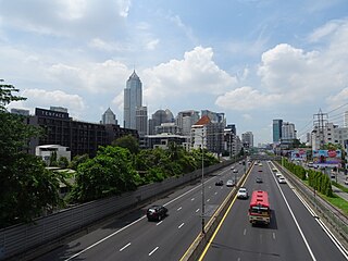
Controlled-access highways in Thailand are systems that can be used only by cars, trucks, and certain types of buses, forming a spider-web network around the Greater Bangkok area and eventually covering the entire country. Currently, there are three different systems in Thailand. The first system, known as the "Intercity Motorway," is owned and operated by the Department of Highways. The second system is the "Expressway," which is owned by the Expressway Authority of Thailand (EXAT) and operated by the Bangkok Expressway and Metro Public Company (BEM), with some expressway routes directly operated by the EXAT itself. The third system is the "Concession Highway," commonly known as the "Tollway," which is owned by the Department of Highways but operated by a private company. The Tollway currently has one route, the Don Mueang Tollway, operated by the Don Mueang Tollway Public Company.
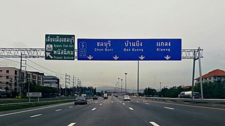
Asian Highway 19 (AH19) is a road in the Asian Highway Network running 459 km from Nakhon Ratchasima to Bangkok in Thailand. This highway connects Nakhon Ratchasima to Bangkok via port city of Laem Chabang.

Rama II Road or Highway 35 is a road in Thailand heading towards the south. Rama II Road starts from Chom Thong District in the Thonburi side of Bangkok, passing through Bang Khun Thian District into Samut Sakhon Province. It then enters Samut Songkhram Province and terminates at a junction with Phet Kasem Road in Ratchaburi Province, with a total distance of 84.041 kilometres (52.221 mi). The road is maintained by the Department of Highways.

Borommaratchachonnani Road, is a main road in Bangkok's Thonburi side and Bangkok Metropolitan Region. The majority of the road constitutes Highway 338.
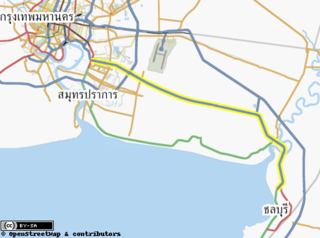
Debaratna Road, officially known as Highway 34 Bang Na–Nong Mai Daeng Route, and still known colloquially —and officially in Bangkok— as Bang Na–Trat Road (ถนนบางนา–ตราด), is a highway in Thailand from Bangkok that heads to the east like Sukhumvit Road and Motorway 7.
The Udon Ratthaya Expressway, also known as the Bang Pa-in–Pak Kret Expressway, is an expressway in Thailand, located in Nonthaburi, Pathum Thani and Phra Nakhon Si Ayutthaya provinces. The expressway is a controlled-access toll road.
