The Queen Elizabeth Range is a rugged mountain range of the Transantarctic Mountains System, located in the Ross Dependency region of Antarctica.
Skelton Glacier is a large glacier flowing from the polar plateau into the Ross Ice Shelf at Skelton Inlet on the Hillary Coast, south of Victoria Land, Antarctica.
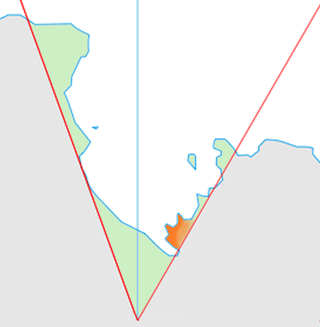
The Churchill Mountains are a mountain range group of the Transantarctic Mountains System, located in the Ross Dependency region of Antarctica. They border on the western side of the Ross Ice Shelf, between Byrd Glacier and Nimrod Glacier.
The Cook Mountains is a group of mountains bounded by the Mulock and Darwin glaciers in Antarctica.

The Darwin Glacier is a large glacier in Antarctica. It flows from the polar plateau eastward between the Darwin Mountains and the Cook Mountains to the Ross Ice Shelf. The Darwin and its major tributary the Hatherton are often treated as one system, the Darwin–Hatherton.
The Gould Coast is a portion of the coast of Antarctica along the eastern margin of the Ross Ice Shelf at Amundsen Coast between the west side of Scott Glacier and the south end of the Siple Coast. It was named by the New Zealand Antarctic Place-Names Committee in 1961 for Laurence M. Gould, a geologist who was second-in-command of the Byrd Antarctic Expedition, 1928–30. Gould led the Geological Party which in 1929 mapped 175 miles (280 km) of this coast. While president of Carleton College, Northfield, Minnesota, he was appointed Chairman of the U.S. National Committee for the International Geophysical Year and took a prominent part in planning the United States research program for Antarctica.

Miers Valley is a valley just south of Marshall Valley and west of Koettlitz Glacier, on the coast of Victoria Land, Antarctica. The valley is ice-free except for Miers Glacier in its upper (western) part and Lake Miers near its center. It was mapped and named by Robert Falcon Scott's British Antarctic Expedition, 1910–13. The name is possibly after Edward J. Miers, a marine biologist from the British Museum who examined crustacea from the Erebus and Terror expeditions.

The David Glacier is a glacier over 60 nautical miles long, flowing east from the polar plateau through the Prince Albert Mountains to the coast of Victoria Land, Antarctica. It enters Ross Sea between Cape Philippi and Cape Reynolds to form the floating Drygalski Ice Tongue. It is the most imposing outlet glacier in Victoria Land. It is fed by two main flows which drain an area larger than 200,000 square kilometres, with an estimated ice discharge rate of 7.8 +/- 0.7 km³/year. The David Glacier was discovered by Ernest Shackleton's "Northern Party," in November 1908, under the leadership of Prof. T.W. Edgeworth David, of Sydney University, for whom the feature was named.
Surveyors Range is a 30 miles (48 km) long mountain range in the Churchill Mountains of Antarctica.
The Mulock Glacier is a large, heavily crevassed glacier which flows into the Ross Ice Shelf 40 kilometers south of the Skelton Glacier in the Ross Dependency, Antarctica.
Rennick Glacier is broad glacier, nearly 200 nautical miles long, which is one of the largest in Antarctica. It rises on the polar plateau westward of Mesa Range and is 20 to 30 nautical miles wide, narrowing to 10 nautical miles near the coast. It takes its name from Rennick Bay where the glacier reaches the sea.

The Apocalypse Peaks are a group of peaks with a highest point of 2,360 metres (7,740 ft), standing east of Willett Range and between Barwick Valley and Balham Valley, in Victoria Land, Antarctica.
Barwick Valley is an ice-free valley north of Apocalypse Peaks, extending from Webb Glacier to Victoria Valley in Victoria Land, Antarctica. A large part of the valley has been designated an Antarctic Specially Protected Area because of its pristine condition.
The Carnegie Range is a mountain range in the Churchill Mountains of the Transantarctic Mountains System, in the Ross Dependency of Antarctica.
The Nash Range is a mainly ice-covered coastal range in the Churchill Mountains of Antarctica.

The Dufek Coast is that portion of the coast along the southwest margin of the Ross Ice Shelf between Airdrop Peak on the east side of the Beardmore Glacier and Morris Peak on the east side of Liv Glacier. It was named by the New Zealand Antarctic Place-Names Committee in 1961 after Rear Admiral George J. Dufek, United States Navy, who served under Rear Admiral Richard E. Byrd with the United States Antarctic Service, 1939–41, and as commander of the Eastern Task Force of U.S. Navy Operation Highjump, 1946–47. He was Commander of U.S. Naval Support Force Antarctica, 1954–59, a period in which the following American science stations were established: McMurdo Station, Little America V, Byrd Station, South Pole Station, Wilkes Station, Hallett Station and Ellsworth Station. United States Navy ships, aircraft, and personnel under his command provided broad logistical support to research and survey operations, including aerial photographic missions to virtually all sectors of Antarctica. On October 31, 1956, Dufek in the ski-equipped R4D Skytrain aircraft Que Sera Sera, flew from McMurdo Sound via Beardmore Glacier to make the first airplane landing at the South Pole.
Hariot Glacier is a glacier flowing northwest along the south side of Morgan Upland before turning west into the northern portion of the Wordie Ice Shelf, along the west coast of the Antarctic Peninsula. It was roughly surveyed by the British Graham Land Expedition, 1936–37, and the upper reaches were photographed from the air by the Ronne Antarctic Research Expedition, 1947. The glacier was surveyed from the ground by members of the Falkland Islands Dependencies Survey who travelled along it in December 1958, and it was named by the UK Antarctic Place-Names Committee after Thomas Hariot, an English mathematician who pioneered new methods of navigation under the patronage of Sir Walter Raleigh.
The Kirkwood Range is a massive coastal mountain range in Antarctica, extending north–south between Fry Glacier and Mawson Glacier. A broad low-level platform on the seaward side of the range is occupied by the Oates Piedmont Glacier.
Saint Johns Range is a crescent-shaped mountain range about 20 nautical miles long, in Victoria Land, Antarctica. It is bounded on the north by the Cotton Glacier, Miller Glacier and Debenham Glacier, and on the south by Victoria Valley and the Victoria Upper Glacier and Victoria Lower Glacier.
The Reeves Glacier is a broad glacier originating on the interior upland and descending between Eisenhower Range and Mount Larsen to merge with the Nansen Ice Sheet along the coast of Victoria Land, Antarctica.
