
Cambridge is a city and non-metropolitan district in the county of Cambridgeshire, England. It is the county town of Cambridgeshire and is located on the River Cam, 55 miles (89 km) north of London. As of the 2021 United Kingdom census, the population of the City of Cambridge was 145,700; the population of the wider built-up area was 181,137. Cambridge became an important trading centre during the Roman and Viking ages, and there is archaeological evidence of settlement in the area as early as the Bronze Age. The first town charters were granted in the 12th century, although modern city status was not officially conferred until 1951.

The A57 is a major road in England. It runs east from Liverpool to Lincoln via Warrington, Salford and Manchester, and then through the Pennines over the Snake Pass (between the high moorlands of Bleaklow and Kinder Scout), around the Ladybower Reservoir, through Sheffield and past Worksop. Between Liverpool and Glossop, the road has largely been superseded by the M62, M602 and M67 motorways. Within Manchester a short stretch becomes the Mancunian Way, designated A57(M).

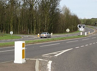
The A14 is a major trunk road in England, running 127 miles (204 km) from Catthorpe Interchange, a major intersection at the southern end of the M6 and junction 19 of the M1 in Leicestershire to the Port of Felixstowe, Suffolk. The road forms part of the unsigned Euroroutes E24 and E30. It is the busiest shipping lane in East Anglia carrying anything from cars to large amounts of cargo between the UK and Mainland Europe.

Addenbrooke's Hospital is a large teaching hospital and research centre in Cambridge, England, with strong affiliations to the University of Cambridge. Addenbrooke's Hospital is located on the Cambridge Biomedical Campus. It is run by Cambridge University Hospitals NHS Foundation Trust and is a designated academic health science centre. It is also the East of England's major trauma centre and was the first such centre to be operational in the United Kingdom.
Cambridge University Hospitals NHS Foundation Trust is a British public sector healthcare provider located in Cambridge, England. It was established on 4 November 1992 as Addenbrooke's National Health Service Trust, and authorised as an NHS foundation trust under its current name on 1 July 2004.

Hobson's Conduit, also called Hobson's Brook, is a watercourse that was built from 1610 to 1614 by Thomas Hobson and others to bring fresh water into the city of Cambridge, England from springs at Nine Wells, a Local Nature Reserve, near the village of Great Shelford. It is now a Scheduled Ancient Monument and historical relic. The watercourse currently runs overground until Cambridge University Botanic Garden and Brookside, where it is at its widest. At the corner of Lensfield Road stands a hexagonal monument to Hobson, which once formed part of the market square fountain, and was moved to this location in 1856, after a fire in the Market. The flow of water runs under Lensfield Road, and subsequently runs along both sides of Trumpington Street in broad gutters towards Peterhouse and St Catharine's College, and also St Andrew's Street. The conduit currently ends at Silver Street.

The School of Clinical Medicine is the medical school of the University of Cambridge in England. The medical school is considered as being one of the most prestigious in the world, ranking as 1st in The Complete University Guide, followed by Oxford University Medical School, Harvard Medical School, and Stanford School of Medicine and 2nd in the world in the 2023 Times Higher Education Ranking. The Cambridge Graduate Course in Medicine (A101) is the most competitive course offered by the University and in the UK, and is among the most competitive medical programs for entry in the world. The school is located alongside Addenbrooke's Hospital and other institutions in multiple buildings across the Cambridge Biomedical Campus.

The Cambridge Biomedical Campus is the largest centre of medical research and health science in Europe. The site is located at the southern end of Hills Road in Cambridge, England.
The A1307 is a secondary class A road in Cambridgeshire and Suffolk between the A1(M) near Alconbury and Haverhill, Suffolk. In 2020 the former A14 between North of Cambridge and Alconbury was reclassified as the A1307. Whilst it generally follows the route of the Roman Road Via Devana from Alconbury to Haverhill. As it becomes unroutable through Cambridge, and sections were developed in different decades, it has been delt with in three parts: Cambridge city, Eastern and Northern.
The A607 is an A road in England that starts in Belgrave, Leicester and heads northeastwards through Leicestershire and the town of Grantham, Lincolnshire, terminating at Bracebridge Heath, a village on the outskirts of Lincoln. It is a primary route from Thurmaston to the A1 junction at Grantham.
The Wolfson Brain Imaging Centre (WBIC) is a UK Biomedical Imaging Centre, located at Addenbrooke's Hospital, Cambridge, England, on the Cambridge Bio-Medical Campus at the southwestern end of Hills Road. It is a division of the Department of Clinical Neurosciences of the University of Cambridge.
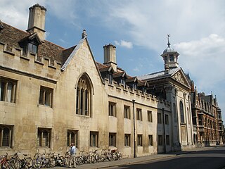
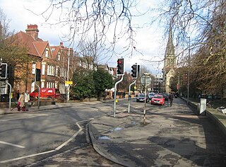
Trumpington Street is a major historic street in central Cambridge, England. At the north end it continues as King's Parade where King's College is located. To the south it continues as Trumpington Road, an arterial route out of Cambridge, at the junction with Lensfield Road.

Trumpington Road is an arterial road in southeast central Cambridge, England. It runs between the junction of Trumpington Street and Lensfield Road at the northern end to the junction of the High Street in the village of Trumpington and Long Road at the southern end. The Fen Causeway leads off to the west near the northern end, over Coe Fen and the River Cam.

Downing Street is a street in central Cambridge, England. It runs between Pembroke Street and Tennis Court Road at the western end and a T-junction with St Andrew's Street at the eastern end. Corn Exchange Street and St Tibbs Row lead off to the north. Downing Place leads off to the south.

Regent Street is an arterial street in southeast central Cambridge, England. It runs between St Andrew's Street, at the junction with Park Terrace, to the northwest and Hills Road at the junction with the A603 to the southeast. Regent Terrace runs in parallel immediately to the northeast. Beyond that is Parker's Piece, a large grassed area with footpaths.
Lensfield Road is a road in southeast central Cambridge, England. It runs between the junction of Trumpington Street and Trumpington Road to the west and the junction of Regent Street and Hills Road to the west. It continues as Gonville Place to the northeast past Parker's Piece, a large grassy area with footpaths.

The Old Addenbrooke's Site is a site owned by the University of Cambridge in the south of central Cambridge, England. It is located on the block formed by Fitzwilliam Street to the north, Tennis Court Road to the east, Lensfield Road to the south, and Trumpington Street to the west.

Huntingdon Road is a major arterial road linking central Cambridge, England with Junction 14 of the M11 motorway and the A14 northwest from the city centre. The road, designated the A1307, follows the route of the Roman Via Devana, and is named after the town of Huntingdon, northwest of Cambridge.

Cambridge Academy for Science and Technology is a university technical college opened in 2014. It is located on the Biomedical Campus, which encompasses Addenbrooke's Hospital, next to the Long Road Sixth Form College in Cambridge. The school is a member of the United Learning Cambridge Cluster along with Parkside Community College, Coleridge Community College, Trumpington Community College, and Parkside Sixth.
Cambridge South railway station is a railway station that is under construction. Located in southern Cambridge, it is planned to serve the Cambridge Biomedical Campus and the adjacent suburb of Trumpington. The station will be on the Cambridge line and the West Anglia Main Line, and is scheduled to open in 2025.


