Related Research Articles

Harare, formerly known as Salisbury, is the capital and largest city of Zimbabwe.

Bulawayo is the second largest city in Zimbabwe, and the largest city in the country's Matabeleland region. The city's population is disputed; the 2022 census listed it at 665,940, while the Bulawayo City Council claimed it to be about 1.2 million. Bulawayo covers an area of 546 square kilometres in the western part of the country, along the Matsheumhlope River. Along with the capital Harare, Bulawayo is one of two cities in Zimbabwe that are also provinces.

Mutare, formerly known as Umtali until 1982, is the most populous city in the province of Manicaland, and the third most populous in Zimbabwe, having surpassed Gweru in the 2012 census, with an urban population of 224,802 and approximately 260,567 in the surrounding districts, giving the wider metropolitan area a total population of over 500,000 people. Mutare is also the capital of Manicaland Province and the largest city in eastern Zimbabwe.
Rusape is a town in eastern Zimbabwe.

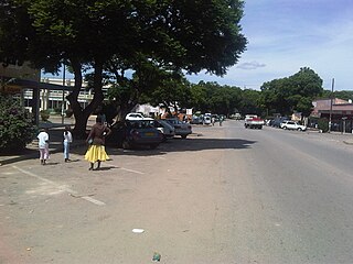
Gwanda is a town in Zimbabwe. It is the capital of the province of Matabeleland South, one of the ten administrative provinces in the country. It is also the district capital of Gwanda District, one of the seven administrative districts in the province.

Clarkson is an outer northern suburb of Perth, Western Australia, located 34 kilometres north of Perth's central business district in the City of Wanneroo.
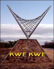
Kwekwe, formerly known as Que Que, is a city in the Midlands province in central Zimbabwe. The city has a population of 119,863 within the city limits, as of the 2022 census, making it the 7th-largest city in Zimbabwe and the second-most populous city in the Midlands, behind Gweru.
Goffals or Coloured Zimbabweans are persons of mixed race, predominately those claiming both European and African descent, in Malawi, Zambia, and, particularly Zimbabwe. They are generally known as Coloureds, though the term Goffal is used by some in the Coloured community to refer to themselves, though this does not refer to the mixed-race community in nearby South Africa. The community includes many diverse constituents of Shona, Northern Ndebele, Bemba, Fengu, British, Afrikaner, Cape Coloured, Cape Malay and less commonly Portuguese, Greek, Goan, and Indian descent. Similar mixed-race communities exist throughout Southern Africa, notably the Cape Coloureds of South Africa.
Plumtree is a town in Zimbabwe. Marula trees, wild plum trees grow abundantly in the area. The town was once called Getjenge by baKalanga. Another name by which it is often caled, is Titji, meaning station and referring to the railway station which was operating in the area around 1897.
Mount Pleasant is a residential suburb of Harare, Zimbabwe, located in the northern part of the city. Originally a farm, the area was developed for housing in the early 20th-century and was a white suburb until Zimbabwe's independence in 1980. Today, Mount Pleasant is a multiracial community and is one of Harare's more affluent suburbs.

Borrowdale is a residential suburb in the north of Harare, Zimbabwe, which ranks among the most affluent and prestigious residential areas in the country. It forms part of the Northeast suburbs of the city of Harare, with a population of 28,929 as of the Zimbabwe 2022 Census.

The Avenues is an inner city suburb in Harare, Zimbabwe. Known for its diversity and mixed use activities, the Avenues contains together residential, commercial and entertainment areas, and has a vibrant nightlife with numerous cafes, bars and restaurants. It also holds a busy stretch of shops, retail businesses and office space. As a distinct, named area, the Avenues came into being in the late 1950s, during the Federation, when it drew together several smaller neighbourhoods that were first developed in the early 20th century.
Glen View is a high-density suburb that lies on the border of Harare Province and Mashonaland West. It split between the two provinces, with the larger part on Harare’s side and the remainder on Mashonaland West side under their governance of Zvimba Rural District. It is believed to have 160,000(6.4% of Harare’s population) people although the Zimstat says it has on 45,000 people. It shares boundaries with Budiriro on the North (4.341km), Glen Norah on the East(4.0km), South and West being Mashonaland West. It is divided into 8 parts namely Glen View 1, 2, 3, 4, 7, 8, 1 Extension and Riverside. It has around 15000 residential stands which ranges from 200sqm to 500sqm with most of them averaging 10 people per house.
Zimbabwean English is a regional variety of English found in Zimbabwe. While the majority of Zimbabweans speak Shona (75%) and Ndebele (18%) as a first language, standard English is the primary language used in education, government, commerce and media in Zimbabwe, giving it an important role in society. Just under 5 percent of Zimbabweans are native English speakers and 89 percent of the population can speak English fluently or at a high level, second only to the Seychelles amongst African nations.
Avonlea is a residential suburb in northwest Harare. It lies just in the west of Avondale southwest of Emerald Hill, southeast of Marlborough, and north of the greater Mabelreign area. Avonlea is home to approximately 15,600 people.
Highlands is an middle income, residential suburb in the east of Harare, best known as the home of the Zimbabwe Broadcasting Corporation, and for its ethnic diversity, history, natural environment and splendid panoramic views of downtown Harare. It is often grouped in the inner east suburbs of Harare such as Eastlea, Highlands, Greendale and Milton Park.
Arcadia, is a small, historic working class suburb, southeast of central Harare and just south of the main railway line that divides the CBD and from its southern suburbs. The area along with nearby, Breaside, St Martins and Hillside, is traditionally a predominately Coloured neighbourhood, who still maintain a majority in the area, though the area has diversified significantly since the 1980s. The current neighbourhood was the second mostly Coloured area developed in the city since the 1930s.
Belgravia is a mixed use residential suburb in the north of Harare, Zimbabwe. It is named for the eponymous commercial area of Belgravia in London. It is bounded by the larger neighbourhoods of Milton Park, Avondale and Kensington, to the south and northwest respectively, as well as Alexandra Park to the east. The suburb is can be considered a transitionary area between inner city districts like Milton Park and the leafier suburbs to the north.
Eastlea, is a central-east, mixed use, medium density suburb of Harare, Zimbabwe, in its east end. Historically lower middle class, it has long been among the city's most diverse areas, attracting British, Greek and Portuguese immigrants in the post war era. This was followed by an influx of black and coloured Zimbabweans and immigrants from Mozambique, Malawi and the DRC after 1980. By 2012, its white population had shrunk to less than 15% from 63% in the early 1980s. The neighbourhood is located just east of the CBD, across from the neighbourhoods of Newlands and Highlands, and just north of Braeside and Hillside. To the east of Eastlea are the suburbs of Greendale and Msasa Park. Eastlea is relatively small area with a high population density.
Lewisam is an area in the northeastern suburbs of Harare, Zimbabwe. Together with more well known districts, such as Belgravia and adjoining Newlands, it forms part of the city's embassy row, home for example to the British ambassador's residence and the Italian embassy.
References
- ↑ "Hillside, Harare, Zimbabwe Afternoon Weather". AccuWeather. Retrieved 15 February 2024.
- ↑ "Lower Hillside - Harare". wikimapia.org.
- ↑ "Hillside · Harare, Zimbabwe". Hillside · Harare, Zimbabwe.
- ↑ "Zimbabwe - Population Census 2012". catalog.ihsn.org.
- ↑ @cohsunshinecity (February 23, 2021). "A new shopping mall is taking shape along Chiremba Road in Hillside. #DecentralisingServices #maskupharare" (Tweet) – via Twitter.
- ↑ "Census 2012 National Report" (PDF). zimstat.co.zw. Retrieved 15 February 2024.