The Avenues, Harare

Last updated

The Avenues, Harare
Neighborhood
The Avenues, Harare.jpg
The Avenues, Harare
Zimbabwe adm location map.svg
Red pog.svg
The Avenues, Harare
Coordinates: 17°49′15″S31°02′57″E / 17.82083°S 31.04917°E / -17.82083; 31.04917 Coordinates: 17°49′15″S31°02′57″E / 17.82083°S 31.04917°E / -17.82083; 31.04917
Country Zimbabwe
Province Harare
District Harare
Elevation
1,490 m (4,890 ft)
Population
 (2012)
  Total15,890
 estimated
Time zone UTC+2 (CAT)
  Summer (DST) UTC+2 (not observed)

The Avenues is an inner city suburb in Harare, Zimbabwe. Known for its diversity and mixed use activities, the Avenues contains together residential, commercial and entertainment areas, and has a vibrant nightlife with numerous cafes, bars and restaurants. It also holds a busy stretch of shops, retail businesses and office space. As a distinct, named area, the Avenues came into being in the late 1950s, during the Federation, when it drew together several smaller neighbourhoods that were first developed in the early 20th century.

Contents

Since the 1950s the Avenues has been characterized by its diversity, with including immigrants, young families, and students, and it is also very popular with young professionals. Today the area is largely composed primarily of a mix of townhouses and midcentury mid-rise apartment buildings, many of which are now flats and condominiums; along with various commercial structures. [1]

The suburb is laid out in the form of a rectangular grid, about 1 km to the north of the central business district. [2] on the other side of the Harare Gardens.The area is traversed by all the major thoroughfares to the northern suburbs. These include Prince Edward Street (western boundary), Leopald Takawira Avenue, Sam Nujoma St (2nd Street), 4th Street, 7th Street (Borrowdale Rd). The streets run north to south and the mostly beautiful tree lined avenues run east to west. These divide the suburb into rectangular grids. Main avenues include J. Tongogara Avenue (Northern boundary), J. Chinamano Avenue, Chitepo Avenue, Central Avenue and the busy Samora Machel Avenue. Neighboring suburbs include Milton Park, Belgravia and Alexandra Park to the north, Belvedere to the west, Eastlea and Newlands to the east and the CBD to the south.

Geography

The suburbs bordering the Avenues include:

North

Milton Park, Belgravia, Alexandra Park

East

Eastlea, Newlands

South

Central Business District

West

Belvedere

History

Before the city of Harare was established in 1890, the area of today's neighborhood was home to the Shona-speaking, Zezuru people. In the 1890s, the area was subdivided into local tracts which sat just above the original planned City of Salisbury, and were either undeveloped or only lightly farmed. As the population expanded, this land was divided into several estates purchased by land companies such as the Salisbury Real Estate Co. [3]

In the mid 20th century, the area was home to a range of people, from new immigrants, particularly those of Greek, Portuguese and Italian background, to white-collar professionals near the border with Belgravia and Alexandra Park, to blue-collar residents near the CBD. [4] Residents comprised all classes and a mix of races, though segregated. [5] After Independence in 1980, the area was formally desegregated, some whites abruptly left the area, other whites stayed and worked to integrate the neighbourhood, and many black and Asian people moved into the area. The neighbourhood, along with the city, was evolving. The area, with its less costly housing, also became home to some artists, students and social activists. [1]

Since the 1990s, the Avenues has seen an influx of new residents, as more the area has become increasingly desirable. New housing is being constructed—some new infill-construction, some developments that use repurposed structures, and some new construction that is replacing older industrial buildings the area. Some of these new and redeveloped apartment buildings are being constructed along Fife Avenue. The new residents include a mix of young professionals and expat Zimbabweans due to its proximity to the CBD, its services, facilities and good transport links. [6] Most residential units are apartment blocks or flats ranging from bedsitters to family sized apartments, garden flats, town houses to luxury apartments.

Since the 1980s, the Avenues also held a seedy reputation for being a red light district especially along J. Chinamano St and lower Fife Avenue. In response the city has been active in the community, with a goal to promote a clean, friendly and safe Avenues. It currently it sponsors local events and provides helpful information to the area residents and tourists.

Cultural diversity

Along with its adjacent sister communities to the north and east, Eastlea and Milton Park, the Avenues has long has been a gateway community for immigrants. Since the 1960s, there was a predominant international presence in these communities, with the majority of immigrants coming from the United Kingdom, Ireland, Cyprus, Portugal, Italy and South Africa. [5] [7] Since the early 1980s, like other areas of the nation, the Avenues has seen a growing influx of immigrants from Malawi, Mozambique and the Democratic Republic of the Congo, as well. Gentrification and the resulting higher cost of housing, however, have displaced many immigrants and long-time working class, black African residents, particularly those with young children, as well as many small businesses, but the community still retains a degree of diversity, most evident in its array of international shops and restaurants. [7]

The Avenues are also has become a thriving spot for nightlife, with several bars and clubs featuring live music. Dozens of establishments possess liquor licenses, putting it on level with other popular nightlife areas like Borrowdale and Avondale.

Despite the exodus of many long-term white and also black African residents from the Avenues because of the declining national economy and gentrification, the Avenues is a prime area for many young professionals and affluent, non-resident Zimbabweans. The Avenues is now mostly occupied by Black-Africans, but there are people of all races and various nationalities living there. [1]

Another barometer of the enduring pull of the Avenues for immigrants and the young professionals is the linguistic and cultural diversity of its schools. Many of the families served live beyond the boundaries established for routine student enrollment; but have their children attend neighbourhood schools, especially Dominican Convent High School due to the quality of its education. [8]

Amenities

The Avenues is home to number of parks notably; The Harare Gardens and Greenwood Park as well as wide tree-lined avenues which colour the landscape lilac and purple every spring when in full bloom. Also the Avenues has a sprinkling of restaurants, guest houses, lodges and hotels such as the Bronte and Holiday Inn. There are also several smaller bed-and-breakfast lodgings in the area.

Avenues is a meeting spot for many groups, especially among young people who meet up on the weekends. The district is also a popular tourist destination. People from across Southern Africa, are often seen mixing with local residents doing their grocery shopping at Ximex Mall and professionals looking for a quick and affordable lunch. Also famous in the district is the Avenues street market that occurs each Saturday and Sunday, which offers tastes of traditional food and various household goods, wares and souvenirs. This well-known event attracts so many people from across the city.

Education and health

The Avenues is home to numerous schools notably the Catholic, Dominican Convent High School and David Livingstone Primary School. The area also hosts a number of colleges such as Speciss College, Trust College, Ilsa College, some of the city's best rated clinics, the Avenues and West End Clinics. [8]

City politics

The Avenues is a part of Harare Central constituency in the Zimbabwean parliament, which along with the rest of the city is a stronghold for the social democratic Movement for Democratic Change (2018)

See also

Related Research Articles

<span class="mw-page-title-main">Harare</span> Capital and largest city of Zimbabwe

Harare is the capital and most populous city of Zimbabwe. The city proper has an area of 940 km2 (371 mi2) and a population of 2.12 million in the 2012 census and an estimated 3.12 million in its metropolitan area in 2019. Situated in north-eastern Zimbabwe in the country's Mashonaland region, Harare is a metropolitan province, which also incorporates the municipalities of Chitungwiza and Epworth. The city sits on a plateau at an elevation of 1,483 metres above sea level and its climate falls into the subtropical highland category.

<span class="mw-page-title-main">Cabbagetown, Toronto</span> Neighbourhood in Toronto, Ontario, Canada

Cabbagetown is a neighbourhood in central Toronto, Ontario, Canada. Administratively, it is defined as part of the Cabbagetown-South St. Jamestown neighbourhood. It largely features semi-detached Victorian houses and is recognized as "the largest continuous area of preserved Victorian housing in all of North America", according to the Cabbagetown Preservation Association.

<span class="mw-page-title-main">Fairbank, Toronto</span> Neighbourhood in Toronto, Ontario, Canada

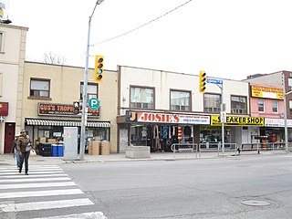
Fairbank is a neighbourhood in Toronto, Ontario, Canada. The area is centred on the intersection of Dufferin Street and Eglinton Avenue West. Fairbank includes the neighbourhoods of Briar Hill–Belgravia and Caledonia–Fairbank. The western border is the CNR lines. The northern and southern borders are the former borders of the City of York and the eastern border is Dufferin Street.

<span class="mw-page-title-main">Little Jamaica</span> Neighbourhood of Toronto in ON, CAN

Little Jamaica, also known as Eglinton West, is an ethnic enclave in Toronto, Ontario, Canada. It is located along Eglinton Avenue West, from Allen Road to Keele Street, and is part of four neighbourhoods: Silverthorn, Briar Hill–Belgravia, Caledonia–Fairbank, and Oakwood–Vaughan. The commercial main street has been recognized to be of great cultural heritage significance to the city of Toronto, as a distinct ethnic and cultural hub for Afro-Caribbean immigrants for many decades.

Avondale is a residential suburb in north and northwest Harare, Zimbabwe, located about 3.5 kilometres (2 mi) north of Harare city centre and just west of Mount Pleasant. It is the earliest suburb established in Harare, having been laid out in 1903. Prior to becoming a suburb Avondale was a dairy farm and was named after Avondale, County Wicklow, Ireland the home of the 19th-century Irish politician Charles Stewart Parnell. Avondale was incorporated into Harare Municipality in 1934.

Mount Pleasant is a residential suburb of Harare, Zimbabwe, located in the northern part of the city. Originally a farm, the area was developed for housing in the early 20th-century and was a white suburb until Zimbabwe's independence in 1980. Today, Mount Pleasant is a multiracial community and is one of Harare's more affluent suburbs.

<span class="mw-page-title-main">Borrowdale, Harare</span> Neighborhood in Harare, Harare, Zimbabwe

Borrowdale is a residential suburb in the north of Harare, Zimbabwe, which ranks among the most affluent and prestigious residential areas in the country. It forms part of the Northeast suburbs of the city of Harare, with a population of 20,312 as of the Zimbabwe 2012 Census.

Belvedere is a suburb of Harare, the capital city and the largest metropolitan area of Zimbabwe. Though historically home to a notable Indian population since 2012 Belvedere has become known for its growing Chinese population, due to the construction of Longcheng Plaza. The area is found to the west of the central Harare by the suburbs of Ridgeview, Monovale and Warren Park. It is noted for a new Chinatown that exists around the Longcheng area. This new Chinatown is now considered as the main Chinatown in Harare, replacing a nascent area in the CBD.

<span class="mw-page-title-main">Chinatown, Toronto</span> Neighbourhood in Toronto, Ontario, Canada

Chinatown, Toronto known also as Downtown Chinatown or West Chinatown is a Chinese ethnic enclave located in the city's downtown core of Toronto, Ontario, Canada. It is centred at the intersections of Spadina Avenue and Dundas Street, West.

Highlands is a middle class, residential suburb in the east of Harare, best known as the home of the Zimbabwe Broadcasting Corporation, and for its ethnic diversity, history, natural environment and splendid panoramic views of downtown Harare. It is often grouped in the inner east suburbs of Harare such as Eastlea, Highlands, Greendale and Milton Park.

Arcadia, is a small, historic working class suburb, southeast of central Harare and just south of the main railway line that divides the CBD and from its southern suburbs. The area along with nearby, Breaside, St Martins and Hillside, is traditionally a predominately Coloured neighbourhood, who still maintain a majority in the area, though the area has diversified significantly since the 1980s. The current neighbourhood was the second mostly Coloured area developed in the city since the 1930s.

Milton Park is a densely populated, inner city, mixed use suburb just west of central Harare, Zimbabwe. Due to its density, diversity and character it is often compared to The Avenues, Belgravia, Greendale, Eastlea and Highlands. Separated from the CBD by the A1 highway east, is it is usually considered to be bounded to the south by Princes Road, to the north by Cork Road, to the west by Warren Hills Golf Club.

Newlands is a low density, residential suburb located in eastern Harare, Zimbabwe.

Italian Zimbabweans, are citizens or residents of Zimbabwe of Italian heritage. The phrase may refer to someone born in the Zimbabwe of Italian descent, someone who has emigrated from Italy to Zimbabwe, a person with Italo-Zimbabwean heritage or someone born elsewhere, who is of Italian descent and has migrated to Zimbabwe. Italian Zimbabweans form one of the younger communities of the Italian diaspora, largely a product of wartime and post-war immigration.

Belgravia is a mixed use residential suburb in the north of Harare, Zimbabwe. It is named for the eponymous commercial area of Belgravia in London. It is bounded by the larger neighbourhoods of Milton Park, Avondale and Kensington, to the south and northwest respectively, as well as Alexandra Park to the east. The suburb is can be considered a transitionary area between inner city districts like Milton Park and the leafier suburbs to the north.

Eastlea, is a central-east, mixed use, medium density suburb of Harare, Zimbabwe, in its east end. Historically lower middle class, it has long been among the city's most diverse areas, attracting British, Greek and Portuguese immigrants in the post war era. This was followed by an influx of black and coloured Zimbabweans and immigrants from Mozambique, Malawi and the DRC after 1980. By 2012, its white population had shrunk to less than 15% from 63% in the early 1980s. The neighbourhood is located just east of the CBD, across from the neighbourhoods of Newlands and Highlands, and just north of Braeside and Hillside. To the east of Eastlea are the suburbs of Greendale and Msasa Park. Eastlea is relatively small area with a high population density.

Causeway is a commercial district on the southeast edge of central Harare. The area is a busy workaday district that hosts numerous civic institutions, research institutes, and international organizations. Additionally, many government departments and ministries are headquartered here, along with museums such as the National Gallery of Art, are located here.

Greenwood Park is both a city park and a small urban neighbourhood located in the northeast section of Harare's central business district and is one of the early subdivisions which were created inside Harare, but which lay outside of the original, officially-planned City of Salisbury. Situated two kilometres north of Parliament, Greenwood Park overlaps with the larger and newer neighbourhood of Avenues and is usually considered to be a part of that more prominent locale. The area of Greenwood Park, and is best known for its eponymous park which covers much of the area.

Glen Lorne is an affluent neighbourhood in northeast Harare, Zimbabwe. It was originally known as Glen Lorne farm or Enterprise valley, beyond the city limits. It is located north of downtown Harare and is one of highest and hilliest suburbs. It is also one of the wealthiest and most prestigious neighbourhoods in Zimbabwe. Glen Lorne has been ranked the best neighbourhood in the city to live in by the Mail & Guardian. It is known as the area where the city's 'old money' lives, and is home to some of Zimbabwe's wealthiest citizens including former vice president, Kembo Mohadi. It is often compared to its larger and more well-known neighbour, Borrowdale to the northwest.

Lewisam (/ˈluːɪʃəm/) is an area in the northeastern suburbs of Harare, Zimbabwe. Together with more well known districts, such as Belgravia and adjoining Newlands, it forms part of the city's embassy row home to the British Ambassadors Residence and the Italian Embassy for example.

References

  1. 1 2 3 "Deconstructing the Colonial Legacy through the Naming Process in Independent Zimbabwe". Journal of Studies in Social Sciences. 6 (1): 71–85. 2014. CiteSeerX   10.1.1.1013.9678 . ISSN   2201-4624.
  2. Street Map of Harare (Map) (2002 ed.). Surveyor General, Zimbabwe.
  3. Old Salisbury: A History, by Stephen Mann (History Press, 1964), pg. 139.
  4. ""Some Are More White Than Others": Racial Chauvinism As A Factor of Rhodesian Immigration Policy, 1890-1963" . Retrieved 27 May 2021.
  5. 1 2 "White Immigration into Rhodesia: From Occupation to Federation" . Retrieved 27 May 2021.
  6. "Hospital - THE AVENUES CLINIC - Harare". www.petitfute.co.uk.
  7. 1 2 "History of Zimbabwean Migration" . Retrieved 27 May 2021.
  8. 1 2 Lowry, Donal. "Cosgrave, Mary Anne (Patrick)". dib.cambridge.org. Retrieved 27 May 2021.{{cite web}}: CS1 maint: url-status (link)