Hirtenberg

Last updated
Hirtenberg
Hirtenberg Pfarrkirche.JPG
Hirtenberg parish church
AUT Hirtenberg COA.png
Austria adm location map.svg
Red pog.svg
Hirtenberg
Location within Austria
Coordinates: 47°55′00″N16°10′00″E / 47.91667°N 16.16667°E / 47.91667; 16.16667 Coordinates: 47°55′00″N16°10′00″E / 47.91667°N 16.16667°E / 47.91667; 16.16667
Country Austria
State Lower Austria
District Baden
Government
  BurgermeisteriBurgermeisterKarl Brandtner (SPÖ)
Area
[1]
  Total1.47 km2 (0.57 sq mi)
Elevation
280 m (920 ft)
Population
 (2018-01-01) [2]
  Total2,586
  Density1,800/km2 (4,600/sq mi)
Time zone UTC+1 (CET)
  Summer (DST) UTC+2 (CEST)
Postal code
2552
Area code 02256
Vehicle registration BN
Website www.hirtenberg.at

Hirtenberg is a town of approx. 2,500 inhabitants near Baden bei Wien in Lower Austria, Austria. The river Triesting is located at the south border of the town. Coming from the Vienna Woods, the valley of Triesting joins the Vienna Basin here.

Contents

Neighbourhoods

Starting in the east going clockwise the following towns are located next to Hirtenberg:

Traffic

The Leobersdorf railway connecting the Austrian Southern Railway at Leobersdorf with the Austrian Western Railway at St. Pölten runs at the southern border of the town. The train-station of Hirtenberg is located on the area of Enzesfeld. The main road in the town is the federal highway B18 Hainfelder Bundesstraße.

History

The name "Hirtenberg" is derived from the name of a small castle - the Feste Huotto - which was located on a hill overlooking the valley of the Triesting. At the end of the first Turkish war in 1532 the army of Kasim Bey was defeated in the area of Hirtenberg. With the beginning of the 20th century some industrial companies were founded: a weaving company, the Otto Eberhardt Patronenfabrik ammunition factory (with a KZ Mauthausen subcamp), and a steel-producing company. Because of this fact the coat of arms of Hirtenberg contains an industrial building with three chimneys. The big companies are now far smaller and employ far fewer people than before and turned to produce different things like airbag ignitions, steel lockers or car rims.

Population

Historical population
YearPop.±%
19712,164    
19812,147−0.8%
19912,088−2.7%
20012,270+8.7%
20112,605+14.8%

Public buildings

Related Research Articles

<span class="mw-page-title-main">Krems an der Donau</span> Statutory city in Lower Austria, Austria

Krems an der Donau is a town of 23,992 inhabitants in Austria, in the federal state of Lower Austria. It is the fifth-largest city of Lower Austria and is approximately 70 kilometres west of Vienna. Krems is a city with its own statute, and therefore it is both a municipality and a district.

<span class="mw-page-title-main">Leobersdorf</span> Place in Lower Austria, Austria

Leobersdorf is a town in the Baden district of Lower Austria, Austria.

<span class="mw-page-title-main">Mürzzuschlag</span> Place in Styria, Austria

Mürzzuschlag is a town in northeastern Styria, Austria, the capital of the former Mürzzuschlag District. It is located on the Mürz river near the Semmering Pass, the border with the state of Lower Austria, about 85 km (53 mi) southwest of Vienna. The population is 8,684. Originally an industrial area, the nearby mountains are today a popular ski resort.

<span class="mw-page-title-main">Bruck an der Leitha</span> Town in Lower Austria, Austria

Bruck an der Leitha is a town in the state of Lower Austria of Austria on the border of Burgenland, marked by the Leitha river. In 2018 it had a population of around 8,000.

<span class="mw-page-title-main">Pernitz</span> Place in Lower Austria, Austria

Pernitz is a town in the district of Wiener Neustadt-Land in the Austrian state of Lower Austria.

<span class="mw-page-title-main">Schwaz</span> Place in Tyrol, Austria

Schwaz is a city in the Austrian state of Tyrol. It is the administrative center of the Schwaz district. Schwaz is located in the lower Inn valley.

<span class="mw-page-title-main">Ferlach</span> Place in Carinthia, Austria

Ferlach in the district of Klagenfurt-Land in Carinthia is the southernmost town in Austria. It is known for its centuries-old gunsmith tradition, part of the Austrian intangible cultural heritage since 2010.

<span class="mw-page-title-main">Baden District, Austria</span> District in Lower Austria, Austria

Bezirk Baden is a district of the state of Lower Austria in Austria.

<span class="mw-page-title-main">Alland</span> Place in Lower Austria, Austria

Alland is a market town in the district of Baden in the Austrian state of Lower Austria.

Altenmarkt an der Triesting is a town in the district of Baden in Lower Austria in Austria.

<span class="mw-page-title-main">Berndorf, Lower Austria</span> Place in Lower Austria, Austria

Berndorf is a town in the district of Baden in Lower Austria in Austria. Because of its historic development in the 19th century it is also referred to as the Krupp town.
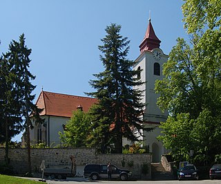
<span class="mw-page-title-main">Enzesfeld-Lindabrunn</span> Place in Lower Austria, Austria

Enzesfeld-Lindabrunn is a town in the district of Baden in Lower Austria in Austria. The city was governed by social democracy until 2010, and since 2010 a citizens' list of Franz Scheider has been in power.

Pottenstein is a town in the district of Baden in Lower Austria in Austria.

<span class="mw-page-title-main">Kaltenleutgeben</span> Place in Lower Austria, Austria

Kaltenleutgeben is a town with a population of 3302 in the district of Mödling in the Austrian state of Lower Austria.

<span class="mw-page-title-main">Seebenstein</span> Place in Lower Austria, Austria

Seebenstein is a town in the district of Neunkirchen in the Austrian state of Lower Austria. It is often called the "Pearl of the Pitten valley" due to its preserved nature.

<span class="mw-page-title-main">Köflach</span> Place in Styria, Austria

Köflach is a small city in the district of Voitsberg in the Austrian state of Styria, at the foot of the Stubalpe mountain. The town has a federal stud in the village of Piber that supplies the Lipizzaner horses to the famous Spanish Riding School in Vienna. Traditionally known for its coal mining, Köflach is slowly changing from an industrial town to a center of the service sector. It is connected by rail to Voitsberg.

<span class="mw-page-title-main">Wals-Siezenheim</span> Place in Salzburg, Austria

Wals-Siezenheim is a municipality in the district of Salzburg-Umgebung (Flachgau) in the Austrian state of Salzburg.
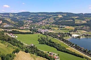
<span class="mw-page-title-main">Stubenberg, Styria</span> Municipality in Austria

Stubenberg, called Stubenberg am See, is a municipality in the district of Hartberg-Fürstenfeld, in Styria, Austria. It is located roughly 50 km from Graz and 200 km from Vienna. It has a population of 2.287 as of April 2010.
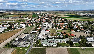
<span class="mw-page-title-main">Gerasdorf bei Wien</span> Place in Lower Austria, Austria

Gerasdorf bei Wien is a town in the district of Korneuburg in the Austrian state of Lower Austria. The city has 10,862 inhabitants.

Stainach-Pürgg is a municipality since 2015 in the Liezen District of Styria, Austria.

References

  1. "Dauersiedlungsraum der Gemeinden Politischen Bezirke und Bundesländer - Gebietsstand 1.1.2018". Statistics Austria. Retrieved 10 March 2019.
  2. "Einwohnerzahl 1.1.2018 nach Gemeinden mit Status, Gebietsstand 1.1.2018". Statistics Austria. Retrieved 9 March 2019.