
Richard Heber was an English book collector.
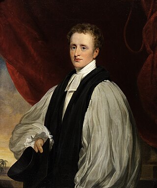
Reginald Heber was an English Anglican bishop, a man of letters, and hymn-writer. After 16 years as a country parson, he served as Bishop of Calcutta until his death at the age of 42. The son of a rich landowner and cleric, Heber gained fame at the University of Oxford as a poet. After graduation he made an extended tour of Scandinavia, Russia and Central Europe. Ordained in 1807, he took over his father's old parish, Hodnet, Shropshire. He also wrote hymns and general literature, including a study of the works of the 17th-century cleric Jeremy Taylor.
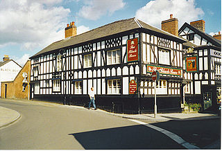
Whitchurch is a market town in the civil parish of Whitchurch Urban, in the north of Shropshire, England. It lies 2 miles (3 km) east of the Welsh border, 2 miles south of the Cheshire border, 20 miles (30 km) north of the county town of Shrewsbury, 20 miles (30 km) south of Chester, and 15 miles (24 km) east of Wrexham. At the 2021 Census, the population of the parish was 10,141. Whitchurch is the oldest continuously inhabited town in Shropshire. Notable people who have lived in Whitchurch include the composer Sir Edward German, and illustrator Randolph Caldecott.
Shropshire was established during the division of Saxon Mercia into shires in the 10th century. It is first mentioned in 1006. After the Norman Conquest it experienced significant development, following the granting of the principal estates of the county to eminent Normans, such as Roger De Montgomery and his son Robert de Bellême.

Hodnet is a village and civil parish in Shropshire, England. The town of Market Drayton lies 5.7 miles (9.2 km) north-east of the village. In 2011 the parish had a population of 1534.
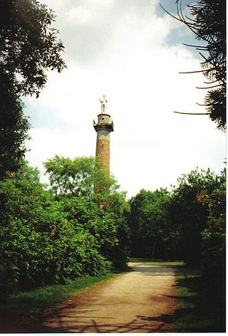
Hawkstone Park is a historic landscape park in Shropshire, England, with pleasure grounds and gardens.

Benthall Hall is a 16th-century English country house in Benthall in the town of Broseley, Shropshire, England, and a few miles from the historic Ironbridge Gorge. It retains much of its fine oak interior, and an elaborate 17th-century staircase. It is still occupied by the Benthall family, but has been owned by the National Trust since 1958, and is open to the public every Monday, Tuesday, Wednesday, Saturday, Sunday and Bank Holiday Monday.

Peplow is a hamlet in Shropshire, England. It is part of the civil parish of Hodnet, a larger village to the north. The hamlets of Bowling Green and Radmoor are both in the village's vicinity.

Weston-under-Redcastle is an estate village of the Sir Rowland Hill legacy estates. It is a civil parish in Shropshire, England. It lies 10 km by road east of Wem. Historically, it has been part of the manor of Hawkstone.

Stoke on Tern is a village located in Shropshire, England, on the River Tern. The civil parish is known as Stoke upon Tern.

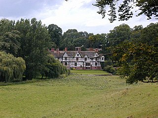
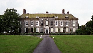
Hawkstone Hall is a 43,400 square feet (4,030 m2) early 18th-century country mansion near Hodnet and Weston-under-Redcastle, Shropshire, England which was more recently occupied as the pastoral centre of a religious organisation for many years. It is a Grade I listed building.

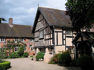
Peplow Hall is a privately-owned 11,635 square feet (1,080.9 m2), 18th-century mansion at Peplow, near Hodnet, Shropshire. It is a Grade II* listed building.

Hon. Hugh Percy was an Anglican bishop who served as Bishop of Rochester (1827) and Bishop of Carlisle (1827–56).
Pitchford Hall is a Grade I listed Tudor country house in the village of Pitchford, Shropshire, 6 miles south east of Shrewsbury.

St Luke's Church is in the village of Hodnet, Shropshire, England. It is an active Anglican parish church in the deanery of Hodnet, the archdeaconry of Salop, and the diocese of Lichfield. Its benefice is united with those of The Epiphany, Peplow, and St Luke, Weston under Redcastle. The church is recorded in the National Heritage List for England as a designated Grade I listed building. It overlooks the park of Hodnet Hall.
Wollerton is a small village within the civil parish of Hodnet in Shropshire, England. It lies approximately three miles to the south west of Market Drayton and sits on the old A53 and adjacent to the new Hodnet bypass which forms the new route of the A53.
Aldenham Park, also known as Aldenham Hall, is a late 17th-century country house in Morville, near Bridgnorth, Shropshire, England which stands in 12 hectares of parkland. It is a Grade II* listed building.

Robert Vernon Heber-Percy, known for much of his life as "the Mad Boy", was "an English eccentric in the grand tradition".
Sir Algernon Eustace Hugh Heber-Percy, KCVO is a British landowner, farmer and public official.

Reginald Cholmondeley of Condover, Shropshire, was an English landowner, artist and collector. He was a Justice of the Peace and Deputy Lieutenant of Shropshire and held the rank of Major, 1st battalion 28th Shropshire Royal Volunteers. The Condover estate passed to him on the death of his brother, Thomas, in 1864.
