Hodzana River

Last updated
Hodzana River
Relief map of USA Alaska.png
Red pog.svg
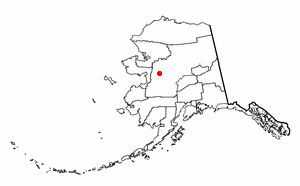
Location of the mouth of the Hodzana River in Alaska
Country United States
State Alaska
Census Area Yukon–Koyukuk
Physical characteristics
Sourcesouthern flanks of the Brooks Range
 - locationwest of Dall Mountain on the Arctic Circle
 - coordinates 66°29′32″N150°02′59″W / 66.49222°N 150.04972°W / 66.49222; -150.04972 [1]
 - elevation3,196 ft (974 m) [2]
River mouth Hodzana Slough of the Yukon River [1]
 - location12 miles (19 km) southwest of Beaver, Yukon Flats National Wildlife Refuge
 - coordinates 66°17′30″N147°46′23″W / 66.29167°N 147.77306°W / 66.29167; -147.77306 Coordinates: 66°17′30″N147°46′23″W / 66.29167°N 147.77306°W / 66.29167; -147.77306 [1]
 - elevation335 ft (102 m) [1]
Length125 mi (201 km) [1]

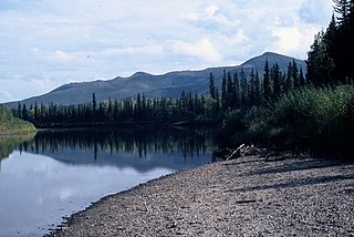
The Hodzana River is a 125-mile (201 km) tributary of the Yukon River in the U.S. state of Alaska. [1] The Yukon Flats National Wildlife Refuge covers a large part of the river basin. [3]

Yukon River river in the Yukon territory of Canada

The Yukon River is a major watercourse of northwestern North America. The river's source is in British Columbia, Canada, from which it flows through the Canadian Yukon Territory. The lower half of the river lies in the U.S. state of Alaska. The river is 3,190 kilometres (1,980 mi) long and empties into the Bering Sea at the Yukon–Kuskokwim Delta. The average flow is 6,430 m3/s (227,000 ft3/s). The total drainage area is 832,700 km2 (321,500 mi2), of which 323,800 km2 (126,300 mi2) is in Canada. The total area is more than 25% larger than Texas or Alberta.

U.S. state constituent political entity of the United States

In the United States, a state is a constituent political entity, of which there are currently 50. Bound together in a political union, each state holds governmental jurisdiction over a separate and defined geographic territory and shares its sovereignty with the federal government. Due to this shared sovereignty, Americans are citizens both of the federal republic and of the state in which they reside. State citizenship and residency are flexible, and no government approval is required to move between states, except for persons restricted by certain types of court orders. Four states use the term commonwealth rather than state in their full official names.

Alaska State of the United States of America

Alaska is a U.S. state in the northwest extremity of North America, just across the Bering Strait from Asia. The Canadian province of British Columbia and territory of Yukon border the state to the east and southeast. Its most extreme western part is Attu Island, and it has a maritime border with Russia to the west across the Bering Strait. To the north are the Chukchi and Beaufort seas—southern parts of the Arctic Ocean. The Pacific Ocean lies to the south and southwest. It is the largest U.S. state by area and the seventh largest subnational division in the world. In addition, it is the 3rd least populous and the most sparsely populated of the 50 United States; nevertheless, it is by far the most populous territory located mostly north of the 60th parallel in North America: its population—estimated at 738,432 by the United States Census Bureau in 2015— is more than quadruple the combined populations of Northern Canada and Greenland. Approximately half of Alaska's residents live within the Anchorage metropolitan area. Alaska's economy is dominated by the fishing, natural gas, and oil industries, resources which it has in abundance. Military bases and tourism are also a significant part of the economy.

Beginning west of Dall Mountain just south of the Arctic Circle, the river flows northeast into the wildlife refuge, then southeast to Hodzana Slough, an arm of the Yukon. [3] The river mouth is 12 miles (19 km) southwest of Beaver, [1] a village further up the Yukon. [3]

Arctic Circle Boundary of the Arctic

The Arctic Circle is one of the two polar circles and the most northerly of the five major circles of latitude as shown on maps of Earth. It marks the northernmost point at which the centre of the noon sun is just visible on the December solstice and the southernmost point at which the centre of the midnight sun is just visible on the June solstice. The region north of this circle is known as the Arctic, and the zone just to the south is called the Northern Temperate Zone.

River mouth end of a river

A river mouth is the part of a river where the river debouches into another river, a lake, a reservoir, a sea, or an ocean.

Beaver, Alaska CDP in Alaska, United States

Beaver is a census-designated place (CDP) in Yukon-Koyukuk Census Area, Alaska, United States. At the 2010 census the population was 84, unchanged from 2000.

See also

Related Research Articles

Yukon–Koyukuk Census Area, Alaska Census area in the United States

Yukon–Koyukuk Census Area is a census area in the U.S. state of Alaska. As of the 2010 census, the population was 5,588. It has the largest area of any county or county-equivalent in the United States. It is part of the unorganized borough of Alaska and therefore has no borough seat. Its largest communities are the cities of Galena, in the west, and Fort Yukon, in the northeast.

Galena, Alaska City in Alaska, United States

Galena is a city in the Yukon-Koyukuk Census Area in the U.S. state of Alaska. At the 2010 census the population was 470, with a 2016 estimate of 488 inhabitants. Galena was established in 1918, and a military airfield was built adjacent to the city during World War II. The city was incorporated in 1971.

Koyukuk, Alaska City in Alaska, United States

Koyukuk is a city in Yukon-Koyukuk Census Area, Alaska, United States. At the 2010 census the population was 96, down from 101 in 2000.

Nowitna River river in the United States of America

The Nowitna River is a 250-mile (400 km) tributary of the Yukon River in the U.S. state of Alaska. The river flows northeast from the Kuskokwim Mountains through Nowitna National Wildlife Refuge and enters the larger river 38 miles (61 km) northeast of Ruby and southwest of Tanana. Major tributaries include the Titna, Big Mud, Little Mud, Lost, and Sulatna rivers.

Andreafsky River river in the United States of America

The Andreafsky River is a 120-mile (190 km) tributary of the Yukon River in the U.S. state of Alaska. The Andreafsky flows south from near Iprugalet Mountain in the Yukon Delta National Wildlife Refuge to meet the larger river at Pitkas Point, near the village of St. Mary's.

Beaver Creek (Yukon River tributary) clear water river in Alaska

Beaver Creek is a 180-mile (290 km) tributary of the Yukon River in the U.S. state of Alaska. The creek begins at the confluence of Champion and Bear creeks in the White Mountains National Recreation Area, about 50 miles (80 km) north of Fairbanks. From there it flows west around the southern end of the White Mountains, then northeast into the Yukon Flats National Wildlife Refuge, then west into the Yukon River downstream of Beaver.

Birch Creek (Yukon River tributary) river in the United States of America

Birch Creek is a 150-mile (240 km) tributary of the Yukon River in the U.S. state of Alaska. Beginning at the confluence of Ptarmigan and Eagle creeks near Porcupine Dome, it flows southwest, then south under the Steese Highway and into the Steese National Conservation Area. It then turns east, then north, again passing under the Steese Highway and entering the Yukon Flats National Wildlife Refuge. Turning northwest, it ends where it splits into two distributaries, Lower Mouth Birch Creek and Upper Mouth Birch Creek, near Birch Creek, Alaska. The distributaries flow into the Yukon River at separate locations downstream of Fort Yukon.

Wind River (Yukon–Koyukuk Census Area, Alaska) River in Alaska, United States

The Wind River is a tributary of the East Fork Chandalar River in the U.S. state of Alaska. It arises in the Philip Smith Mountains of the Brooks Range and flows into the East Fork and eventually into the Yukon River.

Porcupine caribou subspecies of caribou

The Porcupine caribou or Grant's caribou is a subspecies of the reindeer found in Alaska, United States, and adjacent parts of Canada. It resembles the subspecies known as the barren-ground caribou and is sometimes included in it.

Yukon Delta National Wildlife Refuge

The Yukon Delta National Wildlife Refuge is a United States National Wildlife Refuge covering about 19.16 million acres (77,500 km2) in southwestern Alaska. It is the second-largest National Wildlife Refuge in the country, only slightly smaller than the Arctic National Wildlife Refuge. It is a coastal plain extending to the Bering Sea, covering the delta created by the Yukon and Kuskokwim rivers. The delta includes extensive wetlands near sea level that are often inundated by Bering Sea tides. It is bordered on the east by Wood-Tikchik State Park, the largest state park in the United States. The refuge is administered from offices in Bethel.

Southwest Alaska

Southwest Alaska is a region of the U.S. state of Alaska. The area is not exactly defined by any governmental administrative region(s); nor does it always have a clear geographic boundary.

Geography of Alaska

Alaska is one of two U.S. states not bordered by another state; Hawaii the other. Alaska has more ocean coastline than all of the other U.S. states combined. About 500 miles (800 km) of Canadian territory separate Alaska from Washington State. Alaska is thus an exclave of the United States that is part of the continental U.S. and the U.S. West Coast, but is not part of the contiguous U.S. Alaska is also the only state, other than Hawaii, whose capital city is accessible only via ship or air, because no roads connect Juneau to the rest of the continent.

Eek River river in the United States of America

The Eek River is a 108-mile (174 km) tributary of the Kuskokwim River in the U.S. state of Alaska. It is south of the Kwethluk River and north of the Kanektok River, which also drain into the Kuskokwim or Kuskokwim Bay on the Bering Sea.

Yukon Flats

The Yukon Flats are a vast area of wetlands, forest, bog, and low-lying ground centered on the confluence of the Yukon River, Porcupine River, and Chandalar River in the central portion of the U.S. state of Alaska. The Yukon Flats are bordered in the north by the Brooks Range, in the south by the White Mountains, and cover an area of approximately 11,000 square miles (28,490 km2). The Yukon Flats are a critical waterfowl breeding ground due to the large area of wetland provided by the estimated 40,000 small lakes and streams in the area. In recognition of this fact, the area is protected under the Yukon Flats National Wildlife Refuge.

Yukon Flats National Wildlife Refuge protected wetland area in Alaska

The Yukon Flats National Wildlife Refuge is a protected wetland area in the U.S. state of Alaska. It encompasses most of the Yukon Flats, a vast wetland area centered on the confluence of the Yukon River, Porcupine River, and Chandalar River. The area is a major waterfowl breeding ground, and after a proposal to flood the Yukon Flats via a dam on the Yukon River was turned down, the Yukon Flats were deemed worthy of protection. The Alaska National Interest Lands Conservation Act established the refuge in 1980. It is the third-largest National Wildlife Refuge in the United States, although it is less than one-half the size of either of the two largest, the Arctic National Wildlife Refuge, or the Yukon Delta National Wildlife Refuge. The refuge is administered from offices in Fairbanks.

Kanuti National Wildlife Refuge

Kanuti National Wildlife Refuge is a national wildlife refuge in central Alaska, United States. One of 16 refuges in Alaska, it was established in 1980 when Congress passed The Alaska National Interest Lands Conservation Act (ANILCA). At 1,640,000 acres (6,600 km2), Kanuti Refuge is about the size of the state of Delaware. Located at the Arctic Circle, the refuge is a prime example of Alaska's boreal ecosystem. It is dominated by black and white spruce, with some white birch and poplars.

Koyukuk National Wildlife Refuge

The Koyukuk National Wildlife Refuge is a 3,500,000-acre (14,000 km2) conservation area in Alaska. It lies within the floodplain of the Koyukuk River, in a basin that extends from the Yukon River to the Purcell Mountains and the foothills of the Brooks Range. This region of wetlands is home to fish, waterfowl, beaver and Alaskan moose, and wooded lowlands where two species of fox, bears, wolf packs, Canadian lynx and marten prowl.

Interior Alaska-Yukon lowland taiga


The Interior Alaska-Yukon lowland taiga ecoregion, in the Taiga and Boreal forests Biome, of far northern North America.

Christian River river in Alaska, United States

The Christian River is a 140-mile (230 km) tributary of the Yukon River in the U.S. state of Alaska. Beginning near Shark Edge Mountain in the southern Brooks Range, it flows generally south to Cutoff Slough and thence to the larger river. The mouth is in the Yukon Flats National Wildlife Refuge 17 miles (27 km) northwest of Fort Yukon.

References

  1. 1 2 3 4 5 6 7 "Hodzana River". Geographic Names Information System. United States Geological Survey. January 1, 2000. Retrieved October 28, 2013.
  2. Derived by entering source coordinates in Google Earth.
  3. 1 2 3 Alaska Atlas & Gazetteer (7th ed.). Yarmouth, Maine: DeLorme. 2010. pp. 136&ndash, 37. ISBN   978-0-89933-289-5.