
Hildburghausen is a town in Thuringia in central Germany, capital of the Hildburghausen district.

Dobitschen is a municipality in the Altenburger Land district, in the far eastern part of Thuringia, Germany. It borders on the municipalities Schmölln, Göllnitz, Mehna and Starkenberg. It is subdivided into the Ortsteile Dobitschen, Meucha, Pontewitz and Rolika.
is a town situated in the forest of Thuringia in the district of Wartburgkreis in Germany, immediately next to the Rennsteig. Thal and Kittelsthal are parts of the town.
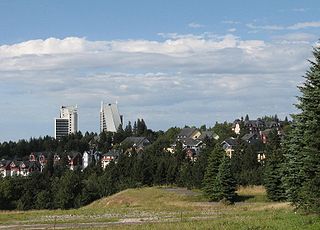
Oberhof is a town in the Schmalkalden-Meiningen district of Thuringia, Germany. Located in the Thuringian Forest mountain range, it is a winter sports center and health resort. With 1,625 inhabitants, it is visited by 144,000 tourists every year (2016). The town obtained its official city status in 1985.

Hilbersdorf is a German municipality in the Thuringian district of Greiz. It belongs to the Verwaltungsgemeinschaft of Ländereck and lies in upper Wipsetal.

Bürgel is a town in the Saale-Holzland district, in Thuringia, Germany. It is situated 12 km east of Jena. It contains the Benedictine monastery of Bürgel Abbey.
Kranichfeld is a town in the Weimarer Land district, in Thuringia. It is situated on the river Ilm, 18 km southeast of Erfurt, and 16 km southwest of Weimar.

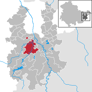
Rastenberg is a town in the district of Sömmerda, in Thuringia, Germany. It is situated 22 km east of Sömmerda, and 23 km northeast of Weimar.

Ronneburg is a town in the district of Greiz, in Thuringia, Germany. It is situated 7 km east of Gera.

Triptis is a town in the Saale-Orla-Kreis district, in Thuringia, Germany. It is situated 22 km southwest of Gera. The town is the seat of the municipal association Triptis.
Weida is a town in the district of Greiz, in Thuringia, Germany, situated 12 km south of Gera on the river Weida.

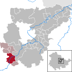
Starkenberg is a municipality in the district Altenburger Land, in Thuringia, Germany. On 1 December 2008, it incorporated the former municipalities Naundorf and Tegkwitz.

Körner is a municipality in the Unstrut-Hainich-Kreis district of Thuringia, Germany.

Gerstenberg is a municipality in the district of Altenburger Land, in Thuringia, Germany. Gerstenberg was first mentioned in a document in 1227. The line of knights "von Gerstenberg" died out in 1710. As early as 1181, a fortification was mentioned in the district of Pöschwitz. This later manor passed into civil ownership in 1798. Members of the families served the dukes of Saxe-Gotha and Saxe-Altenburg. After the expropriation in 1951, what was once the largest farm was just a residential property with MTS and a small new farmer.

Mehna is a municipality in the district Altenburger Land, in Thuringia, Germany.

Rositz is a municipality in the district Altenburger Land, in Thuringia, Germany.

Treben is a municipality in the district Altenburger Land in Thuringia, Germany.

Windischleuba is a municipality in the district Altenburger Land, in Thuringia, Germany.

Volkmannsdorf is a municipality in the Saale-Orla-Kreis district of Thuringia, Germany.

Dornburg-Camburg is a town in the Saale-Holzland district, in Thuringia, Germany. It was created on 1 December 2008, when the towns Dornburg and Camburg and the municipality Dorndorf-Steudnitz were merged.


