Related Research Articles

The Dog Tax war was a confrontation in 1898 between the Crown and a group of Northern Māori, led by Hone Riiwi Toia, opposed to the enforcement of a 'dog tax'. It has been described by some authors as the last gasp of the 19th-century wars between the Māori and Pākehā settlers. It was, however, a bloodless "war", with only a few shots being fired. Hone Heke Ngapua, MHR for Northern Māori, was responsible for de-escalating the confrontation.

The Northland Region is the northernmost of New Zealand's 16 local government regions. New Zealanders sometimes refer to it as the Winterless North because of its mild climate all throughout the year. The main population centre is the city of Whangārei, and the largest town is Kerikeri. At the 2018 New Zealand census, Northland recorded a population growth spurt of 18.1% since the previous 2013 census, placing it as the fastest growing region in New Zealand, ahead of other strong growth regions such as the Bay of Plenty and Waikato.
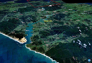
The Hokianga is an area surrounding the Hokianga Harbour, also known as the Hokianga River, a long estuarine drowned valley on the west coast in the north of the North Island of New Zealand.
Kaikohe is the seat of the Far North District of New Zealand, situated on State Highway 12 about 260 km from Auckland. It is the largest inland town and highest community above sea level in the Northland Region. With a population of over 4000 people it is a shopping and service centre for an extensive farming district and is sometimes referred to as "the hub of the north".

The Far North District is the northernmost territorial authority district of New Zealand, consisting of the northern part of the Northland Peninsula in the North Island. It stretches from North Cape and Cape Reinga / Te Rerenga Wairua in the north, down to the Bay of Islands, the Hokianga and the town of Kaikohe.

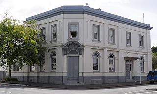
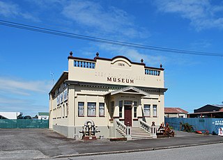
Rawene is a town on the south side of the Hokianga harbour, in Northland, New Zealand. State Highway 12 passes to the south. The town lies at the apex of a peninsula. A car ferry links it to Kohukohu and the northern Hokianga.
Far North District Council is the territorial authority for the Far North District of New Zealand.
Omanaia is a settlement in the Hokianga area of Northland, New Zealand. It is part of the Hokianga South statistical area, which covers the southern side of Hokianga Harbour between Rawene and Koutu. For demographics of this area, see Rawene.
Whirinaki is a locality on the Whirinaki River in the south Hokianga, in Northland, New Zealand. The name means "to lean against a support". Highway 12 runs through it. Opononi lies to the south west, and Rawene lies to the north east.
Waimā is a community in the south Hokianga area of Northland, New Zealand. State Highway 12 runs through the area. The Waima River flows through the Waima Valley into the Hokianga Harbour. Rawene is to the north west, and Kaikohe is to the north east.
Grey County was one of the counties of New Zealand in the South Island.

Mangonui County, formerly Mongonui County, was one of the counties of New Zealand on the North Island. In 1989 it became part of the Far North District Council when amalgamated with the Whangaroa, Hokianga and Bay Of Islands counties, and the Kaitaia and Kaikohe boroughs.
Whangaroa County was one of the counties of New Zealand on the North Island. In 1989 it became part of the Far North District Council when amalgamated with the Mangonui, Hokianga and Bay of Islands counties, and the Kaitaia and Kaikohe boroughs.
Hutt County was one of the former counties of New Zealand. It occupied the south-western corner of the North Island, extending south from the Waikanae River and lying to the west of the summits of the Rimutaka Ranges. The county's name arises from the fact that a large amount of its land area lies in the Hutt River catchment.
George Marshall McCall Smith (1882–1958) was a Scottish medical doctor, medical superintendent and community leader in New Zealand. He was born in Nairn, Scotland in 1882, emigrating to New Zealand in 1914. For 34 years he ran Rawene Hospital, campaigned for state funding of health and created a health service for the Hokianga area.

Westland County, also known as County of Westland, was a local government area on the West Coast of New Zealand's South Island. It existed from 1868 to 1873, and then from 1876 until 1989. In its first incarnation it constituted the government for the area that was split from the Canterbury Province, with the West Coast Gold Rush having given the impetus for that split. It had the same administrative powers as a provincial council, but the legislative power rested with Parliament in Wellington. The first Westland County was the predecessor to Westland Province.
The Mayor of Grey, often referred to as the Mayor of Greymouth, officiates over the Grey District of New Zealand which is administered by the Grey District Council with its seat in Greymouth. The current Mayor is Tania Gibson. Two predecessors to this office were the Mayor of Greymouth, officiating over the Greymouth Borough Council from 1868, and from 1877 the chairman of the Grey County Council.
The 2019 Far North local elections will take place between September and October 2019 by postal vote in Far North District in New Zealand to elect a mayor of Far North District council, 9 councillors, and 19 community board members.
Hobson County was one of the counties of New Zealand in the North Island, from 1876 until 1989. It came into existence in November 1876, when the provinces were abolished. The county seat was at Aratapu, on the western bank of the Wairoa River, 9.5 kilometres (5.9 mi) south of Dargaville, until 1909, when it moved to Dargaville. In 1908, the town of Dargaville and neighboroughing Mangawhare split from Hobson County to form Dargaville Borough. In the 1989 local government reforms, Hobson County re-amalgamated with Dargaville Borough and merged with Otamatea County and parts of Rodney County and Whangarei County to create Kaipara District.
References
- ↑ "Counties Act 1876" . Retrieved 19 March 2022.
- ↑ "Rawene". The Cyclopedia of New Zealand (Auckland Provincial District). Christchurch: Cyclopedia Company. 1902. p. 610. Retrieved 19 March 2022.
- ↑ "Governance". Far North District Council. Retrieved 19 March 2022.
| | This Northland Region-related geography article is a stub. You can help Wikipedia by expanding it. |