The West End of London is a district of Central London, London, England, west of the City of London and north of the River Thames, in which many of the city's major tourist attractions, shops, businesses, government buildings and entertainment venues, including West End theatres, are concentrated.

Bloomsbury is a district in the West End of London, England. It is considered a fashionable residential area, and is the location of numerous cultural, intellectual, and educational institutions.

Clerkenwell is an area of central London, England.

Holborn is a district in central London, which covers the south-eastern part of the London Borough of Camden and a part of the Ward of Farringdon Without in the City of London.
The River Fleet is the largest of London's subterranean rivers, all of which today contain foul water for treatment. It has been used as a sewer since the development of Joseph Bazalgette's London sewer system in the mid 19th century with the water being treated at Beckton Sewage Treatment Works. Its headwaters are two streams on Hampstead Heath, each of which was dammed into a series of ponds—the Hampstead Ponds and the Highgate Ponds—in the 18th century. At the southern edge of Hampstead Heath these descend underground as sewers and join in Camden Town. The waters flow 4 miles (6 km) from the ponds.
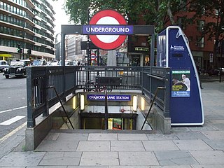
Chancery Lane is a London Underground station on the Central Line between Holborn and The City in Central London, England. It has entrances within both the London Borough of Camden and the City of London. It opened in 1900 and takes its name from the nearby Chancery Lane.

Hatton Garden is a street and commercial zone in the Holborn district of the London Borough of Camden, abutting the narrow precinct of Saffron Hill which then abuts the City of London. It takes its name from Sir Christopher Hatton, a favourite of Queen Elizabeth I, who established a mansion here and gained possession of the garden and orchard of Ely Place, the London seat of the Bishops of Ely. It remained in the Hatton family and was built up as a stylish residential development in the reign of King Charles II. For some decades it often went, outside of the main street, by an alternative name St Alban's Holborn, after the local church built in 1861.
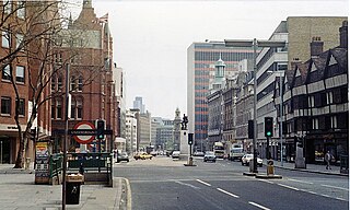
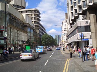
High Holborn is a street in Holborn and Farringdon Without, Central London, which forms a part of the A40 route from London to Fishguard. It starts in the west at the eastern end of St Giles High Street and runs past the Kingsway and Southampton Row, becoming Holborn at its eastern junction with Gray's Inn Road. The western stretch, as far as Drury Lane, was formerly known as Broad Street. On High Holborn, traffic flows one-way westbound from its junction with Drake Street to its western end, and flows both ways for the remainder.

Holborn Viaduct is a road bridge in London and the name of the street which crosses it. It links Holborn, via Holborn Circus, with Newgate Street, in the City of London, England financial district, passing over Farringdon Street and the subterranean River Fleet. The viaduct spans the steep-sided Holborn Hill and the River Fleet valley at a length of 1,400 feet (430 m) and 80 feet (24 m) wide. City surveyor William Haywood was the architect and the engineer was Rowland Mason Ordish.
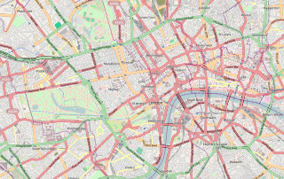
Central London is the innermost part of London, in England, spanning several boroughs. Over time, a number of definitions have been used to define the scope of Central London for statistics, urban planning and local government. Its characteristics are understood to include a high-density built environment, high land values, an elevated daytime population and a concentration of regionally, nationally and internationally significant organisations and facilities.
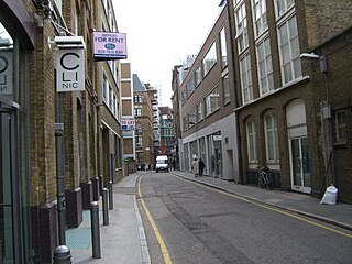
Saffron Hill is a street and former ward in Holborn, in the south eastern corner of the London Borough of Camden, between Farringdon Road and Hatton Garden. The name of the street derives from the fact that it was at one time part of an estate on which saffron grew. The ecclesiastical parish was St Peter, Saffron Hill, a daughter parish of Holborn, which is now combined with St Alban, Holborn.

The A201 is an A road in London, England running from Kings Cross to Bricklayer's Arms.

Gresham Street in the City of London is named after the English merchant and financier Thomas Gresham.
Fetter Lane is a street in the ward of Farringdon Without in the City of London, England. It forms part of the A4 road and runs between Fleet Street at its southern end and Holborn.

The A40 is a major trunk road connecting London to Fishguard, Wales. The A40 in London passes through seven London Boroughs: the City of London, Camden, Westminster, Kensington & Chelsea, Hammersmith & Fulham, Ealing and Hillingdon, to meet the M40 motorway junction 1 at Denham, Buckinghamshire.
The A400 road is an A road in London that runs from Charing Cross to Archway in North London. It passes some of London's most famous landmarks.

Holborn and Covent Garden is a ward of the London borough of Camden, in the United Kingdom. As the name suggests, it covers the parts of Holborn and Covent Garden that lie in Camden; the eastern part of Holborn lies in the City of London and the southern part of Covent Garden lies in the City of Westminster. For elections to Parliament, Holborn and Covent Garden is part of Holborn and St Pancras.

The London Borough of Camden is a London borough in Inner London, England. Camden Town Hall, on Euston Road, lies 1.4 mi (2.3 km) north of Charing Cross. The borough was established on 1 April 1965 from the area of the former boroughs of Hampstead, Holborn, and St Pancras, which prior to its establishment had comprised part of the historic County of London.
St Andrew Holborn was an ancient English parish that until 1767 was partly in the City of London and mainly in the county of Middlesex. Its City, thus southern, part retained its former name or was sometimes officially referred to as St Andrew Holborn Below the Bars.

Saffron Hill, Hatton Garden, Ely Rents and Ely Place was a liberty and from 1866 to 1930 a civil parish in the metropolitan area of London, England. It was part of the ancient parish of St Andrew Holborn.