Hold with Hope

Last updated
Hold with Hope
Hold with Hope
Map of Hold with Hope
Greenland edcp location map.svg
Red pog.svg
Hold with Hope
Location of Hold with Hope in Greenland
Geography
Coordinates 73°45′N21°0′W / 73.750°N 21.000°W / 73.750; -21.000
Adjacent to Loch Fyne
Gael Hamke Bay
Greenland Sea
Foster Bay
Area2,370 km2 (920 sq mi)
Length77 km (47.8 mi)
Width38 km (23.6 mi)
Highest elevation1,229 m (4032 ft)
Highest point Spath Plateau
Administration
Unincorporated area Northeast Greenland National Park
Demographics
Population0 (2021)
Pop. density0/km2 (0/sq mi)
Ethnic groupsnone

Hold with Hope is a peninsula in eastern Greenland. Administratively it is part of the Northeast Greenland National Park zone.

Contents

Geologically Hold with Hope is a place of great interest. [1]

Geography

Hold with Hope is located between Loch Fyne in the west, Godthab Gulf in the NW, Gael Hamke Bay in the north, the Greenland Sea at its eastern end, and Mackenzie Bay and Foster Bay on its southern side. [2]

The Spath Plateau, where the highest elevations are, is located in the northern part of the peninsula and the Tågefjeldene in the southern part. The Gauss Peninsula is located to the southwest, beyond the Badland Valley (Badlanddal). The section north of (Tobias Dal), a valley stretching from east to west across Hold with Hope, is also known as Home Foreland (Home Forland). [3]

Map of Northeastern Greenland. Operational Navigation Chart B-9, 1st edition.jpg
Map of Northeastern Greenland.

History

This peninsula was reported by English sea explorer Henry Hudson during his 1607 and 1608 voyage on the Muscovy Company 80-ton whaler Hopewell of Hull. It was the first definite record of land in this remote area of Greenland. [4] Hudson described the place as:

...a "mayne high Land", a "good Land, and worth the seeing" [5]

The name is one of the oldest known geographical names in Northeastern Greenland. It appeared on an early 17th-century Dutch map by Jodocus Hondius as Holde with hope. [3]

Related Research Articles

<span class="mw-page-title-main">Henry Hudson</span> English explorer

Henry Hudson was an English sea explorer and navigator during the early 17th century, best known for his explorations of present-day Canada and parts of the Northeastern United States.

<span class="mw-page-title-main">Baffin Bay</span> Marginal sea between Greenland and Baffin Island, Canada

Baffin Bay, located between Baffin Island and the west coast of Greenland, is defined by the International Hydrographic Organization as a marginal sea of the Arctic Ocean. It is sometimes considered a sea of the North Atlantic Ocean. It is connected to the Atlantic via Davis Strait and the Labrador Sea. The narrower Nares Strait connects Baffin Bay with the Arctic Ocean. The bay is not navigable most of the year because of the ice cover and high density of floating ice and icebergs in the open areas. However, a polynya of about 80,000 km2 (31,000 sq mi), known as the North Water, opens in summer on the north near Smith Sound. Most of the aquatic life of the bay is concentrated near that region.

<span class="mw-page-title-main">Davis Strait</span> Water between Greenland and Canada

The Davis Strait is a southern arm of the Arctic Ocean that lies north of the Labrador Sea. It lies between mid-western Greenland and Baffin Island in Nunavut, Canada. To the north is Baffin Bay. The strait was named for the English explorer John Davis (1550–1605), who explored the area while seeking a Northwest Passage. By the 1650s it was used for whale hunting.

<span class="mw-page-title-main">Ymer Island</span> Island in Greenland

Ymer Island is an island in northeastern Greenland. The island is a part of Northeast Greenland National Park.

Gauss Peninsula is a peninsula in eastern Greenland. Administratively this peninsula is part of the Northeast Greenland National Park zone.

<span class="mw-page-title-main">Kaiser Franz Joseph Fjord</span> Major fjord system in the NE Greenland National Park area, East Greenland

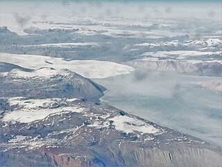
Kaiser Franz Joseph Fjord is a major fjord system in the NE Greenland National Park area, East Greenland.

Foster Bay is a large bay of the Greenland Sea in King Christian X Land, Eastern Greenland. Administratively it belongs to the NE Greenland National Park area.

<span class="mw-page-title-main">Nordfjord (Greenland)</span>

Nordfjord is a fjord in the NE Greenland National Park area, East Greenland.

<span class="mw-page-title-main">King Frederik VIII Land</span> Region in Greenland

King Frederik VIII Land is a major geographic division of northeastern Greenland. It extends above the Arctic Circle from 76°N to 81°N in a North-South direction along the coast of the Greenland Sea.

<span class="mw-page-title-main">Dove Bay</span> Bay in King Frederick VIII Land, Greenland

Dove Bay is a bay in King Frederick VIII Land, northeastern Greenland. It is part of the Northeast Greenland National Park area.

<span class="mw-page-title-main">Adolf S. Jensen Land</span>

Adolf S. Jensen Land is a peninsula in the southern limit of King Frederick VIII Land, northeastern Greenland. Administratively it belongs to the NE Greenland National Park area.

<span class="mw-page-title-main">Queen Louise Land</span> Mountainous region in northeastern Greenland

Queen Louise Land is a vast mountainous region located west of Dove Bay, King Frederik VIII Land, northeastern Greenland. Administratively it is part of the Northeast Greenland National Park zone.

<span class="mw-page-title-main">Hjelm Range</span>

The Hjelm Range is a mountain range in the Gauss Peninsula, King Christian X Land, northeastern Greenland. Administratively this range is part of the Northeast Greenland National Park zone.

Wulff Land is a peninsula in far northwestern Greenland. Administratively it is a part of the Northeast Greenland National Park.

<span class="mw-page-title-main">Canadian Arctic Rift System</span> North American geological structure

The Canadian Arctic Rift System is a major North American geological structure extending from the Labrador Sea in the southeast through Davis Strait, Baffin Bay and the Arctic Archipelago in the northwest. It consists of a series of interconnected rifts that formed during the Paleozoic, Mesozoic and Cenozoic eras. Extensional stresses along the entire length of the rift system have resulted in a variety of tectonic features, including grabens, half-grabens, basins and faults.

Cape Simpson is a headland in the Greenland Sea, Northeast Greenland. Administratively it is part of the Northeast Greenland National Park.

<span class="mw-page-title-main">Mackenzie Bay</span>

Mackenzie Bay is a bay of the Greenland Sea in King Christian X Land, Greenland. Administratively it belongs to the NE Greenland National Park area.

<span class="mw-page-title-main">Muskox Fjord</span>

Muskox Fjord is a fjord in King Christian X Land, East Greenland. Administratively it lies in the Northeast Greenland National Park area. This fjord is part of the Kaiser Franz Joseph Fjord system.

References

  1. Peacock, D.C.P.; Price, S.P.; Whitham, A.G.; Pickles, C.S. (2000). "The World's biggest relay ramp: Hold With Hope, NE Greenland". Journal of Structural Geology. 22 (7): 843–850. doi:10.1016/S0191-8141(00)00012-2.
  2. "Hold with Hope". Mapcarta. Retrieved 24 June 2016.
  3. 1 2 "Catalogue of place names in northern East Greenland". Geological Survey of Denmark. Retrieved 18 June 2016.[ permanent dead link ]
  4. Wordie, J. M. (1927). "The Cambridge Expedition to East Greenland in 1926". The Geographical Journal. 70 (3): 225–265. doi:10.2307/1781943. JSTOR   1781943.
  5. Purchas, S. 1906: Hakluytus Posthumus or Purchas His Pilgrimes. Glasgow: James MacLehose & Sons. pp. 297–298