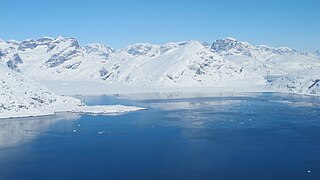
Danmark Fjord, also known as Denmark Sound, is a fjord in northeast Greenland within Northeast Greenland National Park.

Peary Land is a peninsula in northern Greenland, extending into the Arctic Ocean. It reaches from Victoria Fjord in the west to Independence Fjord in the south and southeast, and to the Arctic Ocean in the north, with Cape Morris Jesup, the northernmost point of Greenland's mainland, and Cape Bridgman in the northeast.

King Oscar Fjord is a fjord in East Greenland, marking the northern border of the Scoresby Land Peninsula.

Kaiser Franz Joseph Fjord is a major fjord system in the NE Greenland National Park area, East Greenland.

Wollaston Foreland is a peninsula in King Christian X Land, East Greenland. Administratively it belongs to the NE Greenland National Park area.

Independence Fjord or Independence Sound is a large fjord or sound in the eastern part of northern Greenland. It is about 200 km (120 mi) long and up to 30 km (19 mi) wide. Its mouth, opening to the Wandel Sea of the Arctic Ocean is located at 82°15′N21°54′W.

Skjoldungen is a large uninhabited island in the King Frederick VI Coast, southeastern Greenland. Administratively it is part of the Sermersooq municipality. The weather of the island is characterized by tundra climate.

King Frederick VI Coast is a major geographic division of Greenland. It comprises the coastal area of Southeastern Greenland in Sermersooq and Kujalleq municipalities fronting the Irminger Sea of the North Atlantic Ocean. It is bordered by King Christian IX Land on the north and the Greenland Ice Sheet to the west.

King Frederick VIII Land is a major geographic division of northeastern Greenland. It extends above the Arctic Circle from 76°N to 81°N in a N/S direction along the coast of the Greenland Sea.
Thorland is a peninsula in the King Frederick VI Coast, southeastern Greenland. It is a part of the Sermersooq municipality.
Ingolf Fjord, also known as Ingolf Sound, is a fjord of Greenland's northeastern coast in northern King Frederick VIII Land.

The Princess Caroline-Mathilde Alps are a mountain range system in the Holm Land Peninsula, King Frederick VIII Land, northeastern Greenland. Administratively this range is part of the Northeast Greenland National Park zone.

Queen Margrethe II Land is a peninsula in the northern limit of King Christian X Land, northeastern Greenland. Administratively it belongs to the NE Greenland National Park area.

Odinland, also Odinsland in the Defense Mapping Agency Greenland Navigation charts, is a peninsula in the King Frederick VI Coast, southeastern Greenland. It is a part of the Sermersooq municipality.

The Princess Elizabeth Alps is a mountain range in King Frederick VIII Land, northeastern Greenland. Administratively this range is part of the Northeast Greenland National Park zone.

The Denmark expedition, also known as Denmark Expedition to Greenland's Northeast Coast, and as the Danmark Expedition after the ship, was an expedition to the northeast of Greenland in 1906–1908.
Wulff Land is a peninsula in far northwestern Greenland. Administratively it is a part of the Northeast Greenland National Park.

The Dijmphna Sound is a sound in King Frederick VIII Land, Northeast Greenland. Administratively it is part of the Northeast Greenland National Park zone.

The Hekla Sound is a sound in King Frederick VIII Land, Northeast Greenland. Administratively it is part of the Northeast Greenland National Park zone.


