Ingolf Fjord

Last updated
Ingolf Fjord
Ingolf Sound
Greenland edcp relief location map.jpg
Red pog.svg
Ingolf Fjord
Location in Greenland
LocationNE Greenland
Coordinates 80°32′N17°50′W / 80.533°N 17.833°W / 80.533; -17.833 Coordinates: 80°32′N17°50′W / 80.533°N 17.833°W / 80.533; -17.833
Type Fjord
Ocean/sea sources Greenland Sea
Basin  countries Greenland, Denmark
Max. length100 km (62 mi)
Max. width16 km (9.9 mi)

Ingolf Fjord (Danish : Ingolfs Fjord), also known as Ingolf Sound, is a fjord of Greenland's northeastern coast in northern King Frederick VIII Land. [1]

Contents

The fjord was named by the 1906-1908 Denmark expedition led by Lauge Koch which mapped Greenland's north coast between Cape York and Denmark Sound. It was named after 544-ton schooner Ingolf, used for hydrographic surveys in the waters off Greenland in 1879 and 1895; this vessel had also been used by Andreas Peter Hovgaard on a voyage to the West Indies in 1884–85. [2]

Geography

Ingolf Fjord is located between Holm Land to the south and Amdrup Land to the north at the southern end of the Crown Prince Christian Land peninsula. On its eastern end lie the Wegener Islands, near its mouth in the Greenland Sea. [3] Between Cape Jungersen to the north and Eskimonaesset to the south. On the fjord's southern shore lie the Princess Caroline-Mathilde Alps and the terminus of the Spaerre Brae glacier (Brede Spærregletscher), about 40 km (25 miles) from its mouth. [4] Nunatameporten is a 1,593-metre (5,226 ft) high mountain rising west of the glacier. The Bjørne Glacier discharges from the west side of the outer Ingolf Fjord, draining the Princess Elizabeth Alps range to the north. [2]

The southern end of the Princess Elizabeth Alps and the Hjorne Glacier (Hjørnegletscher) are located on the north side of the inner fjord. A few miles further west the Ingolf Fjord bends to the SSW at a right angle and there is a small arm, Solvig, with valley running SSW at the end of which lies Centrum Lake. The Nunataami Elv river valley — the outflow of Romer Lake further north — discharges at the northern inner arm of the fjord. [2] This arm was formerly believed to form the head of the fjord, but in 1939, the fjord was found to continue further to the west and SW, ending in two short branches in its innermost end, the Månevig branching in a western direction and the Solvig in a southern direction. [2] The Drabe Glacier (Dråbegletscher) is a hanging glacier located on the east side of this area. [4]

Map of Northeastern Greenland North Greenland section-txu-pclmaps-oclc-8322829 a 1.jpg
Map of Northeastern Greenland
1911 German map of NE Greenland showing Ingolf Fjord Karte Nordostgronland Koch 1911.png
1911 German map of NE Greenland showing Ingolf Fjord

See also

Related Research Articles

Danmark Fjord

Danmark Fjord, also known as Denmark Sound, is a fjord in northeast Greenland within Northeast Greenland National Park.

Kaiser Franz Joseph Fjord

Kaiser Franz Joseph Fjord is a major fjord system in the NE Greenland National Park area, East Greenland.

J.P. Koch Fjord is a fjord in Peary Land, northern Greenland. To the west, the fjord opens into the Lincoln Sea of the Arctic Ocean.

Crown Prince Christian Land

Crown Prince Christian Land is a large peninsula in northern Greenland. It is a part of King Frederick VIII Land and administratively it belongs to the Northeast Greenland National Park.

Napasorsuaq Fjord or Napasorsuup Kangerlua is a fjord of the King Frederick VI Coast in the Sermersooq municipality, southeastern Greenland.

Pikiulleq is a bay in eastern Greenland. It is part of the Sermersooq municipality.
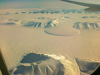
King Frederick VIII Land Region in Greenland

King Frederick VIII Land is a major geographic division of northeastern Greenland. It extends above the Arctic Circle from 76°N to 81°N in a N/S direction along the coast of the Greenland Sea.

Holm Land, sometimes referred to as "Hahn Land", is a peninsula in King Frederick VIII Land, northeastern Greenland. Administratively it belongs to the NE Greenland National Park area.

Romer Lake is a land-locked freshwater fjord at the northern end of King Frederick VIII Land, near Greenland's northeastern coast. The Danish military base/weather station Nord —the only inhabited place in the area— lies 50 km (31 mi) to the northeast. The lake and its surroundings are part of the Northeast Greenland National Park zone.

Princess Caroline-Mathilde Alps Mountain range in Greenland

The Princess Caroline-Mathilde Alps are a mountain range system in the Holm Land Peninsula, King Frederick VIII Land, northeastern Greenland. Administratively this range is part of the Northeast Greenland National Park zone.

Princess Elizabeth Alps

The Princess Elizabeth Alps is a mountain range in King Frederick VIII Land, northeastern Greenland. Administratively this range is part of the Northeast Greenland National Park zone.

Newman Bay or Newman Fjord is a fjord in northern Greenland. To the northwest, the fjord opens into the Robeson Channel of the Lincoln Sea. It is a part of the Northeast Greenland National Park.

Inglefield Gulf Fjord in northwestern Greenland

Inglefield Gulf or Inglefield Fjord is a fjord in northwestern Greenland. To the west, the fjord opens into the Baffin Bay. Administratively it belongs to the Avannaata municipality.

Cape Cannon is a headland in the Lincoln Sea, Arctic Ocean, North Greenland. Administratively it is part of the Northeast Greenland National Park.

Nordvestfjord

Nordvestfjord, meaning 'Northwest Fjord', is a fjord in King Christian X Land, eastern Greenland.

Dijmphna Sound Strait in Greenland

The Dijmphna Sound is a sound in King Frederick VIII Land, Northeast Greenland. Administratively it is part of the Northeast Greenland National Park zone.

Fonfjord

Fonfjord is a fjord in King Christian X Land, eastern Greenland. This fjord is part of the Scoresby Sound system. Administratively it lies in the area of Sermersooq municipality.

Kempe Fjord is a fjord in King Christian X Land, eastern Greenland.

Godthab Gulf

Godthab Gulf, also known as Godthaab Golf, Clavering Fjord, Clavering Sound and Inner Bay, is a fjord in King Christian X Land, East Greenland. Administratively it is part of the Northeast Greenland National Park zone.

References

  1. GoogleEarth
  2. 1 2 3 4 "Catalogue of place names in northern East Greenland". Geological Survey of Denmark. Retrieved 17 June 2016.[ permanent dead link ]
  3. "Ingolf Fjord". Mapcarta. Retrieved 17 June 2016.
  4. 1 2 Prostar Sailing Directions 2005 Greenland and Iceland Enroute, p. 128