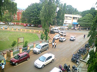
Mandya is a city in the state of Karnataka. It is the headquarter of Mandya district and is located 45 kilometres (28 mi) from Mysore and 100 kilometres (62 mi) from Bangalore.

Davanagere is a city in the centre of the southern Indian state of Karnataka. It is the seventh largest city in the state, and the administrative headquarters of eponymous Davangere district. Hitherto being a cotton hub and hence popularly known before as the Manchester of Karnataka, the commercial ventures of the city is now dominated by education and agro-processing industries. Davanagere became a separate district in 1997, when it was separated from the erstwhile undivided district of Chitradurga for administration conveniences. Davanagere is known for rich culinary traditions which encompass the diversity of entire Karnataka's dishes due to its geographical position in the state as its centre. Notable among them is its aromatic benne dose.

Mysore division, officially Mysuru division, is an administrative division in the southern Indian state of Karnataka. It is one of four administrative divisions in Karnataka, the others being Bangalore division, Belagavi division, and Kalaburagi division. Mysore division comprises eight districts of Karnataka, namely, Chamarajanagar, Chikmagalur, Dakshina Kannada, Hassan, Kodagu, Mandya, Mysore and Udupi district. The city of Mysore is the administrative headquarters of the division. Mysore division covers parts of historical Old Mysore region and southern part of Coastal Karnataka.The total area of the division is 43,503 sq.km. The total population as of 2011 census is 12,563,598.
Sattur or Saathur is a town in Virudhunagar district in the Indian state of Tamil Nadu. As of 2011, the town had a population of 29,398.

Chikmagalur is a city and the headquarters of Chikmagalur district in the Indian state of Karnataka. Located on the foothills of the Mullayanagiri peak of the Western Ghats, the city attracts tourists from around the world for its pleasant and favourable hill station climate, tropical rainforest and coffee estates. The pristine Baba Budangiri lies to the north of Chikmagalur where it's believed Baba Budan first introduced coffee to India.

Kushalanagar or Kushalanagara is a city located in the Kodagu district of the Indian state of Karnataka. Surrounded by Kaveri river, it is the gateway to Kodagu district. It also serves as the headquarters of Kushalanagar Taluk. By population, Kushalanagar is the second largest town in Kodagu district after Madikeri and the fastest developing town in the district. Kushalnagar is an important commercial centre in Kodagu.

Gonikoppal is a census town in the Kodagu district of the Indian state of Karnataka.
Harapanahalli is a city and a taluk in Vijayanagara District in the Indian state of Karnataka. It is the sub-division and administrative headquarters of the Harapanahalli Taluk.
Siruguppa is a town and headquarters of the Siruguppa taluk and second largest city in Ballari district after Hospete carved out of Ballari district of Indian state of Karnataka.

Balehonnur is a village in Narasimharajapura taluk, of Chikkamagaluru district in the Indian state of Karnataka. It comes under the jurisdiction of B.Kanbur Grama Panchayath. As per census survey 2011, its location code number is 609097.

Kutta is a small village in Ponnampet taluk of Kodagu, in Karnataka state of India. As per census survey 2011, location code number of Kutta is 618078.

Belagola , sometimes referred to as Mandya Belagola to distinguish it from Shravana Belagola, is a village in the southern state of Karnataka, India. It is located about 15 kilometers north-northwest of Mysuru city in the Shrirangapattana taluk of Mandya district in Karnataka. It is around 7 km from famous K.R.S Dam.

Kadakola is a Town and a suburb of Mysuru metropolitan area in the southern state of Karnataka, India. It is located in the Mysore taluk of Mysore district. In November 2020, Kadakola was upgraded from a Gram Panchayat to a Town Panchayat and a gazetted notification was passed on November 26, 2020.2. The combined population of the newly formed town is 19,969.

Rammanahalli is a Town and a suburb of Mysore in the Mysuru metropolitan area of Karnataka, India. It is located in the Mysore taluk of Mysore district. In November 2020, Kadakola was upgraded from a Gram Panchayat to a Town Panchayat and a gazetted notification was passed on November 26, 2020. The notification combines Rammanahalli GP villages, Nadanahalli and Alanahalli of Alanahalli GP, Hanchya and Sathagalli villages of Hanchya GP, covering a total area of 22.81 sq. km. The combined population of the town according to 2011 census was 20,804.

Thandavapura is a village in the southern state of Karnataka, India. It is located in the Nanjangud taluk of Mysore district in Karnataka.

Gurur is a small village in Mysore district, Karnataka, India.
Gandasi is a "hobli" in Hassan district of India. As per census survey of India 2011, the location code number of Gandasi is 615799.

Hootagalli or Hutagalli is a city and a Suburb of Mysore, situated in Mysuru metropolitan area ಮೈಸೂರು ಜಿಲ್ಲೆ of Karnataka, India. Hootagalli is located in the outskirts of the city of Mysuru and forms a continuous urban area. Hootagalli city municipal council consists of previous census towns of Hinkal, Hootagalli and Gram Panchyats of Koorgalli and Belavadi totally covering an area of 28.48 square km. In November 2020, the government of Karnataka approved the formation of Hootagalli City Municipal Council by merging four gram panchayats. The initial plan was to include it with MCC to form Greater Mysuru City Corporation (BMMP) however, due to MCC disputing the proposal, a separate body was created. According to 2011 census, the city municipal council has combined population of 56,876. On November 26, 2020, a gazetted notification was passed making the CMC official.

Kabaka Puttur is a major railway station on Mangalore–Hassan–Mysore line. It is located in Padil,Puttur, Dakshina Kannada district, Karnataka state, India. It consists of two platforms. It is named after two places: Kabaka which is 5 km away from railway station location and Puttur where railway station lies. The railway station lies 1.2 km away from Puttur KSRTC bus stand and 1.1 km away from Puttur–Uppinangadi Main Road

Mysuru Local Planning Area is the metropolitan area limit defined in City Development Plan 2031 by Mysore Urban Development Authority. Mysuru Planning Area is divided into 45 planning districts spanning across the Taluks of Mysore, Nanjangud and Srirangapatna of Mandya district. As per City Development Plan 2031, this metropolitan area covers 509sq.km of area and has a population of 1,696,577.


