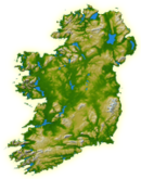
County Wexford is a county in Ireland. It is in the province of Leinster and is part of the Southern Region. Named after the town of Wexford, it was based on the historic Gaelic territory of Hy Kinsella, whose capital was Ferns. Wexford County Council is the local authority for the county. The population of the county was 163,527 at the 2022 census.

This is a list of the extreme points of Ireland – the points that are farthest north, south, east or west in Ireland. It includes the Republic of Ireland and Northern Ireland.

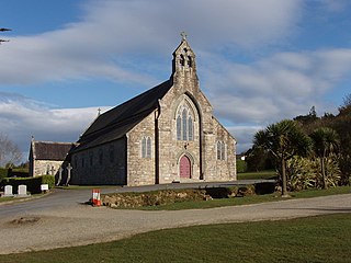
Fethard-on-Sea or Fethard is a village in southwest County Wexford, Ireland. It lies on the R734 road on the eastern side of the Hook peninsula, between Waterford Harbour and Bannow Bay. The village is in Fethard civil parish and partly in Fethard townland.

Waterford Harbour is a natural harbour at the mouth of the Three Sisters; the River Nore, the River Suir and the River Barrow in Ireland. It is navigable for shipping to both Waterford and New Ross. The Port of Waterford is capable of accommodating vessels up to 32,000 tons dwt. It separates County Waterford from County Wexford on the eastern side of the estuary.

Hook Head, historically called Rindowan, is a headland in County Wexford, Ireland, on the east side of the estuary of The Three Sisters. It is part of the Hook peninsula and is adjacent to the historic townland of Loftus Hall. It is situated on the R734 road, 50 kilometres (31 mi) from Wexford town.

The Avoca is a river in County Wicklow, Ireland. It is contained completely within the county. Its length is 35 miles (56.3 km).

The River Slaney is a large river in the southeast of Ireland. It rises on Lugnaquilla Mountain in the western Wicklow Mountains and flows west and then south through counties Wicklow, Carlow and Wexford for 117.5 km (73 mi), before entering St George's Channel in the Irish Sea at Wexford town. The estuary of the Slaney is wide and shallow and is known as Wexford Harbour. The catchment area of the River Slaney is 1,762 km2. The long-term average flow rate of the River Slaney is 37.4m3/s

The Saltee Islands are a pair of small islands lying 5 kilometres off the southern coast of County Wexford in Ireland. The two islands are Great Saltee and Little Saltee. They have been largely unoccupied since the early 20th century and have been privately owned by the Neale family since 1943. Together, the islands cover an area of 1.2 square kilometres.
Barntown is a townland and village in County Wexford, Ireland. Located just outside the town of Wexford, as of the 2022 census, Barntown had a population of 505 people.

Tuskar Rock is a group of rocks topped by a lighthouse 11 kilometres off the southeast coast of County Wexford, Ireland. The rocks have probably destroyed more ships than any other Irish coastal feature. One hundred and seventy-six wrecks are listed for the Tuskar Rock area at Irish Wrecks Online.

Hollyfort is a village north of County Wexford, Ireland. It lies within the townland of Mongan in the valley of the River Bann, 5 km northwest of Gorey.

Monaseed is a small village in north County Wexford. The small village centre comprises a primary national school, a Catholic church, and a community hall. Monaseed is approximately 4 km from Craanford, and 14 km from the larger town of Gorey. Monaseed is one half of a parish with the other half being the village of Craanford.
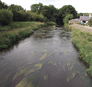
The River Bann is a large river in County Wexford, in the southeast of the Republic of Ireland.

Duncormick or Duncormac is a rural village and surrounding community located in County Wexford, Ireland. At the time of the 2016 census, the village of Duncormick had a population of 116 people. The village is 18 kilometres (11 mi) south-west of Wexford town, close to the fishing village of Kilmore Quay which is one of the largest fishing harbours in Ireland. 'Duncormick' is sometimes used to refer not only to a village, but also to the rural area surrounding it. The village is in a townland and civil parish of the same name.

Ballyhack is a small village located in the south-west of County Wexford, in Ireland, on the eastern shore of the Waterford Harbour, which is the estuary of The Three Sisters

Bannow is a village and civil parish lying east of Bannow Bay on the south-west coast of County Wexford, Ireland. In modern times the main settlement is the village of Carrig-on-Bannow. In Norman times there was a borough called Bannow on Bannow Island at the mouth of the Bay. This town has since disappeared, probably due to the silting up of the natural harbour channels in the 14th century, and the former island is now attached to the rest of the parish.

Sligo Bay is a natural ocean bay in County Sligo, Republic of Ireland.
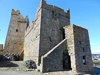
Slade Castle is a tower house and National Monument in County Wexford, Ireland. It is located in the village of Slade on the Hook Peninsula and primarily dates to the late 15th or early 16th century.

Slade is a small village and townland in County Wexford, Ireland. The townland, which has an area of approximately 1 square kilometre (0.4 sq mi), sits on the Hook Peninsula and had a population of 52 people as of the 2011 census. Slade has historically been a fishing port, and was defended by Slade Castle from the late 15th century. In the south of the townland, there is evidence of an earlier ringfort. The harbour in Slade village was extended in the mid-19th century and built upon piers dating from at least the 17th century. A salt-house was built here in the 17th century, to salt (preserve) the fish landed in the harbour. There is a small beach next to the harbour, and Hook Sub Aqua Club is based nearby.