Fylingdales is a civil parish in the Scarborough district of North Yorkshire, England situated south of Whitby, within the North York Moors National Park. It contains the villages of Robin Hood's Bay and Fylingthorpe and Fyling Hall School.
Hampole is a small village and civil parish in the Metropolitan Borough of Doncaster, on the border with West Yorkshire. Historically part of the West Riding of Yorkshire, the eastern boundary of the parish is marked by the Great North Road, and the parish lies in what was once the Barnsdale Forest. It had a population of 187 in 2001, increasing to 203 at the 2011 Census.

Little Gransden is a civil parish and village in South Cambridgeshire, England. In 2001 the population was 262 people, including Waresley and increasing to 296 at the 2011 Census. It is 11 miles (18 km) from Cambridge, on the border with the district of Huntingdonshire. Little Gransden has two airfields, one of which was used in World War II.
Hockley is a large village and civil parish in Essex in the East of England located between Chelmsford and Southend-on-Sea, or, more specifically, between Rayleigh and Rochford. It came to prominence during the coming of the railway in the 1890s and at the 2001 census had a population of 13,616 people, reducing to 9,616 at the 2011 Census, many of whom commute to London. The parish of Hockley itself has a population of 8,909, while the urban area runs into the neighbouring parish of Hawkwell. Hockley railway station serves the village.

Eskdale is a glacial valley and civil parish in the western Lake District National Park in Cumbria, England. It forms part of the Borough of Copeland, and in 2001 had a population of 264, increasing to 304 at the 2011 Census. One of the Lake District's most popular tourist attractions, the Ravenglass and Eskdale Railway, runs through the valley, though along with other western valleys of the Lake District, Eskdale is notably quieter during the high summer season than the more accessible eastern areas.

Bridford is a village and civil parish in south west England, located in the Teign Valley, Devon on the edge of Dartmoor. The parish is surrounded by the parishes of Dunsford, Doddiscombsleigh, Christow, and Moretonhampstead. At the 2011 census the population of the parish was 503, compared with 404 in 1901.
Ridgmont is a small village and civil parish in Bedfordshire, England. It is located beside junction 13 of the M1 motorway, and close to Milton Keynes and Woburn Abbey. The 2001 census states the total population to be 418, reducing to 411 at the 2011 Census.
Ravenstone is a small, rural cluster village with a population of 2,149, situated just off the A511 road between Coalville and Ashby-de-la-Zouch, in North West Leicestershire, and within the National Forest, England. From the 2011 census the population was included in the civil parish of Ravenstone with Snibston.

Awbridge is a small village and civil parish in the Test Valley district of Hampshire, England, about three miles northwest of Romsey, and near the River Test. According to the 2001 census the parish, which includes the villages of Awbridge, Upper Ratley and Lower Ratley, had a population of 695, increasing to 712 at the 2011 Census.

Bulkeley is a village and civil parish in the unitary authority of Cheshire East and the ceremonial county of Cheshire, England. The village is on the A534 road, 9 miles (14 km) west of Nantwich. In the 2011 census it had a population of 239.
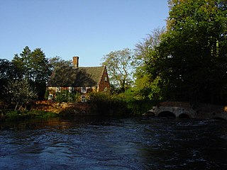
Lyng is a village and civil parish in the English county of Norfolk. It is situated on the River Wensum, some 10 km (6.2 mi) north-east of the town of East Dereham and 20 km (12 mi) north-west of the city of Norwich.

Upper Cumberworth is a small village in West Yorkshire, England, within the civil parish of Denby Dale and the Diocese of Wakefield. It is between the villages of Denby Dale and Shepley, above the village of Lower Cumberworth. It occupies a rural location, surrounded by fields and woodland but close to Huddersfield, Barnsley, Wakefield and Sheffield by public transport or road.

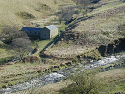
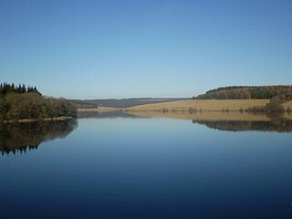
Derwent was a village 'drowned' in 1944 when the Ladybower Reservoir in Derbyshire, England was created. The village of Ashopton, Derwent Woodlands church, and Derwent Hall were also 'drowned' in the construction of the reservoir.

Dufton is a village and civil parish in Cumbria, England. Historically part of Westmorland, it lies in the Eden Valley and below Great Dun Fell. It is mostly around 180m above sea level. At the 2001 census the parish had a population of 169, increasing to 204 at the 2011 Census

Stanton Harcourt is a village and civil parish in Oxfordshire about 4 miles (6.4 km) southeast of Witney and about 6 miles (10 km) west of Oxford. The parish includes the hamlet of Sutton, 1⁄2 mile (800 m) north of the village. The 2011 Census recorded the parish's population as 960.

Ebernoe is a hamlet and civil parish in the District of Chichester in West Sussex, England, and 4 miles (6 km) north of Petworth near the A283 road.

Swettenham is a village and civil parish in the unitary authority of Cheshire East and the ceremonial county of Cheshire, England. According to the 2001 Official UK Census, the population of the entire civil parish was 248, increasing to 291 at the 2011 Census. The civil parish includes the hamlet of Kermincham.

Shudy Camps is a village in the south-east corner of Cambridgeshire, England, near the border of Essex and Suffolk, and is part of the Chilford Hundred. In 2001, according to the census, the population was 310, increasing to 338 at the 2011 Census. The area of the village is 951 hectares. It includes the nearby hamlet of Mill Green. The highest point in the parish is 383' ASL at Mill Green.
Easington is a civil parish within the Ribble Valley district of Lancashire, England, with a population in 2001 of 52. The Census 2011 population details have been grouped with the parish of Slaidburn. Before 1974, it formed part of Bowland Rural District in the West Riding of Yorkshire. It covers just over 9000 acres.