The Islands of the Firth of Clyde are the fifth largest of the major Scottish island groups after the Inner and Outer Hebrides, Orkney and Shetland. They are situated in the Firth of Clyde between Ayrshire and Argyll and Bute. There are about forty islands and skerries. Only four are inhabited, and only nine are larger than 40 hectares. The largest and most populous are Arran and Bute. They are served by dedicated ferry routes, as are Great Cumbrae and Holy Island. Unlike the isles in the four larger Scottish archipelagos, none of the isles in this group are connected to one another or to the mainland by bridges.

Hoy is an island in Orkney, Scotland, measuring 143 square kilometres (55 sq mi) – the second largest in the archipelago, after Mainland. A natural causeway, the Ayre, links the island to the smaller South Walls; the two islands are treated as one entity by the UK census.

Bressay is a populated island in the Shetland archipelago of Scotland.
South Ronaldsay is one of the Orkney Islands off the north coast of Scotland. It is linked to the Orkney Mainland by the Churchill Barriers, running via Burray, Glimps Holm and Lamb Holm.

Shapinsay is one of the Orkney Islands off the north coast of mainland Scotland. There is one village on the island, Balfour, from which roll-on/roll-off car ferries sail to Kirkwall on the Orkney Mainland. Balfour Castle, built in the Scottish Baronial style, is one of the island's most prominent features, a reminder of the Balfour family's domination of Shapinsay during the 18th and 19th centuries; the Balfours transformed life on the island by introducing new agricultural techniques. Other landmarks include a standing stone, an Iron Age broch, a souterrain and a salt-water shower.

North Ronaldsay is the northernmost island in the Orkney archipelago of Scotland. With an area of 690 hectares (2.7 sq mi), it is the fourteenth-largest. It is mentioned in the Orkneyinga saga; in modern times it is known for its historic lighthouse, migratory bird life and unusual breed of sheep.

The Northern Isles are a pair of archipelagos off the north coast of mainland Scotland, comprising Orkney and Shetland. They are part of Scotland, as are the Hebrides. The climate is cool and temperate and much influenced by the surrounding seas. There are a total of 36 inhabited islands. The landscapes of the fertile agricultural islands of Orkney contrast with the more rugged Shetland islands to the north, where the economy is more dependent on fishing and on the oil wealth of the surrounding seas. Both island groups have a developing renewable energy industry. Both have a Pictish and Norse history. Both were part of the Kingdom of Norway until they were absorbed into the Kingdom of Scotland in the 15th century. They remained part of it until the 1707 formation of the Kingdom of Great Britain and the 1801 formation of the United Kingdom. And they both played a significant naval role during the world wars of the 20th century.
Eynhallow is a small, presently uninhabited island, part of Orkney, off the north coast of mainland Scotland.
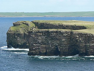
The Calf of Eday is an uninhabited island in Orkney, Scotland, lying north east of Eday. It is known for its wildlife and its prehistoric ruins.

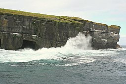
Copinsay is one of the Orkney Islands in Scotland, lying off the east coast of the Orkney Mainland. The smaller companion island to Copinsay, Horse of Copinsay lies to the northeast. The Horse is uninhabited, and is managed as a bird reserve. Copinsay is also home to a lighthouse.

Glimps Holm or Glims Holm is a small uninhabited islet in Orkney, Scotland.
Cava is an uninhabited island in the Orkney archipelago in Scotland. It is 107 hectares (0.41 sq mi) in extent and rises to 38 metres (125 ft) above sea level. The literal meaning of the name is calf island, a terminology often used to designate a small island near to a larger one. Cava is unusual in that it includes a small peninsula joined to the main body of the island by a narrow isthmus, which is in turn called Calf of Cava.

Hunda is an uninhabited island in the Orkney archipelago in Scotland. It is 100 hectares (0.39 sq mi) in extent and rises to 42 metres (138 ft) above sea level. It is situated in the Scapa Flow and connected to the nearby island of Burray by a causeway built in 1941 to stop passage of small surface craft as part of the boom defences, and thence to the Orkney Mainland via the Churchill Barriers.

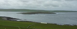
Damsay is an islet in the Orkney archipelago in Scotland. It is approximately 18 hectares (0.07 sq mi) in extent and rises to only 11 metres (36 ft) above sea level. It is situated in the Bay of Firth north of the Orkney Mainland near Finstown. Nearby is the smaller islet of Holm of Grimbister.
Stuley is an island lying to the east of South Uist in the Outer Hebrides, Scotland. It lies off the section of coastline between Loch Eynort and Loch Boisdale. It is 45 hectares (0.17 sq mi) and 40 metres (131 ft) at its highest point.

Staffin Island is an uninhabited islet off the east coast of the Trotternish peninsula of Skye in Scotland.