Related Research Articles

Cajon Pass is a mountain pass between the San Bernardino Mountains to the east and the San Gabriel Mountains to the west in Southern California. Created by the movements of the San Andreas Fault, it has an elevation of 3,777 ft (1,151 m). Located in the Mojave Desert, the pass is an important link from the Greater San Bernardino Area to the Victor Valley, and northeast to Las Vegas. The Cajon Pass area is on the Pacific Crest Trail.

Mount Tom is a large and prominent peak near the city of Bishop in Inyo County of eastern California. It is in the Sierra Nevada and east of the Sierra Crest. The mountain is also in the John Muir Wilderness.

The Verdugo Mountains, also known as the Verdugo Hills or simply The Verdugos, are a small, rugged mountain range of the Transverse Ranges system in Los Angeles County, California. Located just south of the western San Gabriel Mountains, the Verdugo Mountains region incorporates the cities of Burbank, Glendale, Pasadena, and La Cañada Flintridge; the unincorporated communities of Altadena and La Crescenta-Montrose; as well as the City of Los Angeles neighborhood of Sunland-Tujunga.
Panamint Springs is private resort in Inyo County, California. It consists of a motel, cabins, RV and tent campsites, restaurant, and gas station, all operated by Cassell Enterprises, LLC. It lies at an elevation of 1926 feet.

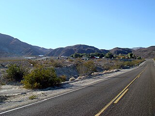
High Desert is a vernacular region with non-discrete boundaries covering areas of the western Mojave Desert in Southern California. The region encompasses various terrain with elevations generally between 2,000 and 4,000 ft above sea level, and is located just north of the San Gabriel, San Bernardino, and Little San Bernardino Mountains.

Devil's Punchbowl is a tilted sandstone formation on the northern slopes of the San Gabriel Mountains, in Los Angeles County, California, at an elevation of 4,750 feet (1,450 m).

Temescal Creek is an approximately 29-mile-long (47 km) watercourse in Riverside County, in the U.S. state of California. Flowing primarily in a northwestern direction, it connects Lake Elsinore with the Santa Ana River. It drains the eastern slopes of the Santa Ana Mountains on its left and on its right the western slopes of the Temescal Mountains along its length. With a drainage basin of about 1,000 square miles (2,600 km2), it is the largest tributary of the Santa Ana River, hydrologically connecting the 720-square-mile (1,900 km2) San Jacinto River and Lake Elsinore watersheds to the rest of the Santa Ana watershed. However, flowing through an arid rain shadow zone of the Santa Ana Mountains, and with diversion of ground water for human use, the creek today is ephemeral for most of its length, except for runoff from housing developments and agricultural return flows.

The Temescal Mountains, also known as the Sierra Temescal, are one of the northernmost mountain ranges of the Peninsular Ranges in western Riverside County, in Southern California in the United States. They extend for approximately 25 mi (40 km) southeast of the Santa Ana River east of the Elsinore Fault Zone to the Temecula Basin and form the western edge of the Perris Block.
Gavilan Hills, sometimes called the Gavilan Mountains, are a range of the Temescal Mountains, in Riverside County, California. The name given them came from local New Mexican and Californio miners of the mountains and Gavilan Plateau. In Spanish Gavilan, means "sparrow hawk".
Crowder Canyon, originally Coyote Canyon, is a valley in San Bernardino County, California. Its mouth was at an elevation of 2,999 feet / 914 meters at its confluence with Cajon Canyon. Its source was at an elevation of 4200 feet at 34°21′02″N117°26′04″W near Cajon Summit. The canyon runs southward just west of the top of Cajon Pass then turns southwestward to meet Cajon Canyon.
Baldy Mesa is a summit whose tallest peaks on its southern extremity, overlook the upper Cajon Canyon in San Bernardino County, California. Its tallest point is an unnamed 4,964 foot high hill on the southwest end of the mesa overlooking the upper Cajon Canyon. The heights that lie along the ridge overlooking the canyon toward the east gradually descend in elevation from one approximately 4,770 feet to the 4,606 foot hill at its far southeastern end at 34°21′34″N117°28′39″W. The mesa descends gradually in elevation to the north, toward the distant Mohave River. it is bounded on the east by the Oro Grande Wash.
Cajon Junction is an unincorporated community in Cajon Canyon and the northern Cajon Pass area, within San Bernardino County, California.
Summit Valley is a valley along SR 138 in the San Bernardino Mountains, east of Cajon Pass within San Bernardino County, California.
Cajon Canyon, originally named El Cajon De San Gabriel De Amuscopiabit, El Cajon in Spanish meaning "the box" in English, is a long valley ending in a box canyon in the northeastern San Gabriel Mountains, within San Bernardino County, California.
Sawpit Canyon is a steep valley or canyon in the San Bernardino Mountains of San Bernardino County, California. Its mouth is at an elevation of 3,386 feet. Its source is located at 34°14′43″N117°20′56″W and lies at an elevation of 5,100 feet, just east of Monument Peak. Its creek was a tributary of the West Fork Mojave River, its original mouth now under Silverwood Lake.
West Fork Mojave River is a 12-mile-long (19 km) tributary stream of the Mojave River in the San Bernardino Mountains of San Bernardino County, California. Its mouth lies at an elevation of 2,986 feet at its confluence with Deep Creek, together the source of the Mojave River. The source of the West Fork is at 34°15′52″N117°24′01″W at an elevation of 4,960 feet, on the north side of a saddle between summits on a ridge running west northwest of Sugarpine Mountain. Sawpit Canyon Creek and East Fork of West Fork Mojave River are its tributaries, both of which now feed into Silverwood Lake that was created when the West Fork was obstructed by the Cedar Springs Dam in 1971.
Cable Canyon is a valley on the south slope of the San Bernardino Mountains in San Bernardino County, California. Its mouth lies at an elevation of 2,073 feet / 632 meters. Its source is at 34°13′48″N117°22′19″W, the confluence of West Fork Cable Canyon and East Fork Cable Canyon, at an elevation of 2,671 feet / 814 meters.
Devil Canyon is a 1.5 mile long canyon on the south slope of the San Bernardino Mountains, in San Bernardino County, California. Its mouth lies at an elevation of 1,759 feet. It heads at 34°12′53″N117°19′43″W, the confluence of East Fork Devil Canyon and West Fork Devil Canyon at an elevation of 2,352 feet.
Eagle Valley is a basin in the Temescal Mountains, of Riverside County, California. It has an elevation of 1,283 feet. The basin is overlooked by summits of the Temescal Mountains on the west, north and east, the tallest is 1,857-foot Arlington Mountain on the northeast. The valley is drained by three streams, the primary one, has its source on the south slope of Arlington Mountain and drains southwestward into Cajalco Canyon and Cajalco Canyon Creek.
References
- ↑ U.S. Geological Survey Geographic Names Information System: Horsethief Canyon
- ↑ "Horsethief Canyon". Modern Hiker. Retrieved 2022-12-21.