California State Route 173

Last updated

California 173.svg

State Route 173

California State Route 173 Map.svg
Map of San Bernardino County in southern California with SR 173 highlighted in red
Route information
Maintained by Caltrans
Length24.944 mi [1]  (40.143 km)
RestrictionsThe one-lane, unpaved segment between the Pacific Crest Trail and a point northeast of Lake Arrowhead is closed indefinitely
Major junctions
West endCalifornia 138.svg SR 138 in Hesperia
East endCalifornia 18.svg SR 18 near Lake Arrowhead
Location
Country United States
State California
Counties San Bernardino
Highway system
California 172.svg SR 172 California 174.svg SR 174

State Route 173 (SR 173) is a state highway in the U.S. state of California that runs entirely in San Bernardino County, mostly in the San Bernardino National Forest. Its west end is at State Route 138 near the west end of Silverwood Lake in the Summit Valley south of Hesperia. Its east end is at State Route 18 south of Lake Arrowhead. The route starts at the Mojave River Forks, skims the easterly and southerly sides of Lake Arrowhead and meets State Route 189, Lake's Edge Road, at the south entrance to the Lake Arrowhead Village.

Contents

It is the only California state highway with an unpaved segment, which is a one-lane jeep trail on the northwestern face of the San Bernardino Mountains directly east of Summit Valley and northwest of Blue Jay. Since March 2011, this one-lane unpaved segment of SR 173 has been closed. [2] Through traffic should use SR 138 and SR 18. An alternate route from Hesperia to Lake Arrowhead would involve heading south on I-15, then south on I-215, then east on SR 210 in San Bernardino to reach the southern terminus of SR 18 at Waterman Road.

Route description

SR 173 begins at SR 138 just inside the Hesperia city limits and travels east near the shore of Silverwood Lake, passing near Cedar Springs Dam, several houses and ranches, and the historic Las Flores Ranch site. The road briefly turns north further into the Hesperia city limits, leaving the San Bernardino National Forest. SR 173 leaves the city and enters Mojave River Forks Regional Park, where it turns east and intersects Arrowhead Lake Road, which leads to the urban center of Hesperia. Once SR 173 intersects the Pacific Crest National Scenic Trail, it turns into a one-lane dirt road rising along the north face of the San Bernardino Mountains, first heading east to its apex before turning south to the Lake Arrowhead area. This one-lane dirt segment has been closed to traffic since March 2011. [2] The paved segment of SR 173 resumes northeast of Lake Arrowhead and enters the community of Cedar Glen, where it parallels the Lake Arrowhead shoreline and encounters Papoose Lake. The highway enters the community of Lake Arrowhead, where SR 173 intersects SR 189 and turns south to terminate at SR 18. [3]

SR 173 is not part of the National Highway System, [4] a network of highways that are considered essential to the country's economy, defense, and mobility by the Federal Highway Administration. [5] SR 173 is eligible for inclusion in the State Scenic Highway System, [6] but it is not officially designated as a scenic highway by the California Department of Transportation. [7]

History

The barrier at the eastern end of the closed unpaved segment of SR 173 California State Route 173 - Eastern Barrier.jpg
The barrier at the eastern end of the closed unpaved segment of SR 173
The eastern point along SR 173 where the pavement ends and the unpaved segment heads west California State Route 173 - Pavement Ends.jpg
The eastern point along SR 173 where the pavement ends and the unpaved segment heads west
The western barrier along SR 173 where the closed unpaved segment begins and heads east 173 sbd7.77 east.png
The western barrier along SR 173 where the closed unpaved segment begins and heads east

Before 1964, Route 173 was part of California Legislative Route 59; however, like a small number of other California State highways, it was not signed. From 1934 to the mid-1950s the part of Route 59 that is now Route 173 was designated by the California Division of Highways to be a segment of California sign route 2; however, signing did not occur. From the mid-1950s through July 1964, the Division of Highways changed the routing of future sign route 2 from the subject segment of Route 59 to Legislative Route 188, the segment of present California 138 between the junction of Routes 138 and 173 and Mount Anderson Junction, the junction of Routes 18 and 138 south of Crestline.

The highway has faced repeated problems since the 2003 Willow Fire that has made the one-lane unpaved trail portion (approximately between Postmile 7.5 and Postmile 11.5) unsafe for passage from erosion and storm damage. Since March 2011, the one-lane trail portion of SR 173 has been permanently closed to through traffic. [2] While roadway preservation maintenance (basic grading, debris clearance) is still done, this decision effectively ends all further interest to upgrade the segment to a 2-lane passable highway through state-funded projects.

Major intersections

Except where prefixed with a letter, postmiles were measured on the road as it was in 1964, based on the alignment that existed at the time, and do not necessarily reflect current mileage. R reflects a realignment in the route since then, M indicates a second realignment, L refers to an overlap due to a correction or change, and T indicates postmiles classified as temporary (for a full list of prefixes, see California postmile § Official postmile definitions ). [1] Segments that remain unconstructed or have been relinquished to local control may be omitted. The entire route is in San Bernardino County.

LocationPostmile
[1] [8] [9]
DestinationsNotes
Hesperia L0.00California 138.svgTo plate blue 1961.svg
I-15 (1961).svg
SR 138 to I-15  Silverwood Lake, Crestline
West end of SR 173
L6.99Arrowhead Lake Road Hesperia
L7.75–
10.90
One-lane, unpaved segment, closed
Lake Arrowhead 21.46California 189.svg SR 189  Blue Jay
23.04California 18.svg SR 18  Running Springs, Big Bear Lake, San Bernardino East end of SR 173
1.000 mi = 1.609 km; 1.000 km = 0.621 mi
  •       Closed/former

See also

Related Research Articles

<span class="mw-page-title-main">California State Route 138</span> Highway in California

State Route 138 is an east–west state highway in the U.S. state of California that generally follows the northern foothills of the San Gabriel Mountains and the western Mojave Desert. The scenic highway begins in the west at its junction with Interstate 5 located south of Gorman in the Sierra Pelona Mountains, continues eastward through the Antelope Valley and Cajon Pass, to its junction with State Route 18 in the east, located in the San Bernardino Mountains south of Crestline.

<span class="mw-page-title-main">California State Route 152</span> East-west highway in central California

State Route 152 is a state highway that runs from east to west near the middle of the U.S. state of California from State Route 1 in Watsonville to State Route 99 southeast of Merced. Its western portion provides access to and from Interstate 5 toward Southern California for motorists in or near Gilroy and San Jose.

<span class="mw-page-title-main">California State Route 74</span> Highway in California

State Route 74, part of which forms the Palms to Pines Scenic Byway or Pines to Palms Highway, and the Ortega Highway, is a state highway in the U.S. state of California. It runs from Interstate 5 in San Juan Capistrano in Orange County to the city limits of Palm Desert in Riverside County. Stretching about 111 miles (179 km), it passes through several parks and National Forests between the Pacific coast and the Coachella Valley.

<span class="mw-page-title-main">California State Route 38</span> Highway in California

State Route 38 is a mostly rural and scenic state highway in the U.S. state of California, connecting Interstate 10 in Redlands with State Route 18 in the Big Bear Lake area. It is one of the primary routes into the San Bernardino Mountains. Despite the orientation of its alignment, SR 38 is assigned in a west–east direction.

<span class="mw-page-title-main">California State Route 2</span> State highway in California, United States

State Route 2 (SR 2) is a state highway in the U.S. state of California. It connects the Los Angeles Basin with the San Gabriel Mountains and the Victor Valley in the Mojave Desert. The highway's southwestern end is at the intersection of Centinela Avenue at the Santa Monica-Los Angeles border and its northeastern end is at SR 138 east of Wrightwood. The SR 2 is divided into four segments, and it briefly runs concurrently with U.S. Route 101 (US 101) and Interstate 210 (I-210). The southwestern section of SR 2 runs along a segment of the east–west Santa Monica Boulevard, an old routing of US 66, to US 101 in East Hollywood; the second section runs along segments of both the north–south Alvarado Street and Glendale Boulevard in Echo Park; the third section to I-210 in Glendale is known as the north–south Glendale Freeway; and the northeastern portion from I-210 in La Cañada Flintridge to SR 138 is designated as the Angeles Crest Highway.

<span class="mw-page-title-main">California State Route 243</span> Highway in California

State Route 243, or the Banning-Idyllwild Panoramic Highway, is a 30-mile (48-kilometer) two-lane state highway in the U.S. state of California that runs from Banning to Idyllwild in Riverside County. The highway is a connector between Interstate 10 (I-10) and SR 74. Along its route, it provides access to the San Bernardino National Forest. A road from Banning to Idyllwild was planned around the turn of the twentieth century, and was open by 1910. The road was added to the state highway system in 1970.

<span class="mw-page-title-main">California State Route 18</span> State route in Los Angeles and San Bernardino counties in California, United States

State Route 18 is a state highway in the U.S. state of California. It serves as a primary route into the San Bernardino Mountains, both from the Riverside–San Bernardino metropolitan area from the south and the Mojave Desert from the north. SR 18 runs from State Route 210 in San Bernardino to State Route 138 in Llano. It has two discontinuities: one in Big Bear Lake, the other in Victorville.

<span class="mw-page-title-main">California State Route 330</span> State highway in San Bernardino County, California, United States

State Route 330 (SR 330) is a state highway in the U.S. state of California, connecting SR 210 in the city of San Bernardino with the San Bernardino National Forest and SR 18 at Running Springs. SR 330 is also known as City Creek Road in the San Bernardino Mountains.

<span class="mw-page-title-main">California State Route 247</span> Highway in California

State Route 247 is a state highway in the U.S. state of California. The road passes through the Mojave Desert in San Bernardino County, connecting SR 62 in Yucca Valley to Interstate 15 (I-15) in Barstow. SR 247 was designated by the California State Legislature in 1969; the county roads along that route were given to the state in 1972.

<span class="mw-page-title-main">California State Route 71</span> Highway in California

State Route 71 (SR 71) is a 15-mile (24 km) state highway in the U.S. state of California. Serving Riverside, San Bernardino, and Los Angeles counties, it runs from SR 91 in Corona to the Kellogg Interchange with I-10 and SR 57 on the border of Pomona and San Dimas. The segment from SR 91 to SR 83 in Chino Hills is called the Corona Freeway, formerly the Corona Expressway and before then the Temescal Freeway. SR 71 is designated as the Chino Valley Freeway between SR 83 and the Kellogg Interchange.

<span class="mw-page-title-main">California State Route 154</span> Highway in California

State Route 154 is a state highway in the U.S. state of California that runs from Los Olivos to Santa Barbara, crossing the San Marcos Pass in the Santa Ynez Mountains. Before U.S. Route 101 was built through the Gaviota Pass, SR 154 was the main throughway to Santa Barbara and the tri city area including use as a stagecoach route in early years. After being replaced by US 101 as the primary route between the Santa Ynez Valley and Santa Barbara, SR 154 now serves as a scenic bypass.

<span class="mw-page-title-main">California State Route 189</span> Highway in California

State Route 189 is a state highway in the U.S. state of California that runs through the San Bernardino Mountains in San Bernardino County. The route travels from State Route 18 near Crestline to State Route 173 in Lake Arrowhead, serving Twin Peaks and Blue Jay along its way.

<span class="mw-page-title-main">California State Route 12</span> State highway in California, United States

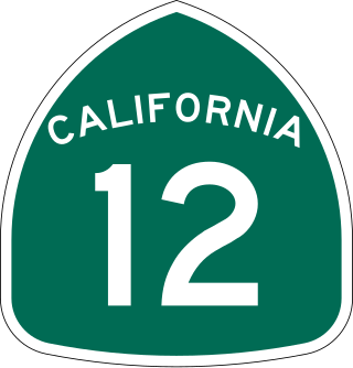
State Route 12 is a state highway in the U.S. state of California that travels in an east–west direction from State Route 116 in Sebastopol in Sonoma County to State Route 49 just north of San Andreas in Calaveras County. The route connects the Sonoma and Napa valleys with the Sacramento–San Joaquin River Delta and the Sierra Foothills. It is constructed to freeway standards from the Fulton Road/South Wright Road stoplight in Santa Rosa, to its partial interchange with Farmers Lane.

<span class="mw-page-title-main">California State Route 33</span> Highway in California

State Route 33 is a north–south state highway in the U.S. state of California. It runs north from U.S. Route 101 in Ventura through the Transverse Ranges and the western side of the San Joaquin Valley to Interstate 5 at a point east of Tracy. SR 33 replaced part of U.S. Route 399 in 1964 during the "great renumbering" of routes. In the unincorporated sections of Kern County it is known as the West Side Highway. In addition, the California Legislature designated the entire Kern County portion as the Petroleum Highway in 2004. The southernmost portion in Ventura is a freeway known as the Ojai Freeway, while it is known as the Maricopa Highway from Ojai to Maricopa.

<span class="mw-page-title-main">California State Route 150</span> Highway in California

State Route 150 is a state highway in the U.S. state of California. It runs from U.S. Route 101 near the Ventura/Santa Barbara County line to State Route 126 in Santa Paula, providing a connection to Lake Casitas and Ojai. It is a two-lane road. There were some one-lane bridges near the western end of the route, but these were rebuilt to be two-lane bridges after flooding in 2005.

<span class="mw-page-title-main">California State Route 29</span> Highway in California

State Route 29 is a state highway in the U.S. state of California that travels from Interstate 80 in Vallejo north to State Route 20 in Upper Lake. It serves as the primary road through the Napa Valley, providing access to the Lake County region to the north and the rest of the San Francisco Bay Area to the south.

<span class="mw-page-title-main">California State Route 108</span> Highway in California

State Route 108 is a state highway in the U.S. state of California that runs from the Central Valley and across the Sierra Nevada via the Sonora Pass. It generally runs northeast from downtown Modesto near the SR 99/SR 132 interchange, to U.S. Route 395 near the Nevada state line. The route was once recommended to continue south of Modesto to Interstate 5, although today that portion exists as a county road. Parts of SR 108 are closed annually during the winter due to inclement weather along the summit.

<span class="mw-page-title-main">California State Route 53</span> Highway in California

State Route 53, also known as the Clearlake Expressway for part of its length, is a state highway in the U.S. state of California that runs in a north–south direction in Lake County east of Clear Lake, It connects SR 29 and SR 20 via the city of Clearlake.

<span class="mw-page-title-main">California State Route 127</span> Highway in California

State Route 127 is a state highway in the U.S. state of California that connects Interstate 15 in Baker to Nevada State Route 373 at the Nevada state line, passing near the eastern boundary of Death Valley National Park. The entire length of the highway closely follows the central portion of the former Tonopah and Tidewater Railroad and loosely follows the Amargosa River.

<span class="mw-page-title-main">California State Route 168</span> Highway in California

State Route 168 is an east-west state highway in the U.S. state of California that is separated into two distinct segments by the Sierra Nevada. The western segment runs from State Routes 41 and 180 in Fresno east to Huntington Lake along the western slope of the Sierra. The eastern segment connects Lake Sabrina in the Eastern Sierra to State Route 266 in the community of Oasis, just to the west of the Nevada border. The eastern segment of SR 168 also forms a concurrency with U.S. Route 395 between Bishop and Big Pine.

References

  1. 1 2 3 California Department of Transportation. "State Truck Route List". Sacramento: California Department of Transportation. Archived from the original (XLS file) on June 30, 2015. Retrieved June 30, 2015.
  2. 1 2 3 "State Route 173 (Unpaved Portion) Permanent Closure" (PDF). CalTrans District 8. Retrieved 18 December 2012.
  3. San Bernardino County Road Atlas (Map). Thomas Brothers. 2008.
  4. Federal Highway Administration (March 25, 2015). National Highway System: California (South) (PDF) (Map). Scale not given. Washington, DC: Federal Highway Administration.
  5. Natzke, Stefan; Neathery, Mike & Adderly, Kevin (June 20, 2012). "What is the National Highway System?". National Highway System. Washington, DC: Federal Highway Administration. Retrieved July 1, 2012.
  6. "Article 2.5 of Chapter 2 of Division 1". California Streets & Highways Code. Sacramento: California Office of Legislative Counsel. Retrieved February 6, 2019.
  7. California Department of Transportation (August 2019). "Officially Designated State Scenic Highways and Historic Parkways" (XLSX). Sacramento: California Department of Transportation. Retrieved September 17, 2017.
  8. California Department of Transportation (July 2007). "Log of Bridges on State Highways". Sacramento: California Department of Transportation.
  9. California Department of Transportation, All Traffic Volumes on CSHS, 2005 and 2006
Template:Attached KML/California State Route 173
KML is from Wikidata