State Route 111 is a state highway in the southeastern part of U.S. state of California. It is a north-south route serving the Imperial Valley, the eastern shore of the Salton Sea, and the Coachella Valley. Its southern terminus is at Imperial Avenue and 1st Street in Calexico, at the former entrance to the Calexico West Port of Entry. SR 111's northern terminus is at Interstate 10 at the northwestern corner of the Palm Springs city limits, near the unincorporated community of Whitewater.

State Route 38 is a mostly rural and scenic state highway in the U.S. state of California, connecting Interstate 10 in Redlands with State Route 18 in the Big Bear Lake area. It is one of the primary routes into the San Bernardino Mountains. Despite the orientation of its alignment, SR 38 is assigned in a west–east direction.

State Route 3 is a state highway in the U.S. state of California that serves Trinity and Siskiyou counties. It runs from SR 36 north along the shore of Trinity Lake, Fort Jones and Etna. The route then approaches Yreka, intersecting with Interstate 5 (I-5), and turns east to Montague. The road was numbered SR 3 in 1964, and most of it has been part of the state highway system since 1933.
State Route 243, or the Banning-Idyllwild Panoramic Highway, is a 30-mile (48-kilometer) two-lane state highway in the U.S. state of California that runs from Banning to Idyllwild in Riverside County. The highway is a connector between Interstate 10 (I-10) and SR 74. Along its route, it provides access to the San Bernardino National Forest. A road from Banning to Idyllwild was planned around the turn of the twentieth century, and was open by 1910. The road was added to the state highway system in 1970.

State Route 247 is a state highway in the U.S. state of California. The road passes through the Mojave Desert in San Bernardino County, connecting SR 62 in Yucca Valley to Interstate 15 (I-15) in Barstow. SR 247 runs along Old Woman Springs Road between Yucca Valley to Lucerne Valley, and Barstow Road between Lucerne Valley and Barstow. SR 247 was designated by the California State Legislature in 1969; the county roads along that route were given to the state in 1972.

State Route 173 is a state highway in the U.S. state of California that runs entirely in San Bernardino County, mostly in the San Bernardino National Forest. Its west end is at State Route 138 near the west end of Silverwood Lake in the Summit Valley south of Hesperia. Its east end is at State Route 18 south of Lake Arrowhead. The route starts at the Mojave River Forks, skims the easterly and southerly sides of Lake Arrowhead and meets State Route 189, Lake's Edge Road, at the south entrance to the Lake Arrowhead Village.

State Route 154 is a state highway in the U.S. state of California that runs from Los Olivos to Santa Barbara, crossing the San Marcos Pass in the Santa Ynez Mountains. Before U.S. Route 101 was built through the Gaviota Pass, SR 154 was the main throughway to Santa Barbara and the tri city area including use as a stagecoach route in early years. After being replaced by US 101 as the primary route between the Santa Ynez Valley and Santa Barbara, SR 154 now serves as a scenic bypass.

State Route 66 is a state highway in the U.S. state of California that runs along a section of old U.S. Route 66 in Los Angeles and San Bernardino counties. It goes from State Route 210 in La Verne east to Interstate 215 in San Bernardino, passing through Claremont, Upland, Rancho Cucamonga, Fontana and Rialto along Foothill Boulevard. In San Bernardino, it is the part of Fifth Street west of H Street.

State Route 142, also known as Carbon Canyon Road for most of its length, is a state highway in the U.S. state of California that connects Brea in Orange County with Chino Hills in San Bernardino County. The eastern portion of the route is known as Chino Hills Parkway.

State Route 34 is a state highway in the U.S. state of California. It runs through Ventura County from Rice Avenue in Oxnard to State Route 118 in Somis.
State Route 232 is a state highway in the U.S. state of California that runs along Vineyard Avenue in Ventura County, serving as a connector between US 101 in Oxnard and SR 118 near Saticoy.
State Route 27, commonly known by its street name Topanga Canyon Boulevard, is a state highway in the U.S. state of California that runs from the Pacific Coast Highway at Topanga State Beach near Pacific Palisades, through the Topanga Canyon in Topanga, and continuing through Woodland Hills, Canoga Park, West Hills, and Chatsworth to the Ronald Reagan Freeway.
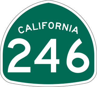
State Route 246 is a state highway in the U.S. state of California that runs from Lompoc east to Solvang and Santa Ynez, cutting through the Santa Ynez Valley and the Santa Barbara Wine Country. Its western terminus is at the western city limits of Lompoc, and its eastern terminus is at State Route 154 near Santa Ynez.
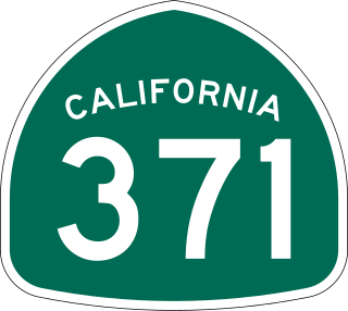
State Route 371 is a state highway in Riverside County, California, serving as a 20.75-mile (33.39 km) connector from SR 79 near Aguanga to SR 74 near Anza. The highway crosses through the private community of Lake Riverside, as well as Cahuilla and the Cahuilla Indian Reservation. It is the primary road running through Anza but mostly serves rural areas.

State Route 62 is a state highway in the U.S. state of California that cuts across the Little San Bernardino Mountains in Riverside and San Bernardino counties. Its western terminus is at Interstate 10 in unincorporated Riverside County outside the borders of Whitewater and Palm Springs. Its eastern terminus is at the Arizona state line just east of Parker, Arizona. The highway passes through the city of Twentynine Palms and along the northern boundary of the Joshua Tree National Park.

State Route 127 is a state highway in the U.S. state of California that connects Interstate 15 in Baker to Nevada State Route 373 at the Nevada state line, passing near the eastern boundary of Death Valley National Park. The entire length of the highway closely follows the central portion of the former Tonopah and Tidewater Railroad and loosely follows the Amargosa River.

State Route 266 (SR 266) is a state highway in the U.S. state of California. The route traverses Fish Lake Valley, which is part in California and part in Nevada. The route connects two Nevada state routes that traverse the Nevada portion of the valley, SR 264 and SR 266. The only connection from SR 266 to the rest of California's road network is via SR 168 in the community of Oasis. Prior to 1986 the southern and northern halves of modern SR 266 had separate numerical designations. The southern portion of the highway, along with modern SR 168, dates to the auto trail era, forming part of the Midland Trail.

State Route 168 is an east-west state highway in the U.S. state of California that is separated into two distinct segments by the Sierra Nevada. The western segment runs from State Routes 41 and 180 in Fresno east to Huntington Lake along the western slope of the Sierra. The eastern segment connects Lake Sabrina in the Eastern Sierra to State Route 266 in the community of Oasis, just to the west of the Nevada border. The eastern segment of SR 168 also forms a concurrency with U.S. Route 395 between Bishop and Big Pine.

State Route 187 is a state highway in the U.S. state of California that runs along Venice Boulevard in Los Angeles from Lincoln Boulevard in Venice to Interstate 10 in the South Robertson district.

U.S. Route 95 (US 95) is a United States Numbered Highway, stretching from the Mexican border in San Luis, Arizona to the Canadian border near Eastport, Idaho. The California portion of US 95 traverses through the far eastern edges of both Riverside and San Bernardino counties. US 95 serves Blythe and Needles and junctions with SR 62 at Vidal Junction.

