
Interstate 45 (I-45) is a major Interstate Highway located entirely within the US state of Texas. While most Interstate routes which have numbers ending in "5" are cross-country north–south routes, I-45 is comparatively short, with the entire route located in Texas. Additionally, it has the shortest length of all the interstates that end in a "5." It connects the cities of Dallas and Houston, continuing southeast from Houston to Galveston over the Galveston Causeway to the Gulf of Mexico.
The Metropolitan Transit Authority of Harris County is a major public transportation agency based in Houston, Texas, United States. It operates bus, light rail, bus rapid transit, HOV and HOT lanes, and paratransit service in the city as well as most of Harris County. It also operates bus service to two cities in Fort Bend County, and to Conroe in Montgomery County. The Metro headquarters are in the Lee P. Brown Administration Building in Downtown Houston. In 2021, the system had a ridership of 46,786,500, or about 188,200 per weekday as of the second quarter of 2022.

METRORail is the 22.7-mile (36.5 km) light rail system in Houston, Texas. In 2021, the system had a ridership of 8,977,300, or about 36,300 per weekday as of the second quarter of 2022. METRORail ranks as the second most-traveled light rail system in the Southern United States and the 12th most-traveled light rail system in the United States, and has the highest ridership per mile for light rail systems in the Southern US. METRORail is operated by the Metropolitan Transit Authority of Harris County (METRO).

The Los Angeles County Metropolitan Transportation Authority (LACMTA), commonly branded as Metro, LA Metro, and L.A. Metro, is the state agency that plans, operates, and coordinates funding for most of the transportation system in Los Angeles County, California The agency directly operates a large transit system that includes bus, light rail, heavy rail (subway), and bus rapid transit services; and provides funding for transit it does not operate, including Metrolink commuter rail, municipal bus operators and paratransit services. Metro also provides funding and directs planning for railroad and highway projects within Los Angeles County. In 2021, the system had a total ridership of 227,718,700 and had a ridership of 781,800 per weekday as of the second quarter of 2022. It is the single largest transit agency within the county as well.

The Research Triangle Regional Public Transportation Authority, known as GoTriangle, provides regional bus service to the Research Triangle region of North Carolina in Wake, Durham, and Orange counties. The GoTriangle name was adopted in 2015 as part of the consolidated GoTransit branding scheme for the Triangle. In 2021, the system had a ridership of 1,362,700, or about 5,300 per weekday as of the second quarter of 2022.

Community Transit (CT) is the public transit authority of Snohomish County, Washington, United States, excluding the city of Everett, in the Seattle metropolitan area. It operates local bus, paratransit and vanpool service within Snohomish County, as well as commuter buses to Downtown Seattle and Northgate station. CT is publicly funded, financed through sales taxes, farebox revenue and subsidies, with an operating budget of $133.2 million. In 2021, the system had a ridership of 4,862,500, or about 19,200 per weekday as of the second quarter of 2022, placing it fourth among transit agencies in the Puget Sound region. The city of Everett, which serves as the county seat, is served by Everett Transit, a municipal transit system.
FasTracks is a multibillion-dollar public transportation expansion plan under construction in metropolitan Denver, Colorado, United States. Developed by the Regional Transportation District (RTD), the plan consists of new commuter rail, light rail, and express bus services. Six new light rail, electric commuter rail and diesel commuter rail lines with a combined length of 122 miles (196 km) will be constructed under the plan. It expands on previous transportation projects, notably T-REX, and includes 57 new transit stations and stops, 21,000 new parking spaces, 18 miles (29 km) of a bus service between Denver and Boulder and the renovation of Denver Union Station as a multi-modal transportation hub.
The Trans-Texas Corridor (TTC) was a proposal for a transportation network in the U.S. State of Texas that was conceived to be composed of a new kind of transportation modality known as supercorridors. The TTC was initially proposed in 2001 and after considerable controversy was discontinued by 2010 in the planning and early construction stages.

Beltway 8 (BW8), the Sam Houston Parkway, along with the Sam Houston Tollway, is an 88-mile (142 km) beltway around the city of Houston, Texas, United States, lying entirely within Harris County.

The Westpark Tollway, also Fort Bend Westpark Tollway, is a limited-access toll road in Texas, serving western Houston and Harris County, and northeastern Fort Bend County. Construction on the facility began in 2001 and portions of the road were opened to traffic in May 2004. Construction of the roadway was completed in August 2005. The Westpark Tollway begins on Westpark Drive just past the South Rice Avenue intersection in the Uptown District of Houston and runs approximately 22 miles (35 km) west to Farm to Market Road 1093 just past Farm to Market Road 723 in Fulshear, Texas. It runs roughly parallel and to the south of Westheimer Road in Harris County and concurrently with FM 1093 in Fort Bend County.
The Harris County Toll Road Authority maintains and operates a 103-mile (165.8 km) toll road system in the Greater Houston area. Its headquarters are located in Houston's Fairbanks/Northwest Crossing neighborhood.

The Big Move is the regional transportation plan (RTP) published by Metrolinx for the Greater Toronto and Hamilton Area (GTHA) in Ontario, Canada. It makes specific recommendations for transit projects, resulting from seven "green papers" and two "white papers" released for public discussion. A draft RTP was released alongside draft investment strategy in September 2008. After a series of stakeholder consultations and public meetings, the final RTP was approved and published by Metrolinx on 28 November 2008.
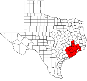
The Houston-Galveston Area Council (H-GAC) is the region-wide voluntary association of local governments in the 13-county Gulf Coast Planning Region of Texas. The organization works with local government officials to solve problems across the area. H-GAC was founded in 1966.

Metrolinx is a Crown agency of the Government of Ontario that manages and integrates road and public transport in the Greater Toronto and Hamilton Area (GTHA), which comprises much of Ontario's Golden Horseshoe region. Headquartered at Union Station in Toronto, the agency was created as the Greater Toronto Transportation Authority on June 22, 2006. The agency adopted its present name as a brand name in 2007 and eventually as the legal name in 2009.
The Massachusetts Department of Transportation (MassDOT) oversees roads, public transit, aeronautics, and transportation licensing and registration in the US state of Massachusetts. It was created on November 1, 2009, by the 186th Session of the Massachusetts General Court upon enactment of the 2009 Transportation Reform Act.

The Texas Department of Transportation (TxDOT) is a governmental agency and its purpose is to "provide safe, effective, and efficient movement of people and goods" throughout the state. Though the public face of the agency is generally associated with maintenance of the state's immense highway system, the agency is also responsible for aviation in the state and overseeing public transportation systems.
The Regional Transportation Plan (RTP) in the United States is a long-term blueprint of a region's transportation system. Usually RTPs are conducted every five years and are plans for thirty years into the future, with the participation of dozens of transportation and infrastructure specialists. The plan identifies and analyzes transportation needs of the metropolitan region and creates a framework for project priorities.
There are approximately 25 current toll roads in the state of Texas. Toll roads are more common in Texas than in many other U.S. states, since the relatively low revenues from the state's gasoline tax limits highway planners' means to fund the construction and operation of highways.

The Tampa Bay Area Regional Transit Authority, or TBARTA, is a regional transportation agency of the U.S. state of Florida which was created on July 1, 2007. The purpose of the agency is "to plan, develop, finance, construct, own, purchase, operate, maintain, relocate, equip, repair, and manage multimodal systems in Hernando, Hillsborough, Manatee, Pasco, and Pinellas Counties." The agency coordinates its efforts with the Florida Department of Transportation to improve transportation in the Tampa Bay Area.
Public transportation in Phoenix, Arizona consists primarily of buses, a 28-mile (45 km) light rail system, and minor additional services. Most transit services run under the name Valley Metro; local cities, counties, and other agencies in the Phoenix area have agreed to use the Valley Metro name. Public transport in the Greater Valley of the Sun exists in a number of modes: local, express, and RAPID commuter buses; neighborhood circulators; dial-a-ride; vanpool service; an online carpool-matching system, and METRO light rail.