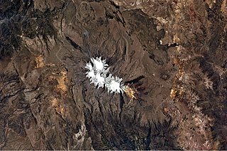
Paraccra is an archaeological site in the Andes of Peru on a mountain of the same name. It is situated in the Arequipa Region, Caylloma Province, Sibayo District, near the Colca River. The site contains towers, round houses and black walls.
Lake Samaccota is a lake in Peru located in the Arequipa Region, Caylloma Province, Tisco District, northeast of the mountain named Palca.

Waqrawiri or Waxra Wiri is a mountain in the Wansu mountain range in the Andes of Peru, about 5,425 metres (17,799 ft) high. It is situated in the Arequipa Region, Castilla Province, Orcopampa District. Waqrawiri lies northwest of the lake Machuqucha and south of the river Millumayu.

Ccella Ccella is a mountain in the Chila in the Andes of Peru, about 5,049 metres (16,565 ft) high. It is situated in the Arequipa Region, Castilla Province, Choco District, and in the Caylloma Province, on the border of the districts of Caylloma and Tapay.

Choquepirhua is a mountain in the Chila mountain range in the Andes of Peru, about 5,400 metres (17,717 ft) high. It lies in the Arequipa Region, Castilla Province, on the border of the districts of Chachas and Choco. Choquepirhua is situated south of Chila.

Qullpa is a mountain in the Andes of Peru, about 5,226.4 metres (17,147 ft) high. It is situated in the Arequipa Region, Castilla Province, on the border of the districts Ayo and Uñón. Qullpa lies south of the mountain Yanqha.

Yanqha is a mountain in the Andes of Peru, about 5,200 metres (17,060 ft) high. It is situated in the Arequipa Region, Castilla Province, on the border of the districts Ayo and Uñón. Yanqha lies south of the mountains Yanawara and Yana Urqu and north of the mountain Qullpa.

Chuqllu Chuqllu or Chhuxllu Chhuxllu is a mountain in the Wansu mountain range in the Andes of Peru, about 5,000 metres (16,404 ft) high. It is situated in the Arequipa Region, Castilla Province, Orcopampa District.

Pillune is a mountain in the Chila mountain range in the Andes of Peru, about 5,000 m (16,000 ft) high. It is situated in the Arequipa Region, Castilla Province, Chachas District. Pillune lies southeast of a lake named Machucocha.

Chuañuma is a mountain in the Andes of Peru, about 5,400 metres (17,717 ft) high. It is situated in the Arequipa Region, Castilla Province, Chachas District. Chuañuma lies south-east of the mountain Huañacagua at a valley named Puncuhuaico. Its stream flows to Chachas.

Pillune is a mountain in the Huanzo mountain range in the Andes of Peru, about 5,000 metres (16,404 ft) high. It is situated in the Arequipa Region, La Unión Province, Puyca District. Pillune lies west of Ancojahua, northwest of Quelcata and northeast of Chuañuma.

Aceruta is a mountain in the Andes of Peru, about 5,400 metres (17,717 ft) high. It is situated in the Arequipa Region, Castilla Province, Chachas District. It lies north-west of the mountain Huayta and north-east of the mountain Huañacagua.

P'isqi P'isqi is a mountain in the Andes of Peru, about 4,600 metres (15,092 ft) high. It lies in the Arequipa Region, Castilla Province, Andagua District. P'isqi P'isqi is situated west of Wakapallqa and Llallawi.

Ancocala is a 4,776-metre-high (15,669 ft) mountain in the Chila mountain range in the Andes of Peru. It is situated in the Arequipa Region, Castilla Province, Chachas District. Ancocala lies southwest of Pillune and the lake named Machucocha.

Apacheta is a 5,328-metre-high (17,480 ft) mountain in the western part of the Chila mountain range in the Andes of Peru. It lies in the Arequipa Region, Castilla Province, Chachas District. It is situated southwest of Chila, northeast of Chila Pillune and southeast of Yuaytacondorsenja.

Chila Pillune is a mountain in the western part of the Chila mountain range in the Andes of Peru, about 5,328 m (17,480 ft) high. It lies in the Arequipa Region, Castilla Province, Chachas District. Chila Pillune is situated west of Chila, the highest mountain of the range, northeast of Ticlla and south of Apacheta.

Huanca is a 5,200-metre-high (17,060 ft) mountain in the Chila mountain range in the Andes of Peru. It is located in the Arequipa Region, Castilla Province, Chachas District. Huanca lies southwest of Huayllatarpuna and Condorcacha and northeast of Chinchón and Aceruta.

Huayta is a mountain in the Chila mountain range in the Andes of Peru, about 5,400 m (17,717 ft) high. It is located in the Arequipa Region, Castilla Province, Chachas District. Huayta lies south of Huanca and Sullucullahua, northeast of Chinchón and southeast of Aceruta.

Samacasa is a mountain in the Chila mountain range in the Andes of Peru, about 5,200 m (17,100 ft) high. It is located in the Arequipa Region, Castilla Province, Chachas District. Samacasa lies north of Airicoto.

Aljajahua is a mountain in the Huanzo mountain range in the Andes of Peru, about 4,800 metres (15,748 ft) high. It is situated in the Arequipa Region, Condesuyos Province, Cayarani District. Aljajahua lies between the Pumaranra valley in the east and the Huañajahua valley in the west.


