Ancash is a region of northern Peru. It is bordered by La Libertad Region on the north, Huánuco and Pasco regions on the east, the Lima Region on the south, and the Pacific Ocean on the west. Its capital is the city of Huaraz, and its largest city and port is Chimbote. The name of the region originates from the Quechua word anqash, from anqas (blue) or from anka (eagle).
Huallanca or Wallanka may refer to the following:

Tuco,Tuku,Tucu or Huanaco Punta is a mountain in the Andes in South America. Its summit is 5,479 m (17,976 ft)) high and it is one of the southernmost peaks in the snow-capped Cordillera Blanca in northwestern central Peru. Tuco is located in the Ancash Region, Bolognesi Province, Aquia District and in the Recuay Province, Catac District. It is situated northeast of Caullaraju, between Challhua in the west and Pastoruri in the east.

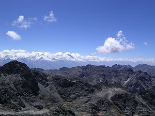
The Huallanca mountain range (possibly from Quechua, wallanka mountain range; a cactus plant ; also called Chaupi Janca or Shicra Shicra lies in the Andes of Peru. It is located in the Ancash Region, Bolognesi Province. The Huallanca mountain range is a small range southeast of the Cordillera Blanca and north of the Huayhuash mountain range extending between 9°52' and 10°03'S and 76°58' and 77°04'W for about 19 km in a northeasterly direction.
Rondoy is a 5,870-metre-high (19,259 ft) mountain in the north of the Huayhuash mountain range in the Andes of Peru. It is located in the Ancash Region, Bolognesi Province, Pacllón District, and in the Huánuco Region, Lauricocha Province, Queropalca District. Rondoy lies north of Yerupajá and Jirishanca and southwest of Lake Mitococha.
Challhua, Wiksu or Huicsu is a mountain in the southern Cordillera Blanca in the Andes of Peru, about 5,487 m (18,002 ft) high. Challhua is located in the Ancash Region, Bolognesi Province, Aquia District and in the Recuay Province, Catac District. It is situated northeast of Caullaraju, west of Pastu Ruri and Tuco and south of Santun. One of the nearest places is the village of Wicso, located next to Callan creek, west of the mountain. This creek flows to the Pumapampa River, a right affluent of the Santa River.
Yanashallash, Yanashalla, or Yanashayash is a mountain in the north of the Wallanka mountain range in the Andes of Peru, about 4,600 m (15,100 ft)) high.

Rajucollota, Suerococha, named after the nearby lake, or Diablo Mudo is a mountain in the west of the Huayhuash mountain range in the Andes of Peru, about 5,427 metres (17,805 ft) high. It is located in the Ancash Region, Bolognesi Province, Pacllon District, and in the Lima Region, Cajatambo Province, Copa District. Rajucollota lies on a sub-range west of Yerupaja, west of the mountain Huacrish, northwest of the mountain Auxilio and north of the lake Suerococha.
Kunkush is a 4,626-metre-high (15,177 ft) mountain in the Wallanka mountain range in the Andes of Peru. It is situated in the Ancash Region, Bolognesi Province, Huallanca District. Kunkush lies at the Ch'uspi valley on an eastern extension of the range, west of Tuna Wayin, Yana Puyku and Muya Wayin and east of Wallanka.

Kuntur Wayi or Kuntur Wayin is a 5,171-metre-high (16,965 ft) mountain in the Wallanka mountain range in the Andes of Peru. It is situated in the Ancash Region, Bolognesi Province, on the border of the districts of Aquia and Huallanca. Kuntur Wayi lies east of the Minapata valley, southwest of Kunkush, south of Wallanka and southeast of Minapata.
Gasha is a 4,880-metre-high (16,010 ft) mountain in the northern part of the Huayhuash mountain range in the Andes of Peru. It is located in the Ancash Region, Bolognesi Province, Pacllón District, and in the Huánuco Region, Lauricocha Province, Queropalca District. Gasha lies northwest of Mitococha and north of Paria.
Tankan or Ruq'a Qaqa, qaqa rock, Hispanicized Rucagaga) is a 5,162-metre-high (16,936 ft) mountain in the northern part of the Wallanka mountain range in the Andes of Peru. It is located in the Ancash Region, Bolognesi Province, in the districts of Aquia and Huallanca.
Mituraju is a 5,750-metre-high (18,865 ft) mountain in the north of the Huayhuash mountain range in the Andes of Peru. It is located in the Ancash Region, Bolognesi Province, Pacllón District, and in the Huánuco Region, Lauricocha Province, Queropalca District. Mituraju lies southeast of Rondoy and southwest of Lake Mitucocha.
Alcay is a 5,300-metre-high (17,388 ft) mountain in the north of the Huayhuash mountain range in the Andes of Peru. It is located in the Huánuco Region, Lauricocha Province, Queropalca District. Alcay lies northwest of a lake named Carhuacocha, east of Mituraju and southeast of Rondoy. The little lake northeast of the mountain is Alcaycocha.

Raju Cutac, Rajo Cutac or Rajutuna, is a 5,355-metre-high (17,569 ft) mountain in the Cordillera Blanca in the Andes of Peru. It is situated in the Ancash Region, Bolognesi Province, Aquia District. Raju Cutac lies southeast of Challhua and Tuco.
Chawpi Hanka is a mountain in the Andes of Peru, about 4,800 m (15,748 ft) high. It is situated in the Ancash Region, Bolognesi Province, in the districts of Huallanca and Huasta, and in the Huánuco Region Lauricocha Province, Queropalca District. It lies on a ridge north of the Waywash mountain range.
Tancancocha is a mountain in the north of the Huallanca mountain range in the Andes of Peru at a small lake of that name. The mountain reaches an altitude of approximately 5,200 m (17,100 ft). It is located in the Ancash Region, Bolognesi Province, in the districts of Aquia and Huallanca.

Chuspi or Chuspic is a 5,090-metre-high (16,700 ft) mountain in the north of the Huallanca mountain range in the Andes of Peru. It is located in the Ancash Region, Bolognesi Province, in the districts of Aquia and Huallanca.
Chaupijanca or Chaupi Janca is a 5,283-metre-high (17,333 ft) mountain in the Huallanca mountain range in the Andes of Peru. It is located in the Ancash Region, Bolognesi Province, in the districts of Huallanca and Huasta.
Chancayoc or Chhankayuq is a mountain in the Andes of Peru which reaches an altitude of approximately 4,800 m (15,700 ft). It is located in the Ancash Region, Bolognesi Province, Huasta District. Chancayoc lies near Pisqan Punta, southwest of the Huallanca mountain range.


