
Clay County is a county located in the U.S. state of Texas. As of the 2020 census, its population was 10,218. The county seat is Henrietta. The county was founded in 1857 and later organized in 1860. It is named in honor of Henry Clay, famous American statesman, Kentucky Senator and United States Secretary of State.

Young County is a county located in the U.S. state of Texas. As of the 2020 census, its population was 17,867. Its county seat is Graham. The county was created in 1856 and organized in 1874. It is named for William Cocke Young, an early Texas settler and soldier.

Wichita County is a county located in the U.S. state of Texas. As of the 2020 census, its population was 129,350. The county seat is Wichita Falls. The county was created in 1858 and organized in 1882. Wichita County is part of the Wichita Falls, Texas, TX metropolitan statistical area.

Archer County is a county located in the U.S. state of Texas. As of the 2020 census, its population was 8,560. Its county seat is Archer City. It is part of the Wichita Falls metropolitan statistical area.

Archer City is a city in and the county seat of Archer County, Texas, United States. The city lies at the junction of State Highway 79 and State Highway 25. It is located 25 miles (40 km) south of Wichita Falls, and is part of the Wichita Falls metropolitan statistical area. Its population was 1,834 at the 2010 census.

Holliday is a city in Archer County, Texas, United States. It is part of the Wichita Falls, Texas Metropolitan Statistical Area. The population was 1,758 at the 2010 census. The town is named for nearby Holliday Creek, named in turn for John Holliday, a member of a Republic of Texas military expedition.

Lakeside City is a town in Archer County, Texas, United States. It is part of the Wichita Falls, Texas Metropolitan Statistical Area. The population was 997 at the 2010 census.

Megargel is a town in Archer County, Texas, United States. It is part of the Wichita Falls, Texas metropolitan statistical area. Its population was 203 at the 2010 census. The town is named for Roy C. Megargel, the president of the railroad that developed the town.
Bellevue is a city in Clay County, Texas, United States. It is part of the Wichita Falls metropolitan statistical area. The population was 362 at the 2010 census.
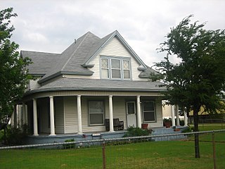
Henrietta is a city in and the county seat of Clay County, Texas, United States. It is part of the Wichita Falls metropolitan statistical area. The population was 3,141 at the 2010 census, a decline of 123 from the 2000 tabulation of 3,264.

Electra is a city in Wichita County, Texas, United States. It is part of the Wichita Falls metropolitan statistical area. The population was 2,791 at the 2010 census., down from 3,168 in 2000. Electra claims the title of Pump Jack Capital of Texas, a title made official by the state in 2001, and has celebrated an annual Pump Jack Festival since 2002. It was named in honor of Electra Waggoner, an heiress to the Waggoner Ranch. Electra is also known for its Grand Theatre which was refurbished and now a functioning theater.
Scotland is a city in Archer County in the U.S. state of Texas. It is part of the Wichita Falls, Texas Metropolitan Statistical Area. The population was 501 at the 2010 census. The town is named for its founder, Henry J. Scott.

Ben Franklin is an unincorporated community in Delta County, Texas, United States, four miles (6 km) northeast of Pecan Gap and 77 miles (124 km) northeast of Dallas. The town's ZIP Code is 75415.

Montague is a census-designated place and unincorporated community in Montague County, Texas, United States. It is the county seat of Montague County and had an estimated population of 400 in 2000, according to the Handbook of Texas. Its population was 304 as of the 2010 census.
Holliday Creek is a stream located in Archer and Wichita counties, Texas. Its headwaters are in western Archer County, Texas. It crosses Archer County and then enters Wichita County and Lake Wichita. From the spillway of Lake Wichita dam, it passes through the city of Wichita Falls, Texas, and empties into the Wichita River, a tributary of the Red River.
Anarene is a ghost town in Archer County, Texas, United States. Its name was used for the town portrayed in the film adaptation of Larry McMurtry's novel, The Last Picture Show.

The Wichita Falls metropolitan statistical area is a metropolitan area in North Texas that covers three counties – Archer, Clay, and Wichita. As of the 2010 census, the MSA had a population of 151,306.

The Wichita River, part of the Red River watershed, lies in north-central Texas. Rising in northeastern Knox County at the confluence of its North and South Forks, the river flows 90 miles (140 km) northeast across Baylor, Archer, Wichita, and Clay counties before joining the Red River just west of Byers Bend in northern Clay County.
Dundee is an unincorporated community located in Archer County, Texas, United States. According to the Handbook of Texas, the community had a population of 12 in 2010. Dundee is located within the Wichita Falls Metropolitan Statistical Area.
Mankins is an unincorporated community located in Archer County, Texas, United States. According to the Handbook of Texas, the community had a population of 10 in 2000. Mankins is located within the Wichita Falls Metropolitan Statistical Area.

