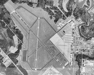
Tri-Cities Airport, is in Blountville, Tennessee, United States. It serves the Tri-Cities area of Northeast Tennessee and Southwest Virginia. The airport is governed by the Tri-Cities Airport Authority (TCAA) whose members are appointed by the cities of Johnson City, Kingsport, Bristol (TN), Bristol (VA) and both Washington County (TN) and Sullivan County (TN).
Smyrna Airport is a public general aviation and military use airport located two nautical miles (4 km) north of the central business district of Smyrna, a town in Rutherford County, Tennessee, United States. It is owned by the Smyrna / Rutherford County Airport Authority. Smyrna Airport is the third largest airport in Tennessee and is the state's busiest general aviation airport. Prior to March 1971, the facility was an active military installation known as Sewart Air Force Base.
Tullahoma Regional Airport, also known as William Northern Field and Soesbe-Martin Field, is a public use airport in Coffee County, Tennessee, United States. It is owned by the City of Tullahoma and located two nautical miles (4 km) northwest of its central business district. This airport is included in the National Plan of Integrated Airport Systems for 2011–2015, which categorized it as a general aviation facility.
Monroe County Airport is a county-owned, public-use airport located two nautical miles northwest of the central business district of Madisonville, a town in Monroe County, Tennessee, United States.

Morristown Regional Airport is a city-owned public-use airport located four nautical miles southwest of the central business district of Morristown, a city in Hamblen County, Tennessee, United States. It was opened in 1953. The manager of the airport was Evelyn Bryan Johnson until her death on May 10, 2012.
McMinn County Airport is a county-owned, public-use airport located three nautical miles (6 km) southeast of the central business district of Athens, a city in McMinn County, Tennessee, United States.

Gatlinburg–Pigeon Forge Airport is a county-owned public-use municipal airport in Sevier County, Tennessee, United States. The airport is well north of the cities of Gatlinburg and Pigeon Forge, but only two nautical miles (3.7 km) southeast of the central business district of Sevierville, and within its city limits.
Fayette County Airport is a county-owned, public-use airport located two nautical miles southwest of the central business district of Somerville, in Fayette County, Tennessee, United States. According to the FAA's National Plan of Integrated Airport Systems for 2009–2013, it was classified as a general aviation airport.
Humboldt Municipal Airport is a public-use airport located in Gibson County, Tennessee, United States. It is three nautical miles southeast of the central business district of the City of Humboldt, which owns the airport. According to the FAA's National Plan of Integrated Airport Systems for 2009–2013, it was classified as a general aviation airport.
Marion County Airport, also known as Brown Field, is a county-owned, public-use airport located four nautical miles southeast of the central business district of Jasper, a town in Marion County, Tennessee, United States.

Abernathy Field is a public use airport located three nautical miles southwest of the central business district of Pulaski, a city in Giles County, Tennessee, United States. It is owned by the City of Pulaski and Giles County. According to the FAA's National Plan of Integrated Airport Systems for 2009–2013, it is categorized as a general aviation facility.
Carroll County Airport is a county-owned public-use airport in Carroll County, Tennessee, United States. It is located four nautical miles northwest of the central business district of Huntingdon, Tennessee. The airport is included in the FAA's National Plan of Integrated Airport Systems for 2011–2015, which categorized it as a general aviation facility.
Lebanon Municipal Airport is a city-owned public-use airport located two nautical miles (4 km) southwest of the central business district of Lebanon, a city in Wilson County, Tennessee, United States. This airport is included in the National Plan of Integrated Airport Systems for 2011–2015, which categorized it as a general aviation airport.
Warren County Memorial Airport is a county-owned public-use airport in Warren County, Tennessee, United States. It is located three nautical miles (6 km) west of the central business district of McMinnville, Tennessee. This airport is included in the National Plan of Integrated Airport Systems for 2011–2015, which categorized it as a general aviation facility.
Hawkins County Airport is a county-owned public-use airport in Hawkins County, Tennessee, United States. It is located six nautical miles northeast of the central business district of Rogersville, Tennessee in the city of Surgoinsville, Tennessee. This airport is included in the National Plan of Integrated Airport Systems for 2011–2015, which categorized it as a general aviation facility.
Maury County Airport is a county-owned public-use airport in Maury County, Tennessee, United States. It is located 2 nautical miles northeast of the central business district of Mount Pleasant, Tennessee and 8 nautical miles southwest of Columbia, Tennessee.
Springfield Robertson County Airport is a public use airport located three nautical miles (6 km) northwest of the central business district of Springfield, a city in Robertson County, Tennessee, United States. It is owned by the Springfield/Robertson Airport Board. This airport is included in the National Plan of Integrated Airport Systems for 2011–2015, which categorized it as a general aviation facility.
Portland Municipal Airport is a city-owned, public-use airport located three nautical miles (6 km) northeast of the central business district of Portland, a city in Sumner County, Tennessee, United States. It is included in the National Plan of Integrated Airport Systems for 2011–2015, which categorized it as a general aviation facility.

Music City Executive Airport is a publicly-owned public-use airport located two nautical miles (4 km) east of the central business district of Gallatin, a city in Sumner County, Tennessee, United States. The airport previously had the designation M33 prior to being changed to XNX. The airport was named Sumner County Regional Airport prior to June 2019. This airport is included in the National Plan of Integrated Airport Systems for 2011 to 2015, which categorized it as a general aviation airport.
Benton County Airport is a county-owned public-use airport located three nautical miles (4.8 km) south of the central business district of Camden, a city in Benton County, Tennessee, United States. This airport is included in the National Plan of Integrated Airport Systems for 2011–2015, which categorized it as a general aviation airport.


