
The Pacific Coast Ranges are the series of mountain ranges that stretch along the West Coast of North America from Alaska south to Northern and Central Mexico. Although they are commonly thought to be the westernmost mountain range of the continental United States and Canada, the geologically distinct Insular Mountains of Vancouver Island lie farther west.

The Transverse Ranges are a group of mountain ranges of southern California, in the Pacific Coast Ranges physiographic region in North America. The Transverse Ranges begin at the southern end of the California Coast Ranges and lie within Santa Barbara, Ventura, Los Angeles, San Bernardino, Riverside and Kern counties. The Peninsular Ranges lie to the south. The name is due to the ranges' east–west orientation, making them transverse to the general northwest–southeast orientation of most of California's coastal mountains.

The Santa Ynez Mountains are a portion of the Transverse Ranges, part of the Pacific Coast Ranges of the west coast of North America. It is the westernmost range in the Transverse Ranges.
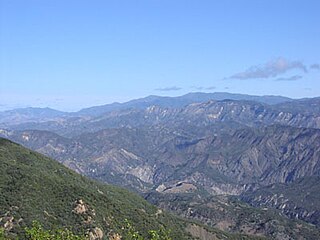
The San Rafael Mountains are a mountain range in central Santa Barbara County, California, U.S., separating the drainages of the Santa Ynez River and the Santa Maria River. They are part of the Transverse Ranges system of Southern California which in turn are part of the Pacific Coast Ranges system of western North America.

The Sierra Madre is a mountain range in southwestern California. It forms the southernmost part of the California Coast Ranges and lies mostly in Santa Barbara County, with a small portion extending into Ventura County. The Sierra Madre has a northwest-to-southeast orientation, bordered on the north and northeast by the Cuyama River and Cuyama Valley, and on the south and east by the drainage of the Sisquoc River.
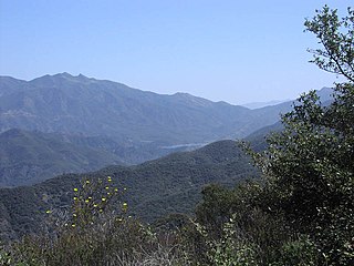
Los Padres National Forest is a United States national forest in southern and central California. Administered by the United States Forest Service, Los Padres includes most of the mountainous land along the California coast from Ventura to Monterey, extending inland. Elevations range from sea level to 8,847 feet (2,697 m).

The Coast Ranges of California span 400 miles (644 km) from Del Norte or Humboldt County, California, south to Santa Barbara County. The other three coastal California mountain ranges are the Transverse Ranges, Peninsular Ranges and the Klamath Mountains.

The Topatopa Mountains are a mountain range in Ventura County, California, north of Ojai, Santa Paula, and Fillmore. They are part of the Transverse Ranges of Southern California.

The San Rafael Wilderness is a wilderness area in the mountains of north central Santa Barbara County, California, United States. It is north of the city of Santa Barbara and east of Santa Maria within the Los Padres National Forest. Formed in 1968, it was the first wilderness area to be created from a previously designated Primitive Area after the passage of the 1964 Wilderness Act. It also includes the Sisquoc Condor Sanctuary, created in 1937, which is the oldest designated sanctuary for the large endangered birds.

The Dick Smith Wilderness is a wilderness area in the mountains of eastern Santa Barbara County, California, United States, with a portion in Ventura County. It is completely contained within the Los Padres National Forest, and is northeast of the city of Santa Barbara and north of the city of Ojai. It is most easily accessible from two trailheads off State Route 33, which runs north from Ojai. It is adjacent to the large San Rafael Wilderness on the west and the Matilija Wilderness on the south. Across Highway 33 to the east, and also in the Los Padres National Forest, is the large Sespe Wilderness.

The Cuyama Valley is a valley along the Cuyama River in Central California, in northern Santa Barbara, southern San Luis Obispo, southwestern Kern, and northwestern Ventura counties. It is about two hours driving time from both Los Angeles and the Santa Barbara area.
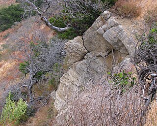
The Vaqueros Formation is a sedimentary geologic unit primarily of Upper Oligocene and Lower Miocene age, which is widespread on the California coast and coastal ranges in approximately the southern half of the state. It is predominantly a medium-grained sandstone unit, deposited in a shallow marine environment. Because of its high porosity and nearness to petroleum source rocks, in many places it is an oil-bearing unit, wherever it has been configured into structural or stratigraphic traps by folding and faulting. Being resistant to erosion, it forms dramatic outcrops in the coastal mountains. Its color ranges from grayish-green to light gray when freshly broken, and it weathers to a light brown or buff color.

The Patagonia Mountains are a 15-mile-long (24 km) mountain range within the Coronado National Forest, and in Santa Cruz County, Arizona, United States.
Sedgwick Reserve is a 5,896-acre (2,386 ha) nature reserve in Santa Barbara County, California, United States. It is located in the San Rafael Mountains, 35 miles north of Santa Barbara near the town of Santa Ynez. The reserve is used for natural science research and education as it includes a wide range of native ecosystems, such as vernal pools, chaparral, and coastal sage scrub.

The Juncal Formation is a prominent sedimentary geologic unit of Eocene age found in and north of the Santa Ynez Mountain range in southern and central Santa Barbara County and central Ventura County, California. An enormously thick series of sediments deposited over millions of years in environments ranging from nearshore to deep water, it makes up much of the crest of the Santa Ynez range north of Montecito, as well as portions of the San Rafael Mountains in the interior of the county. Its softer shales weather to saddles and swales, supporting a dense growth of brush, and its sandstones form prominent outcrops.
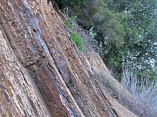
The Jalama Formation is a sedimentary rock formation widespread in southern Santa Barbara County and northern Ventura County, southern California. Of the Late Cretaceous epoch, the unit consists predominantly of clay shale with some beds of sandstone.
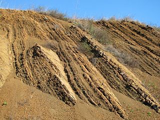
The Espada Formation is a sedimentary rock formation widespread in Santa Barbara County, California. Of late Jurassic to Cretaceous age, the unit consists primarily of shale with some interbedded thin layers of sandstone, conglomerate, and limestone.
The 1991 Sierra Madre earthquake occurred on June 28 at with a moment magnitude of 5.6 and a maximum Mercalli intensity of VII. The thrust earthquake resulted in two deaths, around 100 injuries, and damage estimated at $33.5–40 million. The event occurred beneath the San Gabriel Mountains on the Clamshell–Sawpit Fault, which is a part of the Sierra Madre–Cucamonga Fault System. Instruments captured the event at a number of strong motion stations in Southern California.

The geology of California is highly complex, with numerous mountain ranges, substantial faulting and tectonic activity, rich natural resources and a history of both ancient and comparatively recent intense geological activity. The area formed as a series of small island arcs, deep-ocean sediments and mafic oceanic crust accreted to the western edge of North America, producing a series of deep basins and high mountain ranges.


