
Kodad is a town in Suryapet district of the Indian state of Telangana. It is a municipality and the mandal headquarters of Kodad mandal in Kodad revenue division. It lies on the National Highway 65 between Hyderabad and Vijayawada. It is 44 km away from the district headquarters Suryapet

Suryapet(listen) is a city in the Indian state of Telangana. It is a municipality and the headquarters of its eponymous district. The Government of India announced Suryapet to be developed under the Atal Mission for Rejuvenation and Urban Transformation (AMRUT) scheme. Suryapet has been awarded the "Cleanest city" in South India by the Ministry of Urban development in Swachh Survekshan 2017. It is also known as "Gateway of Telangana". It is located about 134 kilometres (83 mi) east of the state capital, Hyderabad and also it is located about 138 kilometres (86 mi) West of Vijayawada.
Mattampally is a village in the Suryapet district, Telangana, India. It is located 13 km from the banks of the Krishna River, in Mattampally mandal of Kodad revenue division..It is located about 69km from the district headquarters Suryapet.
Nadigudem is a village in Suryapet district, of the Indian state of Telangana. It is located in Nadigudem mandal of Kodad revenue division.
Chilkur (Chilkuru) is a census town in Suryapet district of the Indian state of Telangana.It is 50 km away from district headquarters Suryapet and Lies between Kodad and Huzurnagar..It is the headquarters of Chilkur mandal of Kodad revenue division.
Kandagatla is a village in Suryapet district in Telangana, India. It falls under Athmakur (S) mandal. It is famous for Thati kallu and is surrounded by mountains.
GuduguntlaPalem is a village in Palakeedu mandal, Suryapet district in Telangana state, India. It is located 45 km towards South from District headquarters, Suryapet.
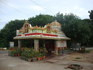
Madhavarayanigudem is a village in the Huzurnagar mandal of Suryapet district, Telangana state. It is located 1 km off the Huzurnagar-Kodad road.
Kodad mandal is one of the 23 mandals in Suryapet district of the Indian state of Telangana. It is under the administration of Kodad revenue division with its headquarters at Kodad. The mandal is located on the banks of Paler river and is bounded by Nadigudem, Munagala, Chilkur, Huzurnagar, Mellachervu mandals. A portion of it also borders Khammam district and the state of Andhra Pradesh.

Suryapet district is a district in the Indian state of Telangana. The city of Suryapet is the district headquarters. The district has three revenue divisions Suryapet, Kodad and Huzurnagar. It is sub-divided into 23 mandals. The district shares boundaries with Nalgonda, Khammam, Yadadri, Jangaon and Mahabubabad districts and with Andhra Pradesh state.
Yallapuram or Yellapuram is a village in Palakeedu mandal, Suryapet district in Telangana state, India. It is located 51 km south of the district's capital, Suryapet.

Kodad revenue division is an administrative division in the Suryapet district of the Indian state of Telangana. It is one of the 2 revenue divisions in the district which consists of 9 mandals under its administration. Kodad is the divisional headquarters of the division.
Munagala mandal is one of the 23 mandals in Suryapet district of the Indian state of Telangana. It is under the administration of Kodad revenue division with its headquarters at Munagala. The mandal is bounded by Nadigudem, Mothey, Chivemla, Chilkur mandals.
Ananthagiri mandal is one of the 23 mandals in Suryapet district of the Indian state of Telangana. It is under the administration of Kodad revenue division with its headquarters at Ananthagiri. It is carved out from Kodad and Nadigudem mandals. It is bounded by Nadigudem in the west, Kodad mandal in the south and Khammam district towards north.
Chilkur mandal is one of the 23 mandals in Suryapet district of the Indian state of Telangana. It is under the administration of Kodad revenue division with its headquarters at Chilkur. The mandal is bounded by Kodad mandal to the east, Huzurnagar mandal to the south, Munagala mandal to the north.
Nadigudem mandal is one of the 23 mandals in Suryapet district of the Indian state of Telangana. It is under the administration of Kodad revenue division with its headquarters at Nadigudem. It is bounded by Munagala mandal towards South, Mothey mandal towards North, Kodad mandal towards East, Chilkur mandal towards South.
Mellachervu mandal is one of the 23 mandals in Suryapet district of the Indian state of Telangana. It is under the administration of Kodad revenue division with its headquarters at Mellachervu. It is bounded by Mattampally mandal towards west, Huzurnagar mandal towards North, Mallareddygudem mandal towards South, Krishna district of Andhra Pradesh towards East.
Garidepally mandal is one of the 23 mandals in Suryapet district in the Indian state of Telangana. It is under the administration of the Suryapet revenue division, with its headquarters at Garidepally. It is bounded by Neredcherla mandal to the west, Huzurnagar mandal to the east, Penpahad mandal to the north, and Mattampally mandal to the south.
Mattampally mandal is one of the 23 mandals in Suryapet district of the Indian state of Telangana. It is under the administration of Kodad revenue division with its headquarters at Mattampally. It is bounded by Mellachervu mandal towards East, Huzurnagar mandal towards North, Garidepally mandal towards west, Guntur district of Andhra Pradesh towards South.
Mallareddygudem mandal is one of the 23 mandals in Suryapet district of the Indian state of Telangana. It is under the administration of Kodad revenue division with its headquarters at Chintalapalem. It is bounded by Mattampally mandal towards west, Mellachervu mandal towards North, Krishna district of Andhra Pradesh towards East. and it is near to pulichinthala project
