Iantha, Missouri

Last updated

Iantha, Missouri
MOMap-doton-Iantha.png
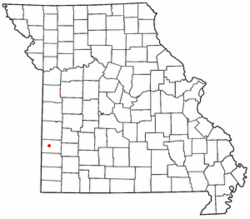
Location of Iantha in Missouri
Coordinates: 37°31′01″N94°23′52″W / 37.51694°N 94.39778°W / 37.51694; -94.39778
Country United States
State Missouri
County Barton
Area
[1]
  Total
0.27 sq mi (0.70 km2)
  Land0.27 sq mi (0.70 km2)
  Water0 sq mi (0.00 km2)
Elevation
[2]
988 ft (301 m)
Population
 (2020)
  Total
95
  Density351/sq mi (135.6/km2)
FIPS code 29-34192
GNIS feature ID2806381 [2]

Iantha is an unincorporated community and census designated place in Barton County, Missouri. [2] It is located six miles west of Lamar.

Contents

History

Iantha was founded in 1881. [3] The community most likely was named after an early settler. [4] A post office called Iantha was established in 1881, and remained in operation until 1885. [5]

Demographics

Historical population
CensusPop.Note
2020 95
U.S. Decennial Census [6]

Notable person

References

  1. "ArcGIS REST Services Directory". United States Census Bureau. Retrieved September 5, 2022.
  2. 1 2 3 U.S. Geological Survey Geographic Names Information System: Iantha, Missouri
  3. Eaton, David Wolfe (1916). How Missouri Counties, Towns and Streams Were Named. The State Historical Society of Missouri. pp.  207.
  4. "Barton County Place Names, 1928-1945 (archived)". The State Historical Society of Missouri. Archived from the original on June 24, 2016. Retrieved August 31, 2016.{{cite web}}: CS1 maint: bot: original URL status unknown (link)
  5. "Post Offices". Jim Forte Postal History. Retrieved August 27, 2016.
  6. "Census of Population and Housing". United States Census Bureau. Retrieved June 4, 2016.