
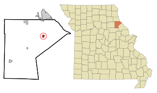
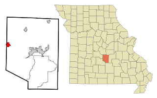
Cooper County is located in the central portion of the U.S. state of Missouri. As of the 2020 United States census, the population was 17,103. Its county seat is Boonville. The county was organized December 17, 1818 and named for Sarshell Cooper, a frontier settler who was killed by Native Americans near Arrow Rock in 1814. It is a part of the Columbia, Missouri metropolitan area.

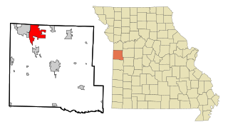
Barton County is a county located in the southwestern part of the U.S. state of Missouri. As of the 2020 census, the population was 11,637. Its county seat is Lamar. The county was organized in 1855 and named after U.S. Senator David Barton from Missouri.

Barton County is a county located in the U.S. state of Kansas. Its county seat and most populous city is Great Bend. As of the 2020 census, the county population was 25,493. The county is named in honor of Clara Barton, responsible for the founding of the American Red Cross, and the only county in Kansas to be named for a woman.
Washington County is a county located in the U.S. state of Illinois. As of the 2020 census, it had a population of 13,761. Its county seat is Nashville. It is located in the southern portion of Illinois known locally as "Little Egypt".
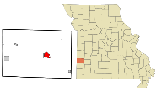
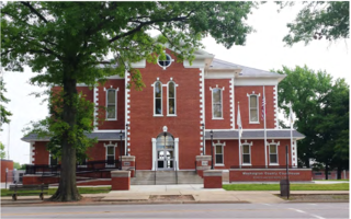
Lamar is a city in and the county seat of Barton County, Missouri, United States. As of the 2020 census, the city population was 4,266. It is known as the birthplace of Harry S. Truman, the 33rd president of the United States.

Mindenmines is a city in Barton County, Missouri, United States. The population was 271 at the 2020 census. The city lies approximately four miles east of Frontenac, Kansas. It has possessed a post office since 1883. It is also the home of the Bank of Minden..

Archie is a city in southern Cass County, Missouri. The city is part of the Kansas City metropolitan statistical area within the United States. The population was 1,170 at the 2010 census.
Raymore is a city in Cass County, Missouri, United States, within the Kansas City Metropolitan Area. Raymore is one of the fastest-growing cities in the state of Missouri. The population was 22,941 at the 2020 census.

Villa Ridge is an unincorporated community and census-designated place (CDP) in Franklin County, Missouri, United States. The population was 2,636 at the 2010 census, up from 2,417 at the 2000 census.

High Ridge is an unincorporated community and census-designated place (CDP) in Jefferson County, Missouri, United States. The population was 4,305 at the 2010 census. At 927 feet (283 m) above sea level, High Ridge is the second-highest point in Jefferson County, second only to Sun Ridge, north of Hillsboro, according to data from the House Springs/Hillsboro 7.5 minute topographic quadrangles. The Beaumont Scout Reservation, a property of the Greater St. Louis Area Council, Boy Scouts of America, is 4 miles (6 km) north of High Ridge.

Dixon is a city in northern Pulaski County, Missouri, United States, with a population of 1,549 at the time of the 2010 census.
New London is a city in Ralls County, Missouri, United States. The population was 943 at the 2020 census. It is the county seat of Ralls County.

Sheldon is a city in southern Vernon County, Missouri, United States. The population was 543 at the 2010 census.
Richland is a city in Camden, Laclede, and Pulaski counties in the U.S. state of Missouri. The population was 1,863 at the 2010 census.
Golden is an unincorporated community and census-designated place in southeastern Barry County, Missouri, United States. It is approximately 20 miles (32 km) southeast of Cassville. It is located south of Table Rock Lake and one mile north of Missouri Route 86 on Highway J. At the 2020 census, Golden had a population of 275.

Iantha is an unincorporated community and census designated place in Barton County, Missouri. It is located six miles west of Lamar.
Irwin is an unincorporated community and census-designated place in northern Barton County, Missouri, United States. As of the 2020 census it had a population of 47.
Harviell is an unincorporated community and census-designated place in Butler County, Missouri, United States. As of the 2020 census it had a population of 98.
Connelsville is an unincorporated community in Nineveh Township, Adair County, Missouri, United States. The community is on Missouri Route 149 about three miles north of Novinger and eight miles northwest of Kirksville. Shuteye Creek flows past the north side of the town and its confluence with the Chariton River is about one mile to the east.
Oskaloosa is an unincorporated community in northwest Barton County, in the U.S. state of Missouri.

