Idaho State Highway 67

Last updated

Idaho 67.svg

State Highway 67

Idaho State Highway 67
SH-67 highlighted in red
Route information
Maintained by ITD
Length8.948 mi [1]  (14.400 km)
Major junctions
West end Mountain Home AFB Main Gate
Major intersectionsIdaho 167.svg SH-167
East endIdaho 51.svg SH-51 in Mountain Home
Location
Country United States
State Idaho
Counties Elmore
Highway system
  • Idaho State Highway System
Idaho 66.svg SH-66 Idaho 69.svg SH-69

State Highway 67 (SH-67) is a state highway in Elmore County, Idaho. It connects the Mountain Home Air Force Base to SH-51 in the city of Mountain Home.

Contents

Route description

SH-67 begins at the main entrance of the Mountain Home Air Force Base, located in southwestern Elmore County. The five-lane highway, named Airbase Road, travels due north from the base entrance to a junction with Grand View Road (signed as SH-167). From the junction, SH-67 turns northeast and travels through a section of the Morley Nelson Snake River Birds of Prey National Conservation Area in the barren outskirts of Mountain Home as a four-lane, undivided highway. The highway then enters the city of Mountain Home and turns east before passing a municipal airport. SH-67 terminates at an intersection with SH-51 near the east end of the airport, located approximately 5 miles (8.0 km) west of an interchange with Interstate 84. [2] Except for a brief divided section at the intersection with SH-167, the entire highway is four-lane non-divided, with center lane-left turn only areas where needed.

History

The history of SH-67 goes back to at least the 1930s, when the first all-weather gravel road connecting Grand View and Mountain Home was built (represented by today's SH-167, SH-67 and SH-51), and can be seen on a 1937 map of the area. [3] A road from this road to the site of the base has existed since at least November 1942, when base construction began.

The route received its current number designation in the late 1960s in honor of the base's then-host unit, the 67th Tactical Reconnaissance Wing (1965-1971).

The original SH-67 also included the entirety of SH-167 from Grand View to where it currently intersects with SH-67 approximately 1.5 miles (2.4 km) from the base's main gate. [4]

In order to improve the base's prospects to remain open during a round of base closures in the 1970s, Idaho's legislature voted to expand the highway to the base to four lanes, although it was an area noted for gusty winds and tumbling tumbleweeds and little else. The expansion project also realigned the highway to go directly to the base's main gate. The unexpanded two-lane section of SH-67 that passed to the west of the base was delisted and unsigned (even though it was still officially maintained by ITD for the Simplot feed lot and the base's recreation area at C. J. Strike Dam just north of the Snake River) prior to its redesignation as SH-167.

Major intersections

The entire highway is in Elmore County.

Locationmi [1] kmDestinationsNotes
Mountain Home AFB 0.0000.000Main Gate
1.186–
1.773
1.909–
2.853
Idaho 167.svg SH-167  Grand View, C. J. Strike Dam Originally part of SH-67
Mountain Home 8.94814.400Idaho 51.svg SH-51  / Elmcrest Road Mountain Home, Boise, Bruneau, Grasmere
1.000 mi = 1.609 km; 1.000 km = 0.621 mi

See also

Related Research Articles

<span class="mw-page-title-main">Idaho State Highway 51</span> State highway in southwestern Idaho from Mountain Home south to the Nevada border

State Highway 51 (SH-51) is a state highway in southwestern Idaho from Mountain Home south to the Nevada border, where it continues as State Route 225 to Elko. It is the major north–south road in Owyhee County.

<span class="mw-page-title-main">Interstate 84 in Idaho</span> Highway in Idaho

Interstate 84 (I-84) in the U.S. state of Idaho is a major Interstate Highway that traverses the state from the Oregon state line in the northwest to Utah state line in the southeast. It primarily follows the Snake River across a plain that includes the cities of Boise, Mountain Home, and Twin Falls. The highway is one of the busiest in Idaho and is designated as the Vietnam Veterans Memorial Highway.

<span class="mw-page-title-main">U.S. Route 93 in Idaho</span> Section of U.S. Highway in Idaho, United States

U.S. Route 93 is a north–south U.S. Highway in the U.S. state of Idaho.

<span class="mw-page-title-main">Idaho State Highway 41</span> State highway in Idaho, United States

State Highway 41 (SH-41) is a state highway mostly in the U.S. state of Idaho. It runs from Interstate 90 in Post Falls to U.S. Route 2 on the Washington state line. The northernmost 0.41 miles (0.66 km) of SH-41 run along State Street along the state line, with the southbound lane in the town of Newport, Washington, and the northbound lane in Oldtown, Idaho. The part of the highway in Washington is designated State Route 41 (SR 41).

<span class="mw-page-title-main">U.S. Route 30 in Idaho</span> US Highway section within the state of Idaho

U.S. Route 30 (US 30) runs northwest–southeast across the southern half of lower Idaho for 455.481 miles (733.026 km). US 30 enters the state from Oregon across the Snake River in Fruitland and exits into Wyoming east of Dingle. US 26 runs through the large population centers of Boise, Twin Falls, and Pocatello, as well as a plethora of smaller communities from Fruitland to Montpelier. The Thousand Springs Scenic Byway is a picturesque section of US 30 in southern Idaho between the towns of Bliss and Buhl, dipping down into the Hagerman Valley and a canyon of the Snake River.

<span class="mw-page-title-main">U.S. Route 26 in Idaho</span> US Highway section within the state of Idaho

U.S. Route 26 (US 26) runs east–west across south central Idaho for 402.5 miles (647.8 km). US 26 enters the state from Oregon across the Snake River east of Nyssa, Oregon concurrent with US 20 and exits into Wyoming northwest of Alpine. US 26 runs through the large population centers of Boise and Idaho Falls, as well as the smaller communities of Parma, Notus, Garden City, Shoshone, Richfield, Carey, Arco, Blackfoot, Swan Valley, and Irwin.

<span class="mw-page-title-main">Idaho State Highway 39</span> State highway in Power and Bingham counties in Idaho, United States

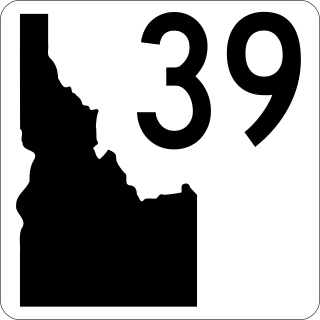
State Highway 39 (SH-39) is a 52.924-mile-long (85.173 km) state highway located in Power and Bingham counties in Idaho. SH-39 runs from its southern terminus at Interstate 86 (I-86) in American Falls to its northern terminus at U.S. Route 26 (US-26) in Blackfoot. Between the two cities, it passes through the city of Aberdeen and the communities of Springfield and Pingree.

<span class="mw-page-title-main">Idaho State Highway 31</span> State highway in Idaho, United States

State Highway 31 (SH-31) is a 21.025-mile-long (33.836 km) north-south state highway in the eastern part of the U.S. state of Idaho. SH-31 runs from U.S. Route 26 (US-26) in Swan Valley north to SH-33 in Victor. The highway is maintained by the Idaho Transportation Department. It is known as PIne Creek Road within Bonneville County. It is also known West Center Street in "downtown" Victor.

<span class="mw-page-title-main">Idaho State Highway 57</span> State highway in the Idaho Panhandle

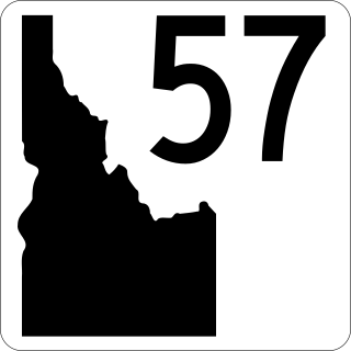
State Highway 57 (SH-57) is a 37.230-mile-long (59.916 km) state highway located entirely within Bonner County in the Idaho Panhandle region of the U.S. state of Idaho. SH-57 runs from U.S. Route 2 in Priest River north to the end of state maintenance in Nordman. The highway is maintained by the Idaho Transportation Department.

<span class="mw-page-title-main">Idaho State Highway 66</span> State highway in Latah County, Idaho, United States

State Highway 66 (SH-66) is a state highway located entirely within Latah County, Idaho, United States. It travels for less than one mile (1.6 km) from Palouse Cove Road at the Washington state line to U.S. Route 95 (US-95) north of Viola. The highway is maintained by the Idaho Transportation Department.

<span class="mw-page-title-main">Idaho State Highway 22</span> State highway in Idaho, United States

State Highway 22 (SH-22) is a 43.936-mile-long (70.708 km) state highway in Idaho from SH-33 to Interstate 15 (I-15) in Dubois.

<span class="mw-page-title-main">Idaho State Highway 45</span> State highway in Idaho

State Highway 45 (SH-45) is a 17.985-mile-long (28.944 km) state highway in Idaho. It runs from SH-78 to Interstate 84 Business in Nampa.

<span class="mw-page-title-main">Idaho State Highway 46</span> State highway in southern Idaho that runs north–south across the Magic Valley region

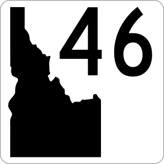
State Highway 46 (SH-46) is a 57.222-mile-long (92.090 km) state highway in southern Idaho that runs north–south across the Magic Valley region. It connects U.S. Route 30 (US-30) in Buhl to Interstate 84 (I-84) in Wendell, US-26 in Gooding, and US-20 east of Fairfield.

<span class="mw-page-title-main">Idaho State Highway 72</span> State highway in Payette County, Idaho, United States

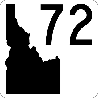
State Highway 72 (SH‑72) is a 1.989-mile (3.201 km) state highway in Payette County, Idaho, United States, that connects U.S. Route 30 (US 30), south of new Plymouth, with Idaho State Highway 52 (SH‑52) in Hamilton Corner. SH‑72 is maintained by the Idaho Transportation Department.

<span class="mw-page-title-main">Idaho State Highway 167</span> State highway in Idaho, United States

State Highway 167 (SH-167) is a state highway in Idaho from SH-78 in Grand View to SH-67 near Mountain Home Air Force Base.

<span class="mw-page-title-main">Idaho State Highway 78</span> State highway in Idaho, United States

State Highway 78 (SH-78) is a state highway in Idaho from SH-55 in Marsing to I-84 Business Loop in Hammett

<span class="mw-page-title-main">Idaho State Highway 162</span> State highway in Idaho, United States

State Highway 162 (SH-162) is a state highway serving Lewis and Idaho counties in the North Central region of Idaho.

<span class="mw-page-title-main">Idaho State Highway 36</span> State highway in Idaho, United States

State Highway 36 (SH-36) is a 73.313-mile-long (117.986 km) east-west state highway located in the southeast part of the U.S. state of Idaho. SH-36 runs from Interstate 15 (I-15) near Malad City to U.S. Route 89 (US-89) near Montpelier. The highway is maintained by the Idaho Transportation Department.

<span class="mw-page-title-main">Idaho State Highway 34</span> State highway in Franklin and Caribou counties in Idaho, United States

State Highway 34 (SH-34) is a state highway serving Franklin and Caribou counties in southeastern Idaho. The highway runs northeasterly along the Bear River from Preston towards Soda Springs and the Wyoming state line, where it terminates and becomes Wyoming Highway 239.

<span class="mw-page-title-main">Idaho State Highway 77</span> State highway in Idaho, United States

State Highway 77 (SH-77) is a state highway in Cassia County, Idaho. The highway runs for 33.978 miles (54.682 km) from SH-81 in Malta to Interstate 84 north of Declo, serving the town of Albion.

References

  1. 1 2 Staff (March 19, 2014). "State Highway 67 Milepoint Log" (PDF). Idaho Transportation Department. Archived from the original (PDF) on September 13, 2014. Retrieved February 3, 2015.
  2. Google (September 15, 2018). "State Highway 67" (Map). Google Maps . Google. Retrieved September 15, 2018.
  3. Rand McNally and Company, Road map: Idaho, Mont., Wyo., published by Texaco, 1937
  4. Staff (May 21, 2014). "State Highway 167 Milepoint Log" (PDF). Idaho Transportation Department. Archived from the original (PDF) on September 13, 2014. Retrieved February 3, 2015.
Template:Attached KML/Idaho State Highway 67
KML is from Wikidata

Commons-logo.svg Media related to Idaho State Highway 67 at Wikimedia Commons