
Interstate 86 (I-86) is an east–west intrastate Interstate Highway located entirely within the state of Idaho. It runs approximately 63 miles (101 km) from an intersection with I-84 east of Declo in rural Cassia County, to an intersection with I-15 in Chubbuck, just north of Pocatello. The highway is part of the main route from Boise and Twin Falls to Idaho Falls and the upper Snake River region.
The President George Bush Turnpike (PGBT) is a 52-mile (84 km) toll road running through the northern, northeastern and western suburbs, forming a partial loop around Dallas, Texas, United States. It is named for the late George H. W. Bush, the 41st president of the United States. At its west end near Belt Line Road in Irving, State Highway 161 continues southwest to Interstate 20 (I-20) in Grand Prairie. The discontinuous free frontage roads along the turnpike from I-35E in Carrollton east to its end at I-30 in Garland are assigned the State Highway 190 designation. SH 190 signage appears only along the Rowlett, Garland, Richardson, Plano, and Carrollton sections of the frontage road with the undersign "frontage road only". At intersections with city streets, only the Bush Turnpike signs are displayed, not the SH 190 signage. Prior to the construction of the main lanes as a tollway, SH 190 was used as the name of the planned main lanes too. Similarly, the part west of I-35E was planned as part of SH 161. Bush Turnpike is signed as a north–south road from I-20 to I-35E, an east–west road from I-35E to the Merritt Main Lane Gantry and as a north–south road from the Merritt Main Lane Gantry to I-30, as Bush Turnpike makes a nearly 90-degree curve in both places.
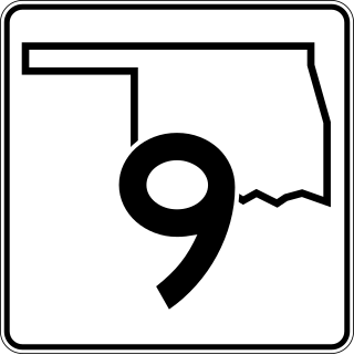
State Highway 9, abbreviated as SH-9, OK-9, or simply Highway 9, is a major east–west highway in the U.S. state of Oklahoma. Spanning across the central part of the state, SH-9 begins at the Texas state line near Madge, Oklahoma, and ends at the Arkansas state line near Fort Smith, Arkansas. State Highway 9 is a major highway around the Norman area. At 348.1 miles (560.2 km), SH-9 is Oklahoma's second-longest state highway.
Bruneau is an unincorporated community in Owyhee County in the southwestern part of the U.S. state of Idaho. The mouth of the Bruneau River is to the northwest and Bruneau Sand Dunes State Park is to the east. As of 2014, Bruneau has a population of 552.

State Highway 51 (SH-51) is a state highway in southwestern Idaho from Mountain Home south to the Nevada border, where it continues as State Route 225 to Elko. It is the major north–south road in Owyhee County.

State Route 128 (SR 128) is a Washington state highway located in Asotin and Whitman counties, west of the Idaho state line. The 2.30-mile (3.70 km) long route runs north from U.S. Route 12 (US 12) in Clarkston to cross the Snake River and turn east after intersecting SR 193 to terminate at State Highway 128 (SH 128) on the Idaho state line. The highway was originally created in 1964 on a Pomeroy–Clarkston route, replacing Secondary State Highway 3K (SSH 3K), which had been established in 1937; in 1991, the route was changed to its present form.

State Route 129 (SR 129) is a state highway in Asotin County, Washington, United States. It travels north–south at the southeastern corner of the state, connecting with Oregon Route 3 (OR 3) at the Oregon state line south of Anatone. The 43-mile (69 km) highway then follows the Snake River, which marks the Idaho state border, north to Clarkston and terminates at U.S. Route 12 (US 12). SR 129 also has a short spur route that connects to a separate intersection with US 12 in Clarkston.

Interstate 84 (I-84) in the U.S. state of Idaho is a major Interstate Highway that traverses the state from the Oregon state line in the northwest to Utah state line in the southeast. It primarily follows the Snake River across a plain that includes the cities of Boise, Mountain Home, and Twin Falls. The highway is one of the busiest in Idaho and is designated as the Vietnam Veterans Memorial Highway.
Interstate 15 (I-15) is a part of the Interstate Highway System that runs from San Diego, California, to Sweetgrass, Montana. In Idaho, the Interstate Highway runs exactly 196 miles (315 km) from the Utah state line near Woodruff north to the Montana state line at Monida Pass. I-15 is the primary north–south highway of Eastern Idaho. The Interstate Highway connects Pocatello and Idaho Falls, the fourth and fifth largest cities in Idaho, and the smaller county seats of Malad City, Blackfoot, and Dubois. I-15 connects all of those cities with Salt Lake City to the south and Butte to the north. The Interstate has business loops through McCammon, Inkom, Pocatello, Blackfoot, and Idaho Falls.

State Highway 55 (SH-55) is an Idaho highway from Marsing to New Meadows, connecting with US-95 at both ends.

U.S. Route 93 (US-93) is a north–south U.S. Highway in the U.S. state of Idaho.
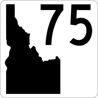
State Highway 75 is a two-lane highway that travels through the Sawtooth Valley of central Idaho. The highway's southern terminus is in Shoshone, and its northern is near Challis. It is designated as one of Idaho's scenic byways and provides access to Sawtooth National Recreation Area. It primarily follows the Big Wood River in the south and the main Salmon River in the north, divided by Galena Summit.

State Highway 21 (SH-21), also known as the Ponderosa Pine Scenic Byway, is a state highway in Idaho. It runs from Boise to Stanley, primarily as a two-lane road. With two-thirds of its length in Boise County, it passes by historic Idaho City and the village of Lowman to the western edge of the Sawtooth Mountains, then along their northern boundary to Stanley.

State Highway 53 (SH-53) is a 14.240-mile-long (22.917 km) state highway serving Kootenai County in the U.S. state of Idaho. SH-53 travels northeast from Washington State Route 290 at the Washington state border near Hauser to a short concurrency with SH-41 in Rathdrum. From Rathdrum, the highway continues east to end at U.S. Route 95 (US-95) north of Hayden. The Hauser to Rathdrum segment first appeared on a map in 1926, while the continuation of the route to the Hayden area appeared in 1937, completing an unnumbered state highway. SH-53 was designated in 1953 after all unnumbered state highways were assigned numbers.

State Highway 37 (SH-37) is a state highway in Power County in southern Idaho, United States that spans 31.231 miles (50.261 km) north-south from the Oneida–Power county line to Interstate 86 (I-86).

State Highway 45 (SH-45) is a 17.985-mile-long (28.944 km) state highway in Idaho. It runs from SH-78 to Interstate 84 Business in Nampa.
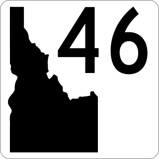
State Highway 46 (SH-46) is a 57.222-mile-long (92.090 km) state highway in southern Idaho that runs north–south across the Magic Valley region. It connects U.S. Route 30 (US-30) in Buhl to Interstate 84 (I-84) in Wendell, US-26 in Gooding, and US-20 east of Fairfield.
State Highway 50 (SH-50) is a 8.092-mile-long (13.023 km) state highway in the U.S. State of Idaho. SH-50 starts at U.S. Route 30 (US-30) before connecting to Interstate 84 (I-84) and ending at SH-25. It provides eastern access to the city of Twin Falls from I-84.
State Highway 67 (SH-67) is a state highway in Elmore County, Idaho. It connects the Mountain Home Air Force Base to SH-51 in the city of Mountain Home.

State Highway 167 (SH-167) is a state highway in Idaho from SH-78 in Grand View to SH-67 near Mountain Home Air Force Base.

