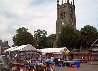
Eastwood is a former coal mining town in the Broxtowe district of Nottinghamshire, England, 8 miles (13 km) northwest of Nottingham and 10 miles (16 km) northeast of Derby on the border between Nottinghamshire and Derbyshire. Mentioned in Domesday Book, it expanded rapidly during the Industrial Revolution. The Midland Railway was formed here and it is the birthplace of D. H. Lawrence. The distinctive dialect of East Midlands English is extensively spoken, in which the name of the town is pronounced.

Ilkeston is a town in the Borough of Erewash, Derbyshire, England, on the River Erewash, from which the borough takes its name, with a population at the 2011 census of 38,640. Its major industries, coal mining, iron working and lace making/textiles, have now all but disappeared.

Long Eaton is a town in the Erewash district of Derbyshire, England, just north of the River Trent, about 7 miles (11 km) south-west of Nottingham and some 8½ miles (13.7 km) south-east of Derby. The town population was 37,760 at the 2011 census. It has been part of Erewash borough since 1 April 1974, when Long Eaton Urban District was disbanded.

Erewash is a local government district with borough status in Derbyshire, England, to the east of Derby and the west of Nottingham. The population of the district as taken at the 2011 Census was 112,081. It contains the towns of Ilkeston, Long Eaton and Sandiacre and fourteen civil parishes.

West Hallam is a large village and civil parish close to Ilkeston in the county of Derbyshire in the East Midlands region of England. West Hallam has had its own parish council since 1894 and, since 1974, has been part of the Erewash borough. The population of the civil parish was 4,829 at the 2001 census reducing to 4,686 at the 2011 census.

Derby railway station is a main line railway station serving the city of Derby in Derbyshire, England. Owned by Network Rail and managed by East Midlands Railway, the station is also used by CrossCountry services and two daily Northern services.

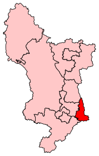
Erewash is a county constituency represented in the House of Commons of the UK Parliament since 2015 by Maggie Throup, a Conservative.

Stapleford is a town and civil parish in the Borough of Broxtowe in Nottinghamshire, England, 5.6 miles (9.0 km) west of Nottingham. The population at the 2011 census was 15,241.

Burton-on-Trent railway station is a mainline railway station located in the town of Burton upon Trent, Staffordshire, England. It is owned by Network Rail and managed by East Midlands Railway, although only CrossCountry services call at the station.

Morley is a village and civil parish within the Borough of Erewash in Derbyshire, England.

Derby College is a further education provider with sites located within Derbyshire. It delivers training in workplace locations across England.

Kirk Hallam is a village in the south-east of Derbyshire in the East Midlands of England. It was part of the former Ilkeston borough and is largely regarded today as a part of the much larger town of Ilkeston which adjoins it to the north east. Since 1974 Kirk Hallam has been part of the borough of Erewash. Kirk Hallam is a ward of the Erewash Borough Council showing a population of 6,417 at the 2001 Census, reducing to 6,216 at the 2011 Census.

Erewash Sound is a community radio station broadcasting to the borough of Erewash in Derbyshire, including Ilkeston, West Hallam, Long Eaton, Borrowash and surrounding areas.

Glossop Town Hall, Market Hall, and Municipal Buildings is a complex in the centre of Glossop, Derbyshire, providing offices for High Peak Borough Council, a retail arcade, and covered market. The Town Hall was constructed in 1838 and significantly extended and altered in 1845, 1897 and 1923. The Town Hall building was designed by Weightman and Hadfield of Sheffield for the 12th Duke of Norfolk. It is constructed from millstone grit ashlar and topped with a distinctive circular cupola and clock. It is Grade II listed, forming a group with the market and Municipal Buildings to the south, and rows of shops to High Street West either side which were also part of Hadfield's design, and which marked the transition of Howard Town from a satellite industrial village to a freestanding urban entity.

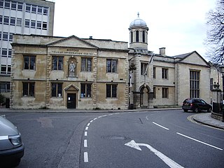
The Old Town Hall is a municipal building in St Paul's Square in Bedford, Bedfordshire, England. The building, which was the headquarters of Bedford Borough Council from 1892 to 2009, is a Grade II listed building.

Eccles Town Hall is a municipal building in Church Street, Eccles, Greater Manchester, England. The town hall was the headquarters of Eccles Borough Council until the council was abolished in 1974.

Dukinfield Town Hall is a municipal building in King Street, Dukinfield, Greater Manchester, England. The town hall, which was the headquarters of Dukinfield Borough Council, is a grade II listed building.

Farnham Town Hall is a municipal building in South Street, Farnham, Surrey, England. It provides the offices and the meeting place of Farnham Town Council.

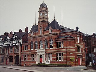
Long Eaton Town Hall is a municipal building in Derby Road, Long Eaton, Derbyshire, England. The town hall, which currently serves as one of two meeting places of Erewash Borough Council, is a Grade II* listed building.
Ilkeston is a town and unparished area in the Borough of Erewash in Derbyshire, England. The town and surrounding area contain 28 listed buildings that are recorded in the National Heritage List for England. Of these, one is listed at Grade I, the highest of the three grades, three are at Grade II*, the middle grade, and the others are at Grade II, the lowest grade. The Erewash Canal passes through the area, and the listed buildings associated with it are two bridges and two locks. The other listed buildings include churches and a chapel, a church tower, houses, a museum, the town hall, two factories, a drinking fountain, a brick kiln, a library, cemetery buildings, two cinemas, a school, and two war memorials.


