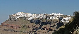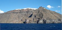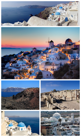
Santorini, officially Thira or Thera, is a Greek island in the southern Aegean Sea, about 200 km (120 mi) southeast from its mainland. It is the largest island of a small, circular archipelago formed by the Santorini caldera. It is the southernmost member of the Cyclades group of islands, with an area of approximately 73 km2 (28 sq mi) and a 2021 census population of 15,480. The municipality of Santorini includes the inhabited islands of Santorini and Therasia, as well as the uninhabited islands of Nea Kameni, Palaia Kameni, Aspronisi and Christiana. The total land area is 90.623 km2 (34.990 sq mi). Santorini is part of the Thira regional unit.

Folegandros is a small Greek island in the Aegean Sea that, together with Sikinos, Ios, Anafi and Santorini, forms the southern part of the Cyclades. Its surface area is 32.216 square kilometres (12.439 sq mi) and it has 719 inhabitants (2021). It has three small villages, Chora, Karavostasis, and Ano Meria, which are connected by a paved road. Folegandros is part of the Thira regional unit.
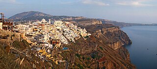
Firá is the modern capital of the Greek Aegean island of Santorini (Thera). A traditional settlement, "Firá" derives its name from an alternative pronunciation of "Thíra", the ancient name of the island itself.

The Catholic Church in Greece is part of the worldwide Catholic Church, under the spiritual leadership of the Pope in Rome. Indigenous Roman Catholic Greeks numbered about 50,000-70,000 in 2022 and were a religious and not an ethnic minority. Most of them are a remnant of Venetian and Genoese rule in southern Greece and many Greek islands from the early 13th until the late 18th century, Greeks who converted to Catholicism or descendants of the thousands of Bavarians that came to Greece in the 1830s as soldiers and civil administrators, accompanying King Otto. One very old but still common term to reference to them is Φράγκοι, or "Franks", dating to the times of the Byzantine Empire, when medieval Greeks would use that term to describe all Catholics.

Anafi or Anaphe is a Greek island community in the Cyclades. In 2021, it had a population of 293. Its land area is 40.370 square kilometres. It lies east of the island of Thíra (Santorini). Anafi is part of the Thira regional unit.
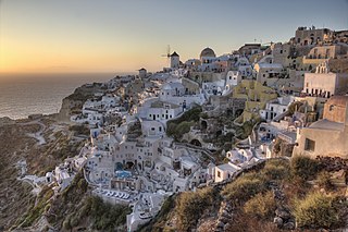
Oia or Ia is a small village and former community in the South Aegean on the islands of Thira (Santorini) and Therasia, in the Cyclades, Greece. Since the 2011 local government reform it has been part of the municipality of Santorini, of which it is a municipal unit. It covers the whole island of Therasia and the northwesternmost part of Santorini, which it shares with the municipal unit of Santorini. The main street is named Nikolaou Nomikou. The population was 1,087 inhabitants at the 2021 census, and the land area is 19.449 km2.

Kamari is a coastal village on the southeastern part of the Aegean island of Santorini, Greece, in the Cyclades archipelago with a population of 1,065 according to the 2021 census. It is part of the Municipality of Thira and is situated approximately 8 km away from the island's capital Fira. Kamari was built by residents of the nearby village of Episkopi Gonias, which was almost flattened by a devastating earthquake that hit Santorini in July 1956.

Pyrgos Kallistis or simply Pyrgos is a village on the Aegean island of Santorini, Greece, in the Cyclades archipelago with a population of 1,078 according to the 2021 census. Pyrgos is part of the Municipality of Thira and is situated approximately 7 km away from the island's capital Fira. It is built amphitheatrically on a hill that offers magnificent views of Santorini in almost all directions. On top of this hill remain the ruins of a Venetian castle (Kasteli) that was once the island's administrative center. Pyrgos is a typical example of medieval architecture with narrow, labyrinthine streets, fortified walls and hidden passages. Nowadays it is one of the villages of Santorini least spoiled by tourism.

The Museum of Prehistoric Thera is located in Fira, on the island of Santorini in Greece. It was built on the site of the old Ypapanti Church which was destroyed in the 1956 Amorgos earthquake.

The Panagia Episkopi is the former middle-Byzantine cathedral of the Greek Cycladic island of Santorini (Thira). It is also called Panagia tis Episkopis or Church of Episkopi Thiras. According to an old, now almost completely destroyed inscription, the building of the church was commissioned by the Byzantine Emperor Alexios I Komnenos at the end of the 11th century, and took the place of a previous three-aisled early Byzantine basilica. The church was dedicated to the Panagia ("All-holy"), a Greek Orthodox appellation for the Virgin Mary. The second part of the name (Episkopi) means "episcopal". The Panagia Episkopi was the seat of the Orthodox diocese of Santorini until 1207 and again from 1537 to 1827.

Emporeio, also known as Nimborios, is a village on the island of Santorini, Greece. It is located 12 km from Fira, near the Profitis Ilias Mountains.
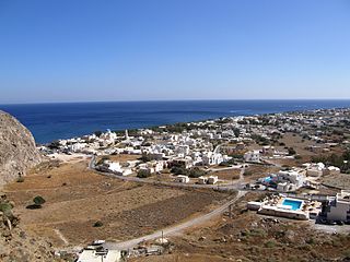
Perissa is a village on the island of Santorini, Greece. It is located 13 km to the southeast of Fira, near the Messa Vouno rock.
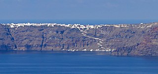
Manolas is the main settlement and the capital of Therasia, the small island opposite to Santorini (Thera). It is located in the east of island, above the abrupt Santorini caldera. It has a beautiful view of the volcano and the main settlements of Santorini such as Fira, Imerovigli, Oia, etc. Manolas can be approached either by road from the port of Riva or the uphill path from the small port of Korfos. Donkeys are the main mode of transport on this path. Manolas has a population of 140 inhabitants according to the 2021 census. It belongs to Thira municipality and Oia municipal unit.

The Raid on Santorini took place on 24 April 1944 as part of the Mediterranean Campaign in World War II. It was conducted by the British Special Boat Service, against the mixed German and Italian garrison on the island of Santorini (Thera) in the Aegean Sea. The raid was made in tandem with similar operations at the islands of Ios, Mykonos and Amorgos that aimed to destroy Axis naval observation posts and radio stations on the Cycladic islands.
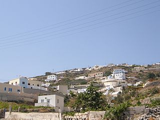
Vourvoulos is a village on the island of Santorini in Greece. It is located 3,7 kilometers northeast of the capital Fira, built on a slope facing the east shore of the island. Vourvoulos is part of the Thira region and had 591 permanent inhabitants according to the Greek census of 2021.

Episkopi Gonias also Mesa Gonia is a village and a community on the island of Santorini in Greece, located 6 km southeast of the capital Fira. The village is built on the foothills of Profitis Ilias mountain and had 187 inhabitants according to the 2021 census. Episkopi Gonias was almost entirely destroyed by an earthquake in 1956. As a result, most of its dwellers moved near the coast and built the village of Kamari. Today, Episkopi Gonias and Kamari comprise the community of Episkopi Gonias with a total population of 1,252 (2021).

Akrotiri is a village and a community on the island of Santorini in Greece. It is located 15 kilometers south of the capital Fira, built on the slopes of a hill offering staggering views of the caldera cliffs. On top of this hill, there are remains of a Venetian castle (Goulas). Akrotiri is part of the Thira region and had 515 permanent inhabitants according to the Greek census of 2021.

The Cathedral of St. John the Baptist is a parish of the Catholic Church in Fira, on the island of Santorini in Greece. It serves as the cathedral of the Diocese of Santorini.
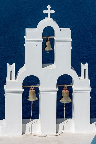
The Three Bells of Fira, officially known as The Catholic Church of the Dormition, is a Greek Catholic church on the island of Santorini. The church is known for its blue dome, three bells and views. The building is located in the town of Fira, directly above the cliffs which dominate western Santorini.
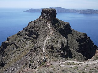
Skaros, also known as Skaros Rock, Fortress Skaros or Castle Skaros, is a rock formation and collection of ruins on the Greek island of Santorini.
