
Wernigerode is a town in the district of Harz, Saxony-Anhalt, Germany. Until 2007, it was the capital of the district of Wernigerode. Its population was 32,181 in 2020.

Dithmarschen is a district in Schleswig-Holstein, Germany. It is bounded by the districts of Nordfriesland, Schleswig-Flensburg, Rendsburg-Eckernförde, and Steinburg, by the state of Lower Saxony, and by the North Sea. From the 13th century up to 1559 Dithmarschen was an independent peasant republic within the Holy Roman Empire and a member of the Hanseatic League.

The Oker is a river in Lower Saxony, Germany, that has historically formed an important political boundary. It is a left tributary of the River Aller, 128 kilometres (80 mi) in length and runs in a generally northerly direction.

Salzgitter is an independent city in southeast Lower Saxony, Germany, located between Hildesheim and Braunschweig. Together with Wolfsburg and Braunschweig, Salzgitter is one of the seven Oberzentren of Lower Saxony. With 101,079 inhabitants and 223.92 square kilometres (86.46 sq mi), its area is the largest in Lower Saxony and one of the largest in Germany. Salzgitter originated as a conglomeration of several small towns and villages, and is today made up of 31 boroughs, which are relatively compact conurbations with wide stretches of open country between them. The main shopping street of the young city is in the borough of Lebenstedt, and the central business district is in the borough of Salzgitter-Bad. The city is connected to the Mittellandkanal and the Elbe Lateral Canal by a distributary. The nearest metropolises are Braunschweig, about 23 kilometres to the northeast, and Hanover, about 51 km to the northwest. The population of the City of Salzgitter has exceeded 100,000 inhabitants since its foundation in 1942, when it was still called Watenstedt-Salzgitter. Beside Wolfsburg, Leverkusen and Eisenhüttenstadt, Salzgitter is one of the few cities in Germany founded during the 20th century.

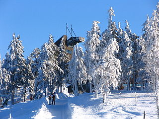
The Harz, also called the Harz Mountains, is a highland area in northern Germany. It has the highest elevations for that region, and its rugged terrain extends across parts of Lower Saxony, Saxony-Anhalt, and Thuringia. The name Harz derives from the Middle High German word Hardt or Hart. The name Hercynia derives from a Celtic name and could refer to other mountain forests, but has also been applied to the geology of the Harz. The Brocken is the highest summit in the Harz with an elevation of 1,141.1 metres (3,744 ft) above sea level. The Wurmberg is the highest peak located entirely within the state of Lower Saxony.
Goslar is a district in Lower Saxony, Germany. It is bounded by the districts of Göttingen, Northeim, Hildesheim and Wolfenbüttel, the city of Salzgitter, and by the states of Saxony-Anhalt and Thuringia (Nordhausen).

Goslar is a historic town in Lower Saxony, Germany. It is the administrative centre of the district of Goslar and is located on the northwestern slopes of the Harz mountain range. The Old Town of Goslar with over 1.500 timber houses and the Mines of Rammelsberg are UNESCO World Heritage Sites for their millennium-long testimony to the history of ore mining and their political importance for the Holy Roman Empire and Hanseatic League. Each year Goslar awards the Kaiserring to an international artist, called the "Nobel Prize" of the art world.

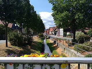
Baerenthal is a commune in the Moselle department of the Grand Est administrative region in north-eastern France.

Altenau ( ) is a town and a former municipality in the district of Goslar, in Lower Saxony, Germany. Since 1 January 2015 it is part of the town Clausthal-Zellerfeld.
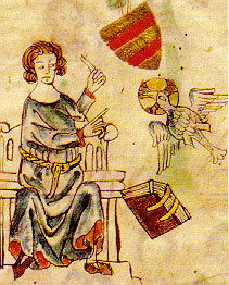
Eike of Repgow was a medieval German administrator who compiled the Sachsenspiegel code of law in the 13th century.

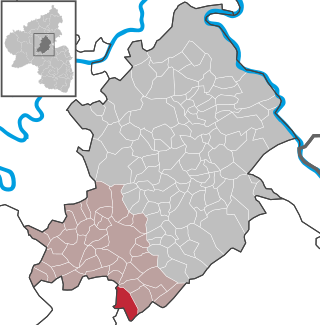
Kempfeld is an Ortsgemeinde – a municipality belonging to a Verbandsgemeinde, a kind of collective municipality – in the Birkenfeld district in Rhineland-Palatinate, Germany. It belongs to the Verbandsgemeinde Herrstein-Rhaunen, whose seat is in Herrstein.

Rothselberg is an Ortsgemeinde – a municipality belonging to a Verbandsgemeinde, a kind of collective municipality – in the Kusel district in Rhineland-Palatinate, Germany. It belongs to the Verbandsgemeinde Lauterecken-Wolfstein.
Woppenroth is an Ortsgemeinde – a municipality belonging to a Verbandsgemeinde, a kind of collective municipality – in the Rhein-Hunsrück-Kreis (district) in Rhineland-Palatinate, Germany. It belongs to the Verbandsgemeinde of Kirchberg, whose seat is in the like-named town.

The Kaiser Way, literally "Emperor Way", is a thematic long distance footpath in the Harz mountains of Germany, which is about 110 km long and crosses both the Harz and the Kyffhäuser hills. From Goslar and Bad Harzburg on the northern edge of the Harz it runs across the Harz to Walkenried in the south; and then via Nordhausen to Tilleda on the Kyffhäuser.

The Salzgitter Hills is an area of upland up to 322.9 metres (1,059 ft) in height, in the Lower Saxon Hills between Salzgitter and Goslar in the districts of Wolfenbüttel and Goslar and in the territory of the independent town of Salzgitter. The hills lie in the German federal state of Lower Saxony.
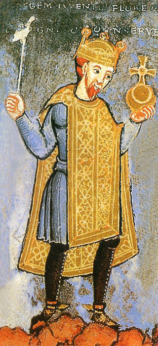
Henry III, called the Black or Heinrich der Schwarze/the Pious, was Holy Roman Emperor from 1046 until his death in 1056. A member of the Salian dynasty, he was the eldest son of Conrad II and Gisela of Swabia.

The Imperial Palace of Goslar is a historical building complex at the foot of the Rammelsberg hill in the south of the town of Goslar north of the Harz mountains, central Germany. It covers an area of about 340 by 180 metres. The palace grounds originally included the Kaiserhaus, the old collegiate church of St. Simon and St. Jude, the palace chapel of St. Ulrich and the Church of Our Lady (Liebfrauenkirche). The Kaiserhaus, which has been extensively restored in the late 19th century, was a favourite imperial residence, especially for the Salian emperors. As early as the 11th century, the buildings of the imperial palace had already so impressed the chronicler Lambert of Hersfeld that he described it as the "most famous residence in the empire". Since 1992, the palace site, together with the Goslar's Old Town and the Rammelsberg has been a UNESCO World Heritage Site because of its millennium-long association with mining and testimony to the exchange and advancement of mining technology throughout history.

Harlingerode is a village in Germany and district of Bad Harzburg in the district of Goslar in Lower Saxony. As of 2020, Harlingerode had a population of 2,916.
Bettingerode is a village that forms a municipal district of Bad Harzburg in the district of Goslar in Lower Saxony. As of 2020, Bettingerode had a population of 402.

The Langenberg is an elongated chalk hill north of Göttingerode and south of Harlingerode in the spa town of Bad Harzburg in Goslar district, in the German state of Lower Saxony. Due to its obvious display of the Northern Harz Boundary Fault in the Langenberg chalk quarry and the discovery of the Europasaurus in 1998 in said quarry, this mountain has gained national geological relevance.


